Bowstring State Forest

Log in to your account

AroundUs is a community-driven map of interesting places, built by curious explorers like you. It grows with every review, story, and photo you share.
Connect to save your favorite spots, contribute locations, and create personalized routes.
By continuing, you accept our Terms and Conditions and our Privacy Policy
Add to collection
Map
Suggest a change
Share

Bowstring State Forest, State forest in northern Minnesota, United States

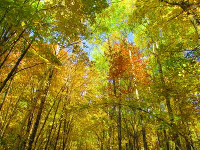
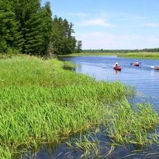
Bowstring State Forest spreads across a large area in northern Minnesota, connecting various habitats including wetlands, clear lakes, and mixed stands of pine and hardwood trees. The forest structure today reflects both natural processes and managed care that have shaped its composition over time.

The forest lands were removed from sale in 1927 and officially designated as a state forest in 1963, marking a significant shift toward managed conservation. These decisions ended unregulated use and established the foundation for how the landscape is protected and managed today.

The forest plays a central role in how local communities connect with the land through hunting and fishing traditions passed down through families. These practices shape how people experience and value the natural world around them.

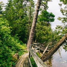
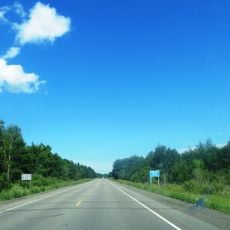
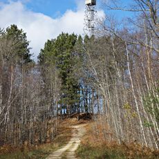
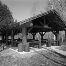
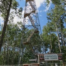
The forest offers multiple trail networks for hiking, cross-country skiing, snowmobiling, and ATV riding, with different sections supporting different activities throughout the year. Plan your visit in advance to find the area that matches your preferred activity and the current season.

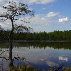
A large lake within the forest boundaries attracts anglers, boaters, and water sports enthusiasts, creating a distinct character separate from the wooded areas. The lake is so extensive that many visitors see it as its own destination rather than simply part of the larger forest.

Location: Itasca County

Location: Cass County

Location: Beltrami County

Website: https://dnr.state.mn.us/state_forests/forest.html?id=sft00009#homepage

GPS coordinates: 47.41830,-94.09240

Latest update: December 14, 2025 13:06

Photos
Around this place
Paul Bunyan and Babe the Blue Ox
United States of America

Paul Bunyan and Babe the Blue Ox

59.5 km
Lake Winnibigoshish
United States of America

Lake Winnibigoshish

7.5 km
Lake Bemidji State Park
United States of America

Lake Bemidji State Park

56.3 km
Waldsee
United States of America

Waldsee

51.1 km
Scenic State Park
United States of America

Scenic State Park

51.7 km
The Big Fish
United States of America

The Big Fish

15.1 km
Rabideau CCC Camp
United States of America

Rabideau CCC Camp

42.2 km
Forest History Center
United States of America

Forest History Center

44.9 km
Schoolcraft State Park
United States of America

Schoolcraft State Park

30.9 km
Bemidji Carnegie Library
United States of America

Bemidji Carnegie Library

59.5 km
Beltrami County Courthouse
United States of America

Beltrami County Courthouse

59.8 km
Nymore Bridge
United States of America

Nymore Bridge

59.4 km
Marcell Ranger Station
United States of America

Marcell Ranger Station

36.3 km
David Park House
United States of America

David Park House

59.4 km
Bigfork Village Hall
United States of America

Bigfork Village Hall

48.9 km
Coleraine Methodist Episcopal Church
United States of America

Coleraine Methodist Episcopal Church

52.2 km
Church of the Good Shepherd
United States of America

Church of the Good Shepherd

52.1 km
Remer State Forest
United States of America

Remer State Forest

37.3 km
Scenic State Park CCC/WPA/Rustic Style Historic Resources
United States of America

Scenic State Park CCC/WPA/Rustic Style Historic Resources

51.7 km
Lake Bemidji State Park CCC/NYA/Rustic Style Historic Resources
United States of America

Lake Bemidji State Park CCC/NYA/Rustic Style Historic Resources

56.7 km
Sandtrap Golf Course
United States of America

Sandtrap Golf Course

40.5 km
Draper Lookout Tower
United States of America

Draper Lookout Tower

56.3 km
Rabideau Civilian Conservation Corps Camp Picnic Shelter
United States of America

Rabideau Civilian Conservation Corps Camp Picnic Shelter

42.4 km
Cuba Hill Lookout Tower
United States of America

Cuba Hill Lookout Tower

31.1 km
Blackduck Lookout Tower
United States of America

Blackduck Lookout Tower

45.8 km
Farley Hill Lookout Tower
United States of America

Farley Hill Lookout Tower

17.5 km
Pinewood Fire Tower
United States of America

Pinewood Fire Tower

62 km
Coleraine Fire Lookout Tower
United States of America

Coleraine Fire Lookout Tower

50.9 km
Show the full map
Reviews

Visited this place? Tap the stars to rate it and share your experience / photos with the community! Try now! You can cancel it anytime.

« Bowstring State Forest - State forest in northern Minnesota, United States » is provided by Around Us (aroundus.com). Images and texts are derived from Wikimedia project under a Creative Commons license. You are allowed to copy, distribute, and modify copies of this page, under the conditions set by the license, as long as this note is clearly visible.

Discover hidden gems everywhere you go!

From secret cafés to breathtaking viewpoints, skip the crowded tourist spots and find places that match your style. Our app makes it easy with voice search, smart filtering, route optimization, and insider tips from travelers worldwide. Download now for the complete mobile experience.

Around Us App Screenshot

A unique approach to discovering new places

Le Figaro

All the places worth exploring

France Info

A tailor-made excursion in just a few clicks

20 Minutes