Schoolcraft State Park

Log in to your account

AroundUs is a community-driven map of interesting places, built by curious explorers like you. It grows with every review, story, and photo you share.
Connect to save your favorite spots, contribute locations, and create personalized routes.
Continue with Google
Continue with Apple
Continue with X
Continue with Facebook
Continue with email
By continuing, you accept our Terms and Conditions and our Privacy Policy
Create an account
Add to collection
Map
Suggest a change
Share

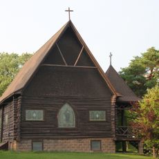
Schoolcraft State Park, Minnesota state park with Mississippi River access in Cass and Itasca counties, United States.

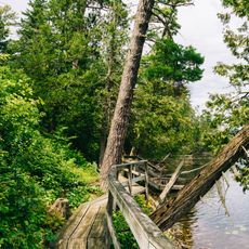
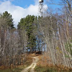
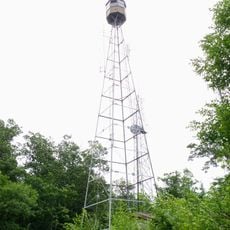
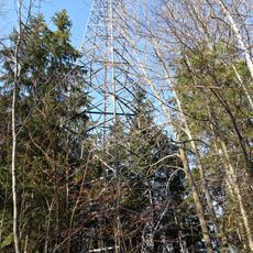
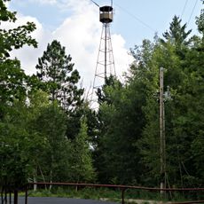
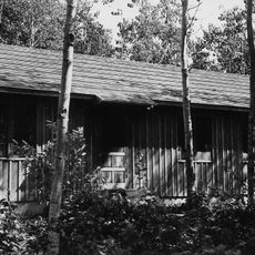
Schoolcraft State Park is a 225-acre natural area with wooded riverbanks along the Mississippi River in Cass and Itasca counties. The park contains multiple trails that wind through dense forest and riverside landscapes.

The Minnesota Department of Natural Resources established this park in 1959 to protect the natural environment along the Mississippi River. Its creation was part of broader efforts to preserve important river ecosystems across the state.

The park bears the name of Henry Schoolcraft, an explorer who documented the Mississippi River's source with help from Anishinabe people. This naming reflects the important role indigenous nations played in mapping this region.

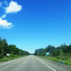
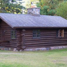
The park opens for overnight camping from April through September with 30 campsites available through online and phone reservations. Visitors should know that facilities operate seasonally, so planning a visit during warmer months works best for camping experiences.

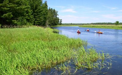
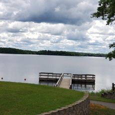
The river widens noticeably at this location, creating excellent paddling conditions for kayaking and canoeing. These natural expansions of the waterway make this section especially rewarding for visitors who enjoy water sports.

Location: Cass County

Location: Itasca County

Inception: 1959

Address: 9042 Schoolcraft Lane NE, Deer River, MN 56636

Phone: +12183288982

Email: schoolcraft.statepark@state.mn.us

Website: https://dnr.state.mn.us/state_parks/park.html?id=spk00263#homepage

GPS coordinates: 47.22470,-93.79970

Latest update: December 14, 2025 11:02

Photos
Around this place
Lake Winnibigoshish
United States of America

Lake Winnibigoshish

38.1 km
Savanna Portage State Park
United States of America

Savanna Portage State Park

65.1 km
Hill Annex Mine State Park
United States of America

Hill Annex Mine State Park

42.1 km
Scenic State Park
United States of America

Scenic State Park

57.9 km
Minnesota State Sanatorium for Consumptives
United States of America

Minnesota State Sanatorium for Consumptives

60.9 km
United States of America

The Big Fish

38 km
Forest History Center
United States of America

Forest History Center

17.7 km
Bowstring State Forest
United States of America

Bowstring State Forest

30.9 km
Savanna State Forest
United States of America

Savanna State Forest

64.9 km
Marcell Ranger Station
United States of America

Marcell Ranger Station

42.2 km
Bigfork Village Hall
United States of America

Bigfork Village Hall

58.8 km
Coleraine Methodist Episcopal Church
United States of America

Coleraine Methodist Episcopal Church

28.9 km
Church of the Good Shepherd
United States of America

Church of the Good Shepherd

28.8 km
Thunder Alley XL
United States of America

Thunder Alley XL

22.3 km
Remer State Forest
United States of America

Remer State Forest

10.3 km
Scenic State Park CCC/WPA/Rustic Style Historic Resources
United States of America

Scenic State Park CCC/WPA/Rustic Style Historic Resources

57.9 km
Sandtrap Golf Course
United States of America

Sandtrap Golf Course

64.5 km
Tioga Pit Beach
United States of America

Tioga Pit Beach

14.2 km
Draper Lookout Tower
United States of America

Draper Lookout Tower

34.6 km
Norway Beach Swimming Area
United States of America

Norway Beach Swimming Area

57.3 km
Quadna Fire Tower
United States of America

Quadna Fire Tower

33.3 km
Cuba Hill Lookout Tower
United States of America

Cuba Hill Lookout Tower

53.7 km
Sandy Lake Lookout Tower
United States of America

Sandy Lake Lookout Tower

67.6 km
Farley Hill Lookout Tower
United States of America

Farley Hill Lookout Tower

46.1 km
Emily Lookout Tower
United States of America

Emily Lookout Tower

61.4 km
Ball Bluff Lookout Tower
United States of America

Ball Bluff Lookout Tower

52.8 km
Coleraine Fire Lookout Tower
United States of America

Coleraine Fire Lookout Tower

27.2 km
Ruby Lake Camp
United States of America

Ruby Lake Camp

37.9 km
Show the full map
Reviews

Visited this place? Tap the stars to rate it and share your experience / photos with the community! Try now! You can cancel it anytime.

« Schoolcraft State Park - Minnesota state park with Mississippi River access in Cass and Itasca counties, United States » is provided by Around Us (aroundus.com). Images and texts are derived from Wikimedia project under a Creative Commons license. You are allowed to copy, distribute, and modify copies of this page, under the conditions set by the license, as long as this note is clearly visible.

Discover hidden gems everywhere you go!

From secret cafés to breathtaking viewpoints, skip the crowded tourist spots and find places that match your style. Our app makes it easy with voice search, smart filtering, route optimization, and insider tips from travelers worldwide. Download now for the complete mobile experience.

Around Us App Screenshot

A unique approach to discovering new places

Le Figaro

All the places worth exploring

France Info

A tailor-made excursion in just a few clicks

20 Minutes