Red Willow County

Log in to your account

AroundUs is a community-driven map of interesting places, built by curious explorers like you. It grows with every review, story, and photo you share.
Connect to save your favorite spots, contribute locations, and create personalized routes.
Continue with Google
Continue with Apple
Continue with X
Continue with Facebook
Continue with email
By continuing, you accept our Terms and Conditions and our Privacy Policy
Create an account
Add to collection
Map
Suggest a change
Share

Red Willow County, Administrative county in Nebraska, United States

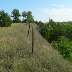
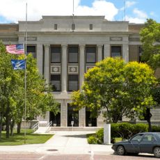
Red Willow County is an administrative county in Nebraska covering around 720 square miles (1,860 square kilometers) of gently rolling terrain. The Republican River flows through its northern section, and McCook functions as the county seat and main population center.

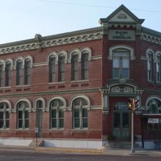
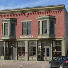
The county was founded in 1873 and named after Red Willow Creek, derived from a Dakota term meaning Red Dogwood. The arrival of the railroad in subsequent years shaped its economy and made McCook an important transportation hub.

McCook grew around its railroad heritage and the California Zephyr Amtrak service still connects residents to major cities across the country. This train connection remains an important link for the community to the wider world.

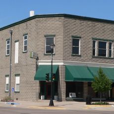
McCook sits along US Highways 6 and 34, making it easily accessible by car through the main routes that cross the county. Most services and facilities are concentrated in McCook, which serves as the administrative and commercial hub for the area.

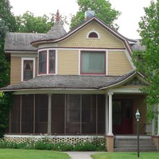
The area is very sparsely populated with around 6 people per square kilometer, making it one of Nebraska's most thinly settled regions. Despite this low population density, residents maintain a strong sense of local community.

Location: Nebraska

Inception: 1873

Capital city: McCook

Shares border with: Frontier County, Decatur County, Furnas County, Hitchcock County, Rawlins County

Website: http://co.red-willow.ne.us

GPS coordinates: 40.18000,-100.48000

Latest update: December 10, 2025 16:04

Photos
Around this place
Harvey P. Sutton House
United States of America

Harvey P. Sutton House

12.7 km
Heartland Museum of Military Vehicles
United States of America

Heartland Museum of Military Vehicles

88.8 km
Norton County meteorite
United States of America

Norton County meteorite

76.1 km
Prairie Dog State Park
United States of America

Prairie Dog State Park

61.3 km
St. John's Evangelical Lutheran German Church and Cemetery
United States of America

St. John's Evangelical Lutheran German Church and Cemetery

53 km
George W. Norris House
United States of America

George W. Norris House

12.7 km
Massacre Canyon Historical Monument
United States of America

Massacre Canyon Historical Monument

41.3 km
Prairie Dog Creek Bridge
United States of America

Prairie Dog Creek Bridge

87.4 km
St. Paul's Methodist Protestant Church
United States of America

St. Paul's Methodist Protestant Church

29.4 km
W. H. Faling House
United States of America

W. H. Faling House

28.8 km
Bank of Oberlin
United States of America

Bank of Oberlin

40.4 km
Mowry Bluff Archeological Site
United States of America

Mowry Bluff Archeological Site

30.5 km
Ideal Cement bridge (Stratton, Nebraska)
United States of America

Ideal Cement bridge (Stratton, Nebraska)

60.6 km
Shirley Opera House
United States of America

Shirley Opera House

63.2 km
Gosper County Courthouse
United States of America

Gosper County Courthouse

69.4 km
McCook Public-Carnegie Library
United States of America

McCook Public-Carnegie Library

12.6 km
Norton Downtown Historic District
United States of America

Norton Downtown Historic District

63.8 km
Allen's Opera House
United States of America

Allen's Opera House

86.5 km
Barbeau House
United States of America

Barbeau House

75.5 km
Ernest A. Calling House
United States of America

Ernest A. Calling House

88.1 km
Red Willow County Courthouse
United States of America

Red Willow County Courthouse

12.6 km
Norcatur City Hall
United States of America

Norcatur City Hall

45.5 km
McCook YMCA
United States of America

McCook YMCA

12.6 km
Gothenburg Carnegie Library
United States of America

Gothenburg Carnegie Library

87.7 km
North Fork Solomon River Lattice Truss Bridge
United States of America

North Fork Solomon River Lattice Truss Bridge

65.3 km
United States of America

Highland Precinct

38.3 km
Republican State Aid Bridge
United States of America

Republican State Aid Bridge

28.6 km
Sappa Creek Bridge
United States of America

Sappa Creek Bridge

78.9 km
Show the full map
Reviews

Visited this place? Tap the stars to rate it and share your experience / photos with the community! Try now! You can cancel it anytime.

Administrative divisions
« Red Willow County - Administrative county in Nebraska, United States » is provided by Around Us (aroundus.com). Images and texts are derived from Wikimedia project under a Creative Commons license. You are allowed to copy, distribute, and modify copies of this page, under the conditions set by the license, as long as this note is clearly visible.

Discover hidden gems everywhere you go!

From secret cafés to breathtaking viewpoints, skip the crowded tourist spots and find places that match your style. Our app makes it easy with voice search, smart filtering, route optimization, and insider tips from travelers worldwide. Download now for the complete mobile experience.

Around Us App Screenshot

A unique approach to discovering new places

Le Figaro

All the places worth exploring

France Info

A tailor-made excursion in just a few clicks

20 Minutes