Enable Location

We need your location to show you interesting places around you

Discover nearby places

Find interesting locations and hidden gems around you

Precise directions

Get accurate directions and distances to places

Your location is never shared with other users. It's only used when you tap the location button.

Howard County

Log in to your account

Start exploring — it's free

Trusted by 63,747 travelers worldwide

Continue with Google
Continue with Apple
or

We will send you a code to connect

By continuing, you accept our Terms and Conditions and our Privacy Policy

Check your inbox

We've sent a pincode in your inbox. Please enter the code below.

Discussion Reviews 1 Photos
7.4k Popularity

Howard County, Administrative county in central Nebraska, United States

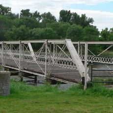
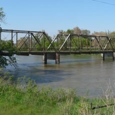
Howard County is an administrative county in central Nebraska covering rolling hills and farming areas. The Loup River system flows through the region, creating a network of waterways across the landscape.

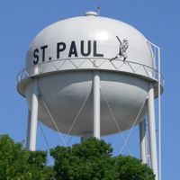
The county was established in 1871 and named after Civil War General Oliver Otis Howard. St. Paul was chosen as its administrative seat and continues to serve that role today.

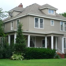
Agriculture defines daily life here, with farms scattered across the land and shaping the local economy. Visitors can see how farming remains central to the region's identity and way of living.

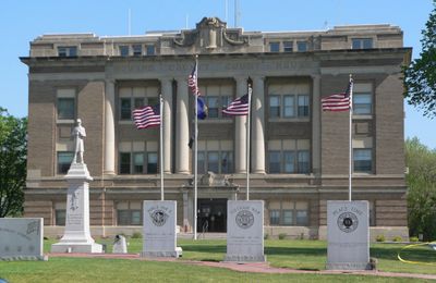
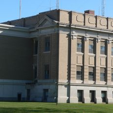
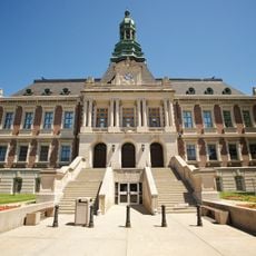
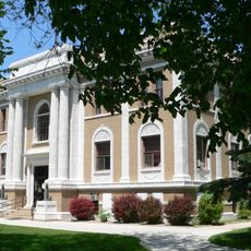
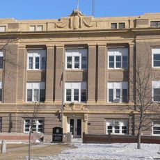
The county courthouse is located in St. Paul and handles administrative services and public records. Plan visits during normal business hours when offices are open and staff are available.

Three branches of the Loup River meet and merge within this county, creating a distinctive natural water network. This convergence of waterways shapes the landscape in ways that make this region different from surrounding areas.

The community of curious travelers

AroundUs brings together thousands of curated places, local tips, and hidden gems, enriched daily by 60,000 contributors worldwide.

Start exploring
Location
Inception
1871
Capital city
St. Paul
Shares border with
Greeley County, Hall County, Sherman County, Merrick County, Nance County, Buffalo County
GPS coordinates
41.22000,-98.52000
Latest update
December 10, 2025 15:47
Around this place
Stuhr Museum
United States of America

Stuhr Museum

39.4 km
Cathedral of the Nativity of the Blessed Virgin Mary
United States of America

Cathedral of the Nativity of the Blessed Virgin Mary

36.5 km
Lone Tree Monument
United States of America

Lone Tree Monument

44.7 km
Church of the Visitation of the Blessed Virgin Mary
United States of America

Church of the Visitation of the Blessed Virgin Mary

32.6 km
Grand Island United States Post Office and Courthouse
United States of America

Grand Island United States Post Office and Courthouse

36.2 km
Nine Bridges Bridge
United States of America

Nine Bridges Bridge

45.2 km
Merrick County Courthouse
United States of America

Merrick County Courthouse

45.2 km
State Theatre
United States of America

State Theatre

44.9 km
Wright Morris Boyhood House
United States of America

Wright Morris Boyhood House

42.8 km
St. Peder's Dansk Evangelical Lutheran Kirke
United States of America

St. Peder's Dansk Evangelical Lutheran Kirke

12.3 km
Liederkranz
United States of America

Liederkranz

36.3 km
Dannevirke Danish Lutheran Church and Community Hall
United States of America

Dannevirke Danish Lutheran Church and Community Hall

19.4 km
Andrew M. Hargis House
United States of America

Andrew M. Hargis House

36.3 km
Hall County Courthouse
United States of America

Hall County Courthouse

36.3 km
Loup City Township Carnegie Library
United States of America

Loup City Township Carnegie Library

37.9 km
Howard County Courthouse
United States of America

Howard County Courthouse

5.3 km
North Loup Bridge
United States of America

North Loup Bridge

37.7 km
Columbia Hall
United States of America

Columbia Hall

11.5 km
Sherman County Courthouse
United States of America

Sherman County Courthouse

37.8 km
Greeley County Courthouse
United States of America

Greeley County Courthouse

36.5 km
H. J. Bartenbach House
United States of America

H. J. Bartenbach House

36.4 km
Grand Island Carnegie Library
United States of America

Grand Island Carnegie Library

36.2 km
Evangelische Lutherische Dreienigkeit Kirche
United States of America

Evangelische Lutherische Dreienigkeit Kirche

36.1 km
Hamilton-Donald House
United States of America

Hamilton-Donald House

36.2 km
Glade-Donald House
United States of America

Glade-Donald House

36.5 km
Lee Huff Apartment Complex
United States of America

Lee Huff Apartment Complex

36.5 km
Heinrich Giese House
United States of America

Heinrich Giese House

37.9 km
Oscar Roeser House
United States of America

Oscar Roeser House

36.6 km
Show the full map
Reviews
Share your experience

No review yet

Discussions
Start a discussion...

No discussion yet

Administrative divisions
« Howard County - Administrative county in central Nebraska, United States » is provided by Around Us (aroundus.com). Images and texts are derived from Wikimedia project under a Creative Commons license. You are allowed to copy, distribute, and modify copies of this page, under the conditions set by the license, as long as this note is clearly visible.

Discover hidden gems everywhere you go!

From secret cafés to breathtaking viewpoints, skip the crowded tourist spots and find places that match your style. Our app makes it easy with voice search, smart filtering, route optimization, and insider tips from travelers worldwide. Download now for the complete mobile experience.

Around Us App Screenshot

A unique approach to discovering new places

Le Figaro

All the places worth exploring

France Info

A tailor-made excursion in just a few clicks

20 Minutes

Around Us
Travel Guide & Maps
Download

Send to your phone

QR Code
1

Open the camera app on your mobile.

2

Point at the QR code with your camera. A notification will appear.

3

Tap the notification to open the link.