Phelps County

Log in to your account

AroundUs is a community-driven map of interesting places, built by curious explorers like you. It grows with every review, story, and photo you share.
Connect to save your favorite spots, contribute locations, and create personalized routes.
Continue with Google
Continue with Apple
Continue with X
Continue with Facebook
Continue with email
By continuing, you accept our Terms and Conditions and our Privacy Policy
Create an account
Add to collection
Map
Suggest a change
Share

Phelps County, County in Nebraska, United States

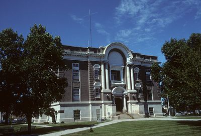
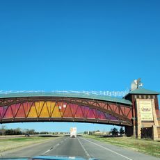
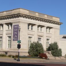
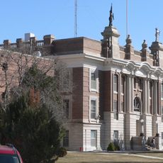
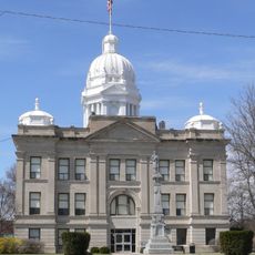
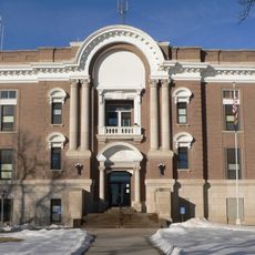
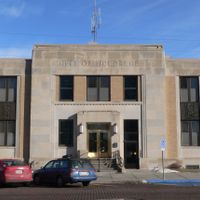
Phelps County is an administrative division in south-central Nebraska characterized by rolling hills and farms spread across several hundred square miles. Holdrege serves as the county seat, housing the courthouse and main administrative services for the region.

The county was established in 1873 and Holdrege was chosen as its administrative center, shaping the region's development ever since. This founding was part of the broader settlement and development of the central United States during the late 1800s.

The Field of Blue bronze sculpture on the courthouse grounds reflects how deeply the local identity is connected to farming and rural life in the region. Visitors can see this heritage expressed through public art that stands in the center of community life.

The courthouse in Holdrege is open on weekdays and provides the main administrative services from a central location. Visitors should plan ahead as this is a rural county with considerable distances between towns and services.

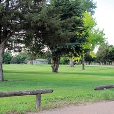
The Atlanta Marsh National Wildlife Management Area within the county protects natural habitats for birds and other wildlife in a preserved environment. This area offers a quiet spot for nature watching away from the farming lands that dominate the region.

Location: Nebraska

Inception: 1873

Capital city: Holdrege

Shares border with: Buffalo County, Harlan County, Furnas County, Gosper County, Dawson County, Kearney County, Franklin County

Website: http://phelpsgov.org

GPS coordinates: 40.51000,-99.41000

Latest update: December 10, 2025 15:47

Photos
Around this place
Fort Kearny
United States of America

Fort Kearny

38 km
Great Platte River Road Archway Monument
United States of America

Great Platte River Road Archway Monument

36.1 km
Pioneer Village
United States of America

Pioneer Village

38.9 km
Heartland Museum of Military Vehicles
United States of America

Heartland Museum of Military Vehicles

37.9 km
The Great Platte River Road Archway
United States of America

The Great Platte River Road Archway

36.1 km
Museum of Nebraska Art
United States of America

Museum of Nebraska Art

34.9 km
George W. Frank House
United States of America

George W. Frank House

33.2 km
Dawson County Courthouse
United States of America

Dawson County Courthouse

41 km
Salem Swedish Methodist Episcopal Church
United States of America

Salem Swedish Methodist Episcopal Church

20.6 km
Gosper County Courthouse
United States of America

Gosper County Courthouse

39.1 km
Kearney County Courthouse
United States of America

Kearney County Courthouse

39.1 km
Kinner House
United States of America

Kinner House

8.2 km
Saint Luke's Protestant Episcopal Church
United States of America

Saint Luke's Protestant Episcopal Church

34.5 km
United States of America

Minden United States Post Office

39.2 km
Dr. A.O. Thomas House
United States of America

Dr. A.O. Thomas House

34 km
Ira Webster Olive House
United States of America

Ira Webster Olive House

41.3 km
John Barnd House
United States of America

John Barnd House

35.7 km
Phelps County Courthouse
United States of America

Phelps County Courthouse

8.6 km
Fort Theatre
United States of America

Fort Theatre

34.7 km
W. T. Thorne Building
United States of America

W. T. Thorne Building

39.1 km
John J. and Lenora Bartlett House
United States of America

John J. and Lenora Bartlett House

33.3 km
Hanson-Downing House
United States of America

Hanson-Downing House

34.1 km
Klehm House
United States of America

Klehm House

33.9 km
World Theatre
United States of America

World Theatre

34.8 km
Turkey Creek Bridge
United States of America

Turkey Creek Bridge

25.1 km
Tobin Indian Raid Historical Marker
United States of America

Tobin Indian Raid Historical Marker

26.3 km
Kilgore Bridge
United States of America

Kilgore Bridge

43.3 km
Harry V. Temple House
United States of America

Harry V. Temple House

41.4 km
Show the full map
Reviews

Visited this place? Tap the stars to rate it and share your experience / photos with the community! Try now! You can cancel it anytime.

Administrative divisions
« Phelps County - County in Nebraska, United States » is provided by Around Us (aroundus.com). Images and texts are derived from Wikimedia project under a Creative Commons license. You are allowed to copy, distribute, and modify copies of this page, under the conditions set by the license, as long as this note is clearly visible.

Discover hidden gems everywhere you go!

From secret cafés to breathtaking viewpoints, skip the crowded tourist spots and find places that match your style. Our app makes it easy with voice search, smart filtering, route optimization, and insider tips from travelers worldwide. Download now for the complete mobile experience.

Around Us App Screenshot

A unique approach to discovering new places

Le Figaro

All the places worth exploring

France Info

A tailor-made excursion in just a few clicks

20 Minutes