Johnston County

Log in to your account

AroundUs is a community-driven map of interesting places, built by curious explorers like you. It grows with every review, story, and photo you share.
Connect to save your favorite spots, contribute locations, and create personalized routes.
By continuing, you accept our Terms and Conditions and our Privacy Policy
Add to collection
Map
Suggest a change
Share

Johnston County, County administration in North Carolina, United States

Johnston County is an administrative region in North Carolina that covers a substantial land area and includes nine incorporated municipalities, with Smithfield serving as the county seat and Clayton emerging as a growing center. The county blends rural farmland with areas experiencing rapid suburban expansion.

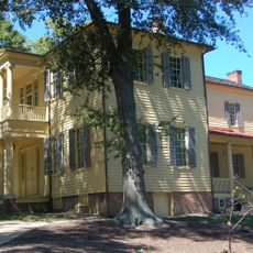
The county was established in 1746 during the colonial era and has evolved from a rural settlement into a region experiencing significant growth. Proximity to Raleigh's expansion has transformed its development pattern over recent decades.

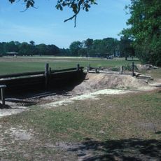
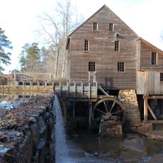
The county preserves traditions rooted in farming and small-town life, while absorbing influences from nearby Raleigh's growth. You can observe how older neighborhoods and newer developments shape the daily rhythm of local communities.

The county is easily accessed via Interstate 95 and Interstate 40, which connect it to surrounding regions and facilitate transportation. Most locations within the county are car-accessible, and road infrastructure helps visitors navigate the area efficiently.

The county is home to several major logistics and distribution hubs, including Amazon warehouses, which benefit from the strategic position between rural and urban areas. These operations have become an important economic driver for the region.

Location: North Carolina

Inception: June 28, 1746

Capital city: Smithfield

Shares border with: Nash County, Wayne County, Harnett County, Wilson County, Sampson County, Wake County, Franklin County

Website: https://johnstonnc.com

GPS coordinates: 35.52000,-78.37000

Latest update: December 6, 2025 22:01

Photos
Around this place
Show the full map
WNCN
United States of America

WNCN

22.4 km
North Carolina State Capitol
United States of America

North Carolina State Capitol

37.8 km
North Carolina Museum of Art
United States of America

North Carolina Museum of Art

44.2 km
North Carolina Museum of Art
United States of America

North Carolina Museum of Art

44.2 km
Coastal Credit Union Music Park at Walnut Creek
United States of America

Coastal Credit Union Music Park at Walnut Creek

31.6 km
North Carolina Executive Mansion
United States of America

North Carolina Executive Mansion

37.9 km
North Carolina Museum of Natural Sciences
United States of America

North Carolina Museum of Natural Sciences

38 km
Holy Name of Jesus Cathedral, Raleigh
United States of America

Holy Name of Jesus Cathedral, Raleigh

39.5 km
Mordecai House
United States of America

Mordecai House

38.6 km
North Carolina Museum of History
United States of America

North Carolina Museum of History

37.9 km
Ava Gardner Museum
United States of America

Ava Gardner Museum

2.5 km
Historic Oakwood Cemetery
United States of America

Historic Oakwood Cemetery

37.6 km
PNC Plaza
United States of America

PNC Plaza

37.5 km
Pullen Park
United States of America

Pullen Park

39.5 km
North Carolina State Legislative Building
United States of America

North Carolina State Legislative Building

38.1 km
Bentonville Battlefield
United States of America

Bentonville Battlefield

24.1 km
Red Hat Amphitheater
United States of America

Red Hat Amphitheater

37.5 km
Two Progress Plaza
United States of America

Two Progress Plaza

37.4 km
Yates Mill
United States of America

Yates Mill

36.3 km
Joel Lane House
United States of America

Joel Lane House

38.3 km
J. C. Raulston Arboretum
United States of America

J. C. Raulston Arboretum

42.7 km
Lonnie Poole Golf Course
United States of America

Lonnie Poole Golf Course

38.6 km
Pope House Museum
United States of America

Pope House Museum

37.2 km
Riddick Stadium
United States of America

Riddick Stadium

39.9 km
North Carolina State University Memorial Belltower
United States of America

North Carolina State University Memorial Belltower

39.8 km
Pullen Park Carousel
United States of America

Pullen Park Carousel

39.3 km
Sacred Heart Cathedral
United States of America

Sacred Heart Cathedral

38.1 km
Duke Energy Center for the Performing Arts
United States of America

Duke Energy Center for the Performing Arts

37.1 km
Show the full map
Reviews

Visited this place? Tap the stars to rate it and share your experience / photos with the community! Try now! You can cancel it anytime.

Administrative divisions
« Johnston County - County administration in North Carolina, United States » is provided by Around Us (aroundus.com). Images and texts are derived from Wikimedia project under a Creative Commons license. You are allowed to copy, distribute, and modify copies of this page, under the conditions set by the license, as long as this note is clearly visible.

Discover hidden gems everywhere you go!

From secret cafés to breathtaking viewpoints, skip the crowded tourist spots and find places that match your style. Our app makes it easy with voice search, smart filtering, route optimization, and insider tips from travelers worldwide. Download now for the complete mobile experience.

Around Us App Screenshot

A unique approach to discovering new places

Le Figaro

All the places worth exploring

France Info

A tailor-made excursion in just a few clicks

20 Minutes