Brown County, County in southern Indiana, US
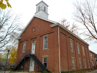
Brown County is an administrative division in southern Indiana with extensive forests and water bodies. Nashville is the only incorporated town and serves as the administrative center with the county courthouse.
Indiana's legislature established the county on February 4, 1836, naming it after General Jacob Brown from the War of 1812. The area later underwent dramatic change through heavy logging that caused soil erosion.
The region attracted artists starting in the early 1900s who settled here and built a thriving art community. Today, craft galleries and artist studios continue to shape the character of the place.
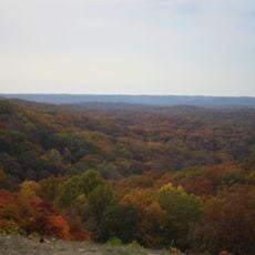
The best time to visit is spring and fall when weather is mild and forests display their colors. The rural setting means you will need a car to explore different areas comfortably.
After intense logging in the 1800s, forest cover gradually regenerated and now shapes the landscape again. This recovery shows how nature can heal itself over decades when given the chance.
The community of curious travelers
AroundUs brings together thousands of curated places, local tips, and hidden gems, enriched daily by 60,000 contributors worldwide.