Enable Location

We need your location to show you interesting places around you

Discover nearby places

Find interesting locations and hidden gems around you

Precise directions

Get accurate directions and distances to places

Your location is never shared with other users. It's only used when you tap the location button.

Gallatin County

Log in to your account

Start exploring — it's free

Trusted by 61,685 travelers worldwide

Continue with Google
Continue with Apple
or

We will send you a code to connect

By continuing, you accept our Terms and Conditions and our Privacy Policy

Check your inbox

We've sent a pincode in your inbox. Please enter the code below.

Gallatin County, Administrative county in northern Kentucky, US

Description

Gallatin County sits in northern Kentucky along the Ohio River and spans roughly 105 square miles with farmland, residential areas, and several transportation routes. The area spreads across gentle terrain with roads and rail connections that link to larger nearby cities like Cincinnati.

History

The county was established on December 14, 1798, as Kentucky's 33rd county and named after Albert Gallatin, who served as Secretary of the Treasury under Presidents Jefferson and Madison. This early founding moment shows the region's role in shaping the young state.

Culture

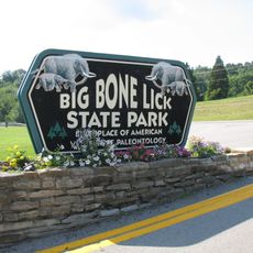
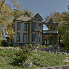
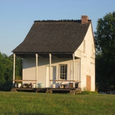
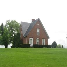
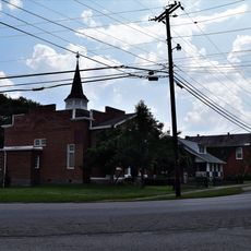
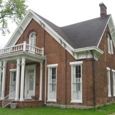
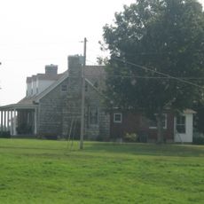
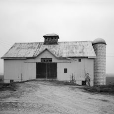
The area holds deep roots in farming, and many residents continue working the land today. The Ohio River waterfront and local gatherings shape how people connect and live together throughout the year.

Practical

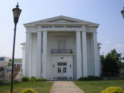
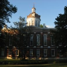
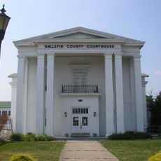
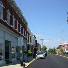
The county government operates from the courthouse in Warsaw at 200 Washington Street and serves as the main hub for official business. Visitors should know that multiple roads connect this area to Cincinnati, which can be useful when planning travel through the region.

Did you know?

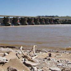
The Markland Locks and Dam was completed in 1964 and generates electricity through water power while managing Ohio River levels for commercial shipping. This facility often goes unnoticed by visitors, yet it plays a central role in the region's daily operations and economy.

Location
Inception
December 14, 1798
Capital city
Warsaw
Part of
Cincinnati metropolitan area
Shares border with
Switzerland County, Boone County, Grant County, Owen County, Carroll County
GPS coordinates
38.76000,-84.86000
Latest update
December 7, 2025 20:43

AroundUs brings together thousands of curated places, local tips, and hidden gems, enriched daily by 60,000 contributors worldwide. Discover all places nearby (Kentucky).

Around this place
Kentucky Speedway
United States of America

Kentucky Speedway

7.4 km
Big Bone Lick State Park
United States of America

Big Bone Lick State Park

17.1 km
Markland Locks and Dam
United States of America

Markland Locks and Dam

9.2 km
National Dirt Late Model Hall of Fame
United States of America

National Dirt Late Model Hall of Fame

18.9 km
Benjamin Schenck Mansion
United States of America

Benjamin Schenck Mansion

18.6 km
Eagle Station meteorite
United States of America

Eagle Station meteorite

18.5 km
Abner Gaines House
United States of America

Abner Gaines House

25.8 km
Rabbit Hash Historic District
United States of America

Rabbit Hash Historic District

20.3 km
Hoosier Theatre
United States of America

Hoosier Theatre

18 km
Edward and George Cary Eggleston House
United States of America

Edward and George Cary Eggleston House

18.3 km
Big Bone Methodist Church
United States of America

Big Bone Methodist Church

17.2 km
L.O. Cox House
United States of America

L.O. Cox House

24.6 km
Switzerland County Courthouse
United States of America

Switzerland County Courthouse

18.2 km
James Rogers House
United States of America

James Rogers House

25.3 km
Ford Stone House
United States of America

Ford Stone House

10.7 km
United States of America

Belleview Post Office

25.3 km
Warsaw Historic District
United States of America

Warsaw Historic District

4.3 km
Clore Plow Works-J.W. Whitlock and Company
United States of America

Clore Plow Works-J.W. Whitlock and Company

20.9 km
Thomas T. Wright House
United States of America

Thomas T. Wright House

23.5 km
Ghent Historic District
United States of America

Ghent Historic District

17.5 km
Venoge Farmstead
United States of America

Venoge Farmstead

20.6 km
Benjamin F. Turley House
United States of America

Benjamin F. Turley House

8.2 km
New Liberty Historic District
United States of America

New Liberty Historic District

16.7 km
Central Owenton Historic District
United States of America

Central Owenton Historic District

25 km
Henry C. Peak House
United States of America

Henry C. Peak House

4.3 km
John Chandler House
United States of America

John Chandler House

24.5 km
Chandler House
United States of America

Chandler House

24.5 km
Merit-Tandy Farmstead
United States of America

Merit-Tandy Farmstead

13.4 km
Show the full map
« Gallatin County - Administrative county in northern Kentucky, US » is provided by Around Us (aroundus.com). Images and texts are derived from Wikimedia project under a Creative Commons license. You are allowed to copy, distribute, and modify copies of this page, under the conditions set by the license, as long as this note is clearly visible.

Discover hidden gems everywhere you go!

From secret cafés to breathtaking viewpoints, skip the crowded tourist spots and find places that match your style. Our app makes it easy with voice search, smart filtering, route optimization, and insider tips from travelers worldwide. Download now for the complete mobile experience.

Around Us App Screenshot

A unique approach to discovering new places

Le Figaro

All the places worth exploring

France Info

A tailor-made excursion in just a few clicks

20 Minutes

Around Us
Travel Guide & Maps
Download

Send to your phone

QR Code
1

Open the camera app on your mobile.

2

Point at the QR code with your camera. A notification will appear.

3

Tap the notification to open the link.