Enable Location

We need your location to show you interesting places around you

Discover nearby places

Find interesting locations and hidden gems around you

Precise directions

Get accurate directions and distances to places

Your location is never shared with other users. It's only used when you tap the location button.

Wabasha

Log in to your account

Start exploring — it's free

Trusted by 61,908 travelers worldwide

Continue with Google
Continue with Apple
or

We will send you a code to connect

By continuing, you accept our Terms and Conditions and our Privacy Policy

Check your inbox

We've sent a pincode in your inbox. Please enter the code below.

Wabasha, River settlement in Wabasha County, Minnesota, United States.

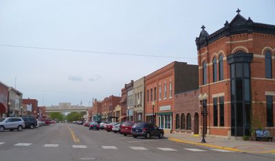
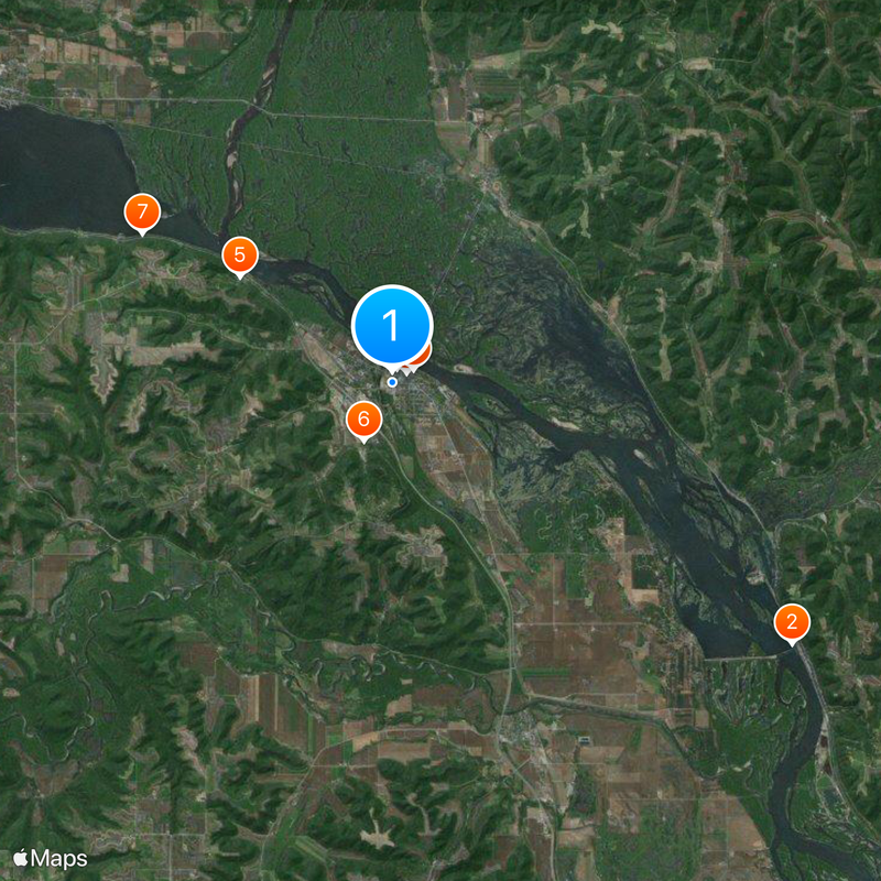
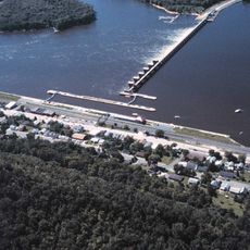
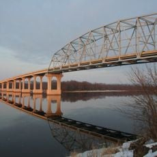
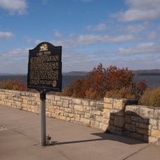
Wabasha is a city perched on the western bank of the Mississippi River in southeastern Minnesota at approximately 209 meters elevation. The riverside location shapes the town's character and provides views of the water along with outdoor recreation opportunities.

The settlement began in the 1800s as Cratte's Landing and became an important supply point for settlers during westward expansion. This early role established its importance as a trading post along the Mississippi.

The National Eagle Center reveals how bald eagles have shaped local identity for generations and continue to draw people to the river. Visitors discover how these birds connect the community to the natural rhythm of the Mississippi.

The city is accessible via U.S. Highway 61, which connects to recreational areas and water activities on the Mississippi. Visitors should prepare for changing weather and wear sturdy shoes, especially when exploring trails or accessing the riverbank.

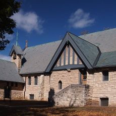
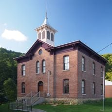
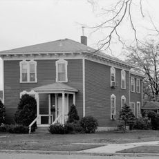
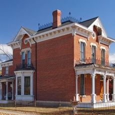
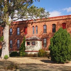
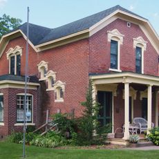
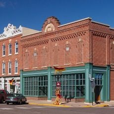
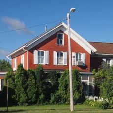
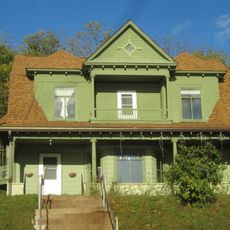
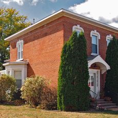
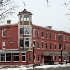
Several buildings from the 1800s remain standing in town, offering glimpses into early settlement life and how people built their homes. These structures tell stories of the frontier period through their design and construction.

The community of curious travelers

AroundUs brings together thousands of curated places, local tips, and hidden gems, enriched daily by 60,000 contributors worldwide.

Start exploring
Location
Elevation above the sea
209 m
GPS coordinates
44.37944,-92.03556
Latest update
December 20, 2025 00:55
Around this place
Lock and Dam No. 4
United States of America

Lock and Dam No. 4

11 km
Wabasha–Nelson Bridge
United States of America

Wabasha–Nelson Bridge

814 m
Grace Memorial Episcopal Church
United States of America

Grace Memorial Episcopal Church

396 m
Reads Landing School
United States of America

Reads Landing School

4.3 km
First Congregational Parsonage
United States of America

First Congregational Parsonage

1.5 km
Reads Landing Overlook
United States of America

Reads Landing Overlook

6.7 km
Lorenz and Lugerde Ginthner House
United States of America

Lorenz and Lugerde Ginthner House

339 m
Lucas Kuehn House
United States of America

Lucas Kuehn House

578 m
Alexander Thoirs House
United States of America

Alexander Thoirs House

495 m
Wabasha County Poor House
United States of America

Wabasha County Poor House

2.2 km
United States of America

Burlington Hotel

10.8 km
Clara and Julius Schmidt House
United States of America

Clara and Julius Schmidt House

565 m
Wabasha Commercial Historic District
United States of America

Wabasha Commercial Historic District

542 m
William H. and Alma Downer Campbell House
United States of America

William H. and Alma Downer Campbell House

422 m
Dr. J. T. Tenny House
United States of America

Dr. J. T. Tenny House

11.3 km
United States of America

Ulrich Walser House

11.1 km
Henry S. and Magdalena Schwedes House
United States of America

Henry S. and Magdalena Schwedes House

558 m
Jacob Berni House
United States of America

Jacob Berni House

10.6 km
Historic Anderson House Hotel
United States of America

Historic Anderson House Hotel

622 m
United States of America

Coffee Mill Country Club

2.7 km
United States of America

National Eagle Center

620 m
United States of America

Scenic viewpoint

6.7 km
United States of America

Scenic viewpoint

8.1 km
United States of America

Scenic viewpoint

11.1 km
United States of America

Scenic viewpoint

11.1 km
United States of America

Scenic viewpoint

4.8 km
United States of America

Scenic viewpoint

5.8 km
United States of America

Scenic viewpoint

5.4 km
Show the full map
« Wabasha - River settlement in Wabasha County, Minnesota, United States » is provided by Around Us (aroundus.com). Images and texts are derived from Wikimedia project under a Creative Commons license. You are allowed to copy, distribute, and modify copies of this page, under the conditions set by the license, as long as this note is clearly visible.

Discover hidden gems everywhere you go!

From secret cafés to breathtaking viewpoints, skip the crowded tourist spots and find places that match your style. Our app makes it easy with voice search, smart filtering, route optimization, and insider tips from travelers worldwide. Download now for the complete mobile experience.

Around Us App Screenshot

A unique approach to discovering new places

Le Figaro

All the places worth exploring

France Info

A tailor-made excursion in just a few clicks

20 Minutes

Around Us
Travel Guide & Maps
Download

Send to your phone

QR Code
1

Open the camera app on your mobile.

2

Point at the QR code with your camera. A notification will appear.

3

Tap the notification to open the link.