Wabasha County

Log in to your account

AroundUs is a community-driven map of interesting places, built by curious explorers like you. It grows with every review, story, and photo you share.
Connect to save your favorite spots, contribute locations, and create personalized routes.
Continue with Google
Continue with Apple
Continue with X
Continue with Facebook
Continue with email
By continuing, you accept our Terms and Conditions and our Privacy Policy
Create an account
Add to collection
Map
Suggest a change
Share

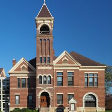
Wabasha County, Administrative county in southeastern Minnesota, United States

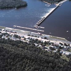
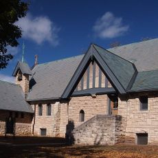
Wabasha County is an administrative division in southeastern Minnesota that stretches along the Mississippi River and is characterized by river valleys and tall bluffs. The landscape features natural formations along the waterway that shape the character of the region.

The county was established on October 27, 1849, and was named after Chief Wa-pa-shaw of the Sioux Nation, whose people used the region as a significant settlement area. The early connection to Native Americans remains an important part of the region's history.

The National Eagle Center in the county seat of Wabasha offers visitors programs and exhibits focused on bald eagle behavior and regional wildlife protection. The facility reflects how the community connects with the natural world around it.

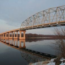
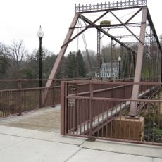
The area is connected to Wisconsin through multiple bridges that cross the Mississippi River, providing easy passage between the states. These crossings replaced the ferryboat systems that once transported people and goods across the water.

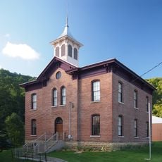
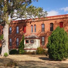
The Reads Landing School, built in 1870, now operates as a museum displaying classrooms frozen in time from the 1920s and 1930s. Visitors can step inside to see how students learned and studied roughly a century ago.

Location: Minnesota

Inception: October 27, 1849

Capital city: Wabasha

Shares border with: Pepin County, Olmsted County, Buffalo County, Winona County, Goodhue County

Website: http://co.wabasha.mn.us

GPS coordinates: 44.28000,-92.24000

Latest update: December 7, 2025 20:47

Photos
Around this place
Carley State Park
United States of America

Carley State Park

18.9 km
Lock and Dam No. 4
United States of America

Lock and Dam No. 4

26 km
Nicholas Marnach House
United States of America

Nicholas Marnach House

24.3 km
Wabasha–Nelson Bridge
United States of America

Wabasha–Nelson Bridge

20.3 km
Grace Memorial Episcopal Church
United States of America

Grace Memorial Episcopal Church

20.1 km
Patrick H. Rahilly House
United States of America

Patrick H. Rahilly House

17 km
Reads Landing School
United States of America

Reads Landing School

18.6 km
Jon Hassler Theater
United States of America

Jon Hassler Theater

13.9 km
Bear Valley Grange Hall
United States of America

Bear Valley Grange Hall

18.4 km
First Congregational Parsonage
United States of America

First Congregational Parsonage

18.4 km
Williamson–Russell–Rahilly House
United States of America

Williamson–Russell–Rahilly House

18.6 km
Reads Landing Overlook
United States of America

Reads Landing Overlook

17.9 km
Lorenz and Lugerde Ginthner House
United States of America

Lorenz and Lugerde Ginthner House

20 km
Swedish Evangelical Lutheran Church
United States of America

Swedish Evangelical Lutheran Church

6.1 km
Walnut Street Bridge
United States of America

Walnut Street Bridge

24.6 km
Lucas Kuehn House
United States of America

Lucas Kuehn House

20.3 km
Zumbro Parkway Bridge
United States of America

Zumbro Parkway Bridge

14.5 km
Alexander Thoirs House
United States of America

Alexander Thoirs House

20 km
Wabasha County Poor House
United States of America

Wabasha County Poor House

20.2 km
Lake City City Hall
United States of America

Lake City City Hall

18.8 km
Clara and Julius Schmidt House
United States of America

Clara and Julius Schmidt House

20.2 km
Wabasha Commercial Historic District
United States of America

Wabasha Commercial Historic District

20.2 km
Bridge No. 5827-Zumbro Falls
United States of America

Bridge No. 5827-Zumbro Falls

14.2 km
William H. and Alma Downer Campbell House
United States of America

William H. and Alma Downer Campbell House

20 km
James C. and Agnes M. Stout House
United States of America

James C. and Agnes M. Stout House

18.6 km
John Steiner Store
United States of America

John Steiner Store

26.5 km
Dr. J. T. Tenny House
United States of America

Dr. J. T. Tenny House

26.3 km
United States of America

Ulrich Walser House

26.2 km
Show the full map
Reviews

Visited this place? Tap the stars to rate it and share your experience / photos with the community! Try now! You can cancel it anytime.

« Wabasha County - Administrative county in southeastern Minnesota, United States » is provided by Around Us (aroundus.com). Images and texts are derived from Wikimedia project under a Creative Commons license. You are allowed to copy, distribute, and modify copies of this page, under the conditions set by the license, as long as this note is clearly visible.

Discover hidden gems everywhere you go!

From secret cafés to breathtaking viewpoints, skip the crowded tourist spots and find places that match your style. Our app makes it easy with voice search, smart filtering, route optimization, and insider tips from travelers worldwide. Download now for the complete mobile experience.

Around Us App Screenshot

A unique approach to discovering new places

Le Figaro

All the places worth exploring

France Info

A tailor-made excursion in just a few clicks

20 Minutes