Chest opened
+${chestReward.xp} XP
Explorer
NOUVEAU ×${chestReward.collectible.quantity}
tapez pour fermer
Chest locked

Open chests in the app

Around Us is built for your phone — chests unlock when you walk, explore and capture nearby places.

Enable Location

We need your location to show you interesting places around you

Discover nearby places

Find interesting locations and hidden gems around you

Precise directions

Get accurate directions and distances to places

Your location is never shared with other users. It's only used when you tap the location button.

Log in to your account

Start exploring — it's free

Trusted by 72,889 travelers worldwide

Continue with Google
Continue with Apple
or

We will send you a code to connect

By continuing, you accept our Terms and Conditions and our Privacy Policy

Check your inbox

We've sent a pincode in your inbox. Please enter the code below.

Kalamazoo River
Discussion Reviews Photo
21.5k Popularity

Kalamazoo River, River system in southwestern Michigan, United States.

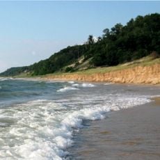
The Kalamazoo River flows across southwestern Michigan and drains a vast landscape of forests and farmland. It passes through multiple counties before emptying into Lake Michigan.

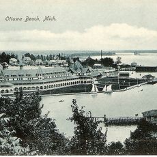
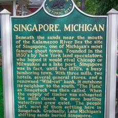
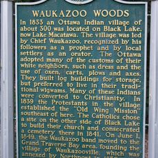
Native peoples lived along this waterway for centuries before European traders arrived in the region. The river shaped settlement patterns and economic activity throughout the area's development.

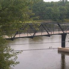
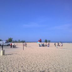
The river links several Michigan cities and forms a central water corridor for the region. People use its banks and waters for recreation and outdoor activities.

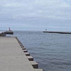
The river has multiple access points where visitors can launch boats and enjoy water activities. Check local conditions before visiting and choose your location based on the activity you want to do.

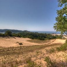
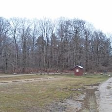
A lower section holds a special designation that protects the natural character of its banks. This stretch offers visitors a chance to see the river in a less developed setting.

The community of curious travelers

AroundUs brings together thousands of curated places, local tips, and hidden gems, enriched daily by 60,000 contributors worldwide.

Start exploring
Location
GPS coordinates
42.67669,-86.21531
Latest update
December 7, 2025 10:04
Around this place
Holland State Park
United States of America

Holland State Park

11.4 km
Saugatuck Dunes State Park
United States of America

Saugatuck Dunes State Park

3.2 km
Dorr E. Felt Mansion
United States of America

Dorr E. Felt Mansion

2.9 km
Holland Harbor Light
United States of America

Holland Harbor Light

10.7 km
Tunnel Park
United States of America

Tunnel Park

13.5 km
Egbert H. Gold Estate
United States of America

Egbert H. Gold Estate

12.6 km
New Richmond Swing Bridge
United States of America

New Richmond Swing Bridge

9.3 km
Isaac Cappon House
United States of America

Isaac Cappon House

14.8 km
Third Reformed Church of Holland
United States of America

Third Reformed Church of Holland

14.7 km
Holland Historic District
United States of America

Holland Historic District

14.8 km
Lake Shore Chapel
United States of America

Lake Shore Chapel

3 km
Ottawa Beach Historic District
United States of America

Ottawa Beach Historic District

11.1 km
All Saints Episcopal Church
United States of America

All Saints Episcopal Church

2.6 km
Francis Metallic Surfboat
United States of America

Francis Metallic Surfboat

3.8 km
Douglas Union School
United States of America

Douglas Union School

3.7 km
Thomas and Anna Morrissey House
United States of America

Thomas and Anna Morrissey House

14.9 km
Navigation Structures at Saugatuck Harbor
United States of America

Navigation Structures at Saugatuck Harbor

74 m
Saugatuck Pump House
United States of America

Saugatuck Pump House

1.9 km
Warner P. Sutton House
United States of America

Warner P. Sutton House

3 km
Hacklander Site
United States of America

Hacklander Site

6.3 km
Alley Pizza
United States of America

Alley Pizza

3.8 km
Saugatuck Harbour lighthouse
United States of America

Saugatuck Harbour lighthouse

51 m
Singapore, Michigan Historical Marker
United States of America

Singapore, Michigan Historical Marker

2.5 km
Ottawa Beach
United States of America

Ottawa Beach

11 km
Holland Harbor Historical Marker
United States of America

Holland Harbor Historical Marker

10.6 km
Waukazoo Woods Historical Marker
United States of America

Waukazoo Woods Historical Marker

12.9 km
Harderwyk Christian Reformed Church
United States of America

Harderwyk Christian Reformed Church

14.6 km
First Congregational Church Historical Marker
United States of America

First Congregational Church Historical Marker

2.4 km
Show the full map
Reviews
Share your experience

No review yet

Discussions
Start a discussion...

No discussion yet

« Kalamazoo River - River system in southwestern Michigan, United States » is provided by Around Us (aroundus.com). Images and texts are derived from Wikimedia project under a Creative Commons license. You are allowed to copy, distribute, and modify copies of this page, under the conditions set by the license, as long as this note is clearly visible.

Discover hidden gems everywhere you go!

From secret cafés to breathtaking viewpoints, skip the crowded tourist spots and find places that match your style. Our app makes it easy with voice search, smart filtering, route optimization, and insider tips from travelers worldwide. Download now for the complete mobile experience.

Around Us App Screenshot

A unique approach to discovering new places

Le Figaro

All the places worth exploring

France Info

A tailor-made excursion in just a few clicks

20 Minutes

Around Us
Travel Guide & Maps
Download

Send to your phone

QR Code
1

Open the camera app on your mobile.

2

Point at the QR code with your camera. A notification will appear.

3

Tap the notification to open the link.