Coffre ${chestReward.rarityLabel}
+${chestReward.xp} XP
Explorer
NOUVEAU ×${chestReward.collectible.quantity}
tapez pour fermer
Chest locked

Open chests in the app

Around Us is built for your phone — chests unlock when you walk, explore and capture nearby places.

Enable Location

We need your location to show you interesting places around you

Discover nearby places

Find interesting locations and hidden gems around you

Precise directions

Get accurate directions and distances to places

Your location is never shared with other users. It's only used when you tap the location button.

Joint Base Andrews

Log in to your account

Start exploring — it's free

Trusted by 72,388 travelers worldwide

Continue with Google
Continue with Apple
or

We will send you a code to connect

By continuing, you accept our Terms and Conditions and our Privacy Policy

Check your inbox

We've sent a pincode in your inbox. Please enter the code below.

Discussion Reviews 1 Photos
119k Popularity

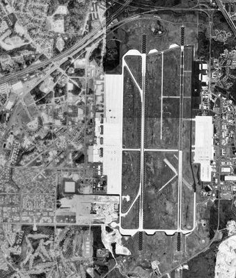
Joint Base Andrews, Military air facility in Camp Springs, United States

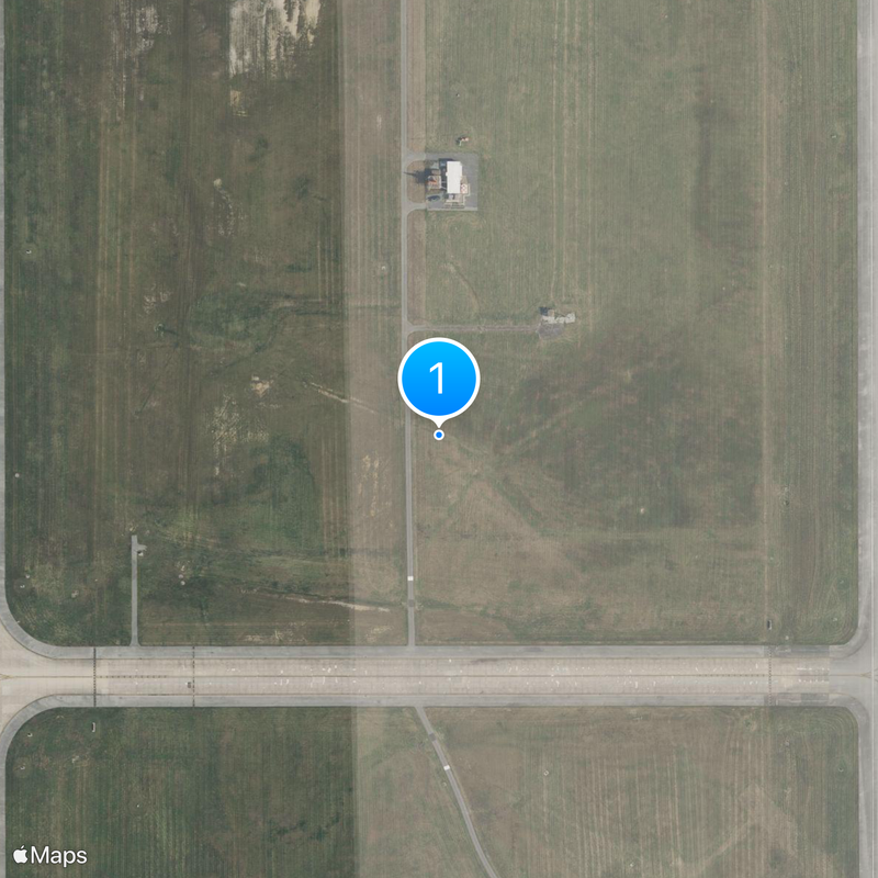
Joint Base Andrews is a military air facility in Prince George's County, Maryland. The installation features two parallel runways and houses aircraft along with residential facilities for personnel and family members.

The facility opened in 1943 as Camp Springs Army Air Field to support military air operations during World War II. It later received its current name in honor of Lieutenant General Frank Maxwell Andrews, a key figure in United States military aviation.

The facility serves as home base for presidential transport aircraft, which residents near the perimeter sometimes see taking off or landing during operations. Visitors can watch military aircraft and flight demonstrations up close during the biennial open-house aviation event.

Access to the facility is restricted by military security protocols and only available to civilians during special public events. Those planning to attend the biennial air show should expect entry queues and bag inspections at the gate.

The 89th Airlift Wing coordinates all government flights from this location and maintains specially equipped aircraft for medical emergencies during travel by high-ranking officials. The wing's personnel undergo specialized security training and service the planes to stricter standards than regular military flights.

The community of curious travelers

AroundUs brings together thousands of curated places, local tips, and hidden gems, enriched daily by 60,000 contributors worldwide.

Start exploring
Inception
October 1, 2009
Operator
United States Air Force
Part of
Air Force District of Washington
Shares border with
Clinton, Upper Marlboro, Morningside, Forestville
GPS coordinates
38.81081,-76.86703
Latest update
December 17, 2025 13:25
Around this place
Surratt House & Tavern
United States of America

Surratt House & Tavern

5.8 km
Suitland-Silver Hill
United States of America

Suitland-Silver Hill

6.5 km
United States of America

Smithsonian Museum Support Center

7.2 km
Rosaryville State Park
United States of America

Rosaryville State Park

6.3 km
His Lordship's Kindness
United States of America

His Lordship's Kindness

4.1 km
Fairfax Village
United States of America

Fairfax Village

9.4 km
United States of America

Museum Conservation Institute

7.3 km
Francis A. Gregory Neighborhood Library
United States of America

Francis A. Gregory Neighborhood Library

9.7 km
Melwood Park
United States of America

Melwood Park

4.4 km
Concord
United States of America

Concord

7.4 km
United States of America

Cheltenham Wildlife Management Area

9.1 km
Woodstock
United States of America

Woodstock

7.3 km
Ridgeley School
United States of America

Ridgeley School

8.7 km
United States of America

Randall Tract Recreation Area

6.8 km
Fort Dupont
United States of America

Fort Dupont

9.4 km
United States of America

Fort Davis

9.6 km
United States of America

The Courses at Andrews

3.1 km
United States of America

Marlton Golf Course

8.8 km
United States of America

Andrews East Course

2.5 km
United States of America

Henson Creek Golf Course

10.2 km
United States of America

Between Earth and Sky - Number 1

6.9 km
United States of America

Between Earth and Sky - Number 2

6.8 km
United States of America

Between Earth and Sky - Number 3

6.8 km
United States of America

Between Earth and Sky - Number 4

6.8 km
United States of America

Between Earth and Sky - Number 5

6.9 km
United States of America

Between Earth and Sky - Number 6

6.8 km
United States of America

Between Earth and Sky - Number 7

6.8 km
United States of America

Monument featuring aircraft

1.4 km
Show the full map
Reviews
Share your experience

No review yet

Discussions
Start a discussion...

No discussion yet

« Joint Base Andrews - Military air facility in Camp Springs, United States » is provided by Around Us (aroundus.com). Images and texts are derived from Wikimedia project under a Creative Commons license. You are allowed to copy, distribute, and modify copies of this page, under the conditions set by the license, as long as this note is clearly visible.

Discover hidden gems everywhere you go!

From secret cafés to breathtaking viewpoints, skip the crowded tourist spots and find places that match your style. Our app makes it easy with voice search, smart filtering, route optimization, and insider tips from travelers worldwide. Download now for the complete mobile experience.

Around Us App Screenshot

A unique approach to discovering new places

Le Figaro

All the places worth exploring

France Info

A tailor-made excursion in just a few clicks

20 Minutes

Around Us
Travel Guide & Maps
Download

Send to your phone

QR Code
1

Open the camera app on your mobile.

2

Point at the QR code with your camera. A notification will appear.

3

Tap the notification to open the link.