Enable Location

We need your location to show you interesting places around you

Discover nearby places

Find interesting locations and hidden gems around you

Precise directions

Get accurate directions and distances to places

Your location is never shared with other users. It's only used when you tap the location button.

Rosaryville State Park

Log in to your account

Start exploring — it's free

Trusted by 67,094 travelers worldwide

Continue with Google
Continue with Apple
or

We will send you a code to connect

By continuing, you accept our Terms and Conditions and our Privacy Policy

Check your inbox

We've sent a pincode in your inbox. Please enter the code below.

Rosaryville State Park
Discussion Reviews 1 Photos
5.4k Popularity

Rosaryville State Park, Nature reserve in Prince George's County, United States

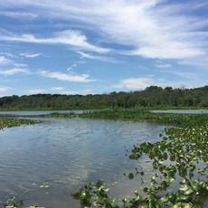
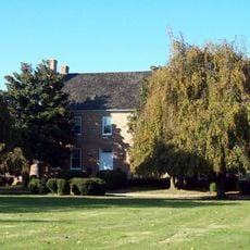
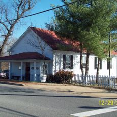
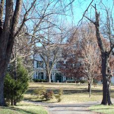
Rosaryville State Park is a Maryland state park in Prince George's County, covering forests, meadows, and open fields alongside several historical structures. The most notable building on the grounds is Mount Airy Mansion, set within a network of trails that wind through different types of terrain.

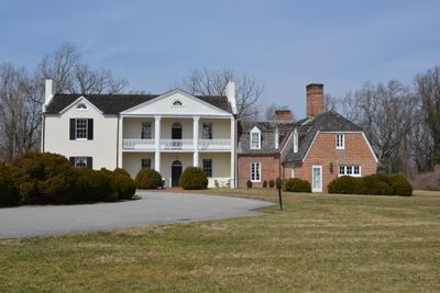
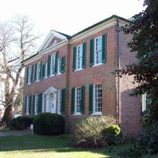
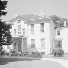
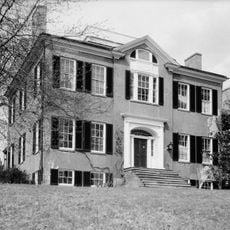
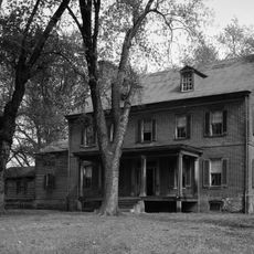
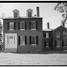
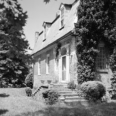
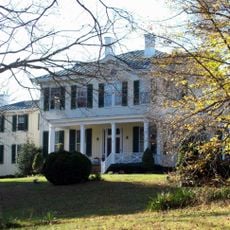
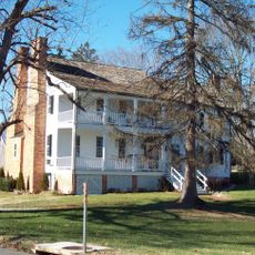
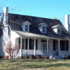
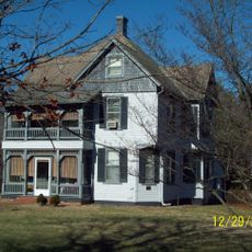
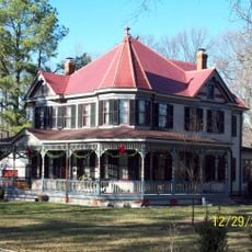
Mount Airy Mansion was built in 1751 by Benedict Swingate Calvert as the heart of a large colonial estate in Maryland. The building later served as a country inn known as Dower House before the state bought the property in 1976 and opened it as a public park.

The park takes its name from the Calvert family estate, whose presence shaped the land for generations. Walking around Mount Airy Mansion today, visitors can still read the story of a colonial family in the layout of the grounds and the style of the building.

The park has trails for hiking, mountain biking, and horseback riding, with surfaces and difficulty varying from one route to the next. Spring and autumn tend to offer the easiest conditions, as temperatures are moderate and the ground is more stable than in summer or winter.

Eleanor Calvert, daughter of the man who built the mansion, married John Parke Custis, the stepson of George Washington, drawing the estate into the circle of the first American president's family. This family link is not marked by any grand monument on site, making it easy to walk past without realizing the connection.

The community of curious travelers

AroundUs brings together thousands of curated places, local tips, and hidden gems, enriched daily by 60,000 contributors worldwide.

Start exploring
Elevation above the sea
49 m
Address
7805 West Marlton Ave, Upper Marlboro, MD 20735
Phone
GPS coordinates
38.77417,-76.81111
Latest update
March 3, 2026 10:08
Around this place
Show the full map
Reviews
Share your experience

No review yet

Discussions
Start a discussion...

No discussion yet

« Rosaryville State Park - Nature reserve in Prince George's County, United States » is provided by Around Us (aroundus.com). Images and texts are derived from Wikimedia project under a Creative Commons license. You are allowed to copy, distribute, and modify copies of this page, under the conditions set by the license, as long as this note is clearly visible.

Discover hidden gems everywhere you go!

From secret cafés to breathtaking viewpoints, skip the crowded tourist spots and find places that match your style. Our app makes it easy with voice search, smart filtering, route optimization, and insider tips from travelers worldwide. Download now for the complete mobile experience.

Around Us App Screenshot

A unique approach to discovering new places

Le Figaro

All the places worth exploring

France Info

A tailor-made excursion in just a few clicks

20 Minutes

Around Us
Travel Guide & Maps
Download

Send to your phone

QR Code
1

Open the camera app on your mobile.

2

Point at the QR code with your camera. A notification will appear.

3

Tap the notification to open the link.