
Bloomfield, city in Stoddard County, Missouri, USA
Location: Stoddard County
Elevation above the sea: 147 m
GPS coordinates: 36.88780,-89.93000
Latest update: March 8, 2025 09:23

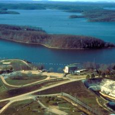
Lake Wappapello
34.7 km
Mingo National Wildlife Refuge
21.3 km
Rodgers Theatre
43.8 km
Morris State Park
38.6 km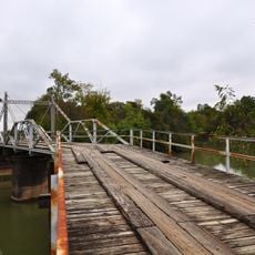
Hargrove Pivot Bridge
42.5 km
Stoddard County Courthouse
381 m
Williams-Gierth House
44.4 km
North Main Street Historic District
43.7 km
Mark Twain School
44.1 km
Thomas Moore House
43.8 km
Wright-Dalton-Bell-Anchor Department Store Building
43.8 km
Butler County Courthouse
43.7 km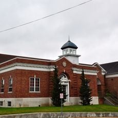
Poplar Bluff Public Library
43.6 km
John Archibald Phillips House
44.2 km
Alfred W. Greer House
44.4 km
Moore-Dalton House
43.7 km
Garfield Historic District
43.8 km
St. Louis-San Francisco Railroad Depot
44.1 km
Wheatley Public School
43.8 km
Jacob Swank House
49.9 km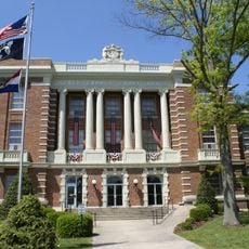
Scott County Courthouse
40 km
J. Herbert Moore House
41.9 km
Charles and Bettie Birthright House
48.8 km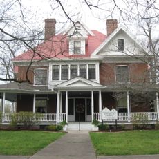
Moore House
51.8 km
Williamson-Kennedy School
43.5 km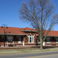
Sikeston St. Louis, Iron Mountain and Southern Railway Depot
30.3 km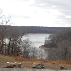
Lake Wappapello State Park
37.4 km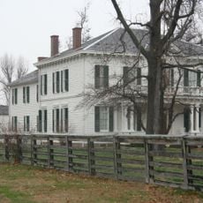
Hunter-Dawson State Historic Site
48.7 kmVisited this place? Tap the stars to rate it and share your experience / photos with the community! Try now! You can cancel it anytime.
Discover hidden gems everywhere you go!
From secret cafés to breathtaking viewpoints, skip the crowded tourist spots and find places that match your style. Our app makes it easy with voice search, smart filtering, route optimization, and insider tips from travelers worldwide. Download now for the complete mobile experience.

A unique approach to discovering new places❞
— Le Figaro
All the places worth exploring❞
— France Info
A tailor-made excursion in just a few clicks❞
— 20 Minutes