Enable Location

We need your location to show you interesting places around you

Discover nearby places

Find interesting locations and hidden gems around you

Precise directions

Get accurate directions and distances to places

Your location is never shared with other users. It's only used when you tap the location button.

Kansas River

Log in to your account

Start exploring — it's free

Trusted by 68,192 travelers worldwide

Continue with Google
Continue with Apple
or

We will send you a code to connect

By continuing, you accept our Terms and Conditions and our Privacy Policy

Check your inbox

We've sent a pincode in your inbox. Please enter the code below.

Kansas River
Discussion Reviews 2 Photos
36.7k Popularity

Kansas River, Waterway through northeastern Kansas, United States.

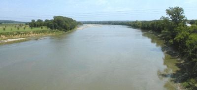
The Kansas River is a waterway that flows approximately 173 miles from Junction City to Kansas City through northeastern Kansas. Along its course, the river features numerous sandbars and natural formations that shape the landscape.

The Lewis and Clark Expedition documented the river in 1804 and established a camp at Kaw Point while recognizing the area's potential for settlement. This early exploration helped shape the region's development into a significant trade center.

The river takes its name from the Kanza people who once lived along its shores. This connection to Native American history remains woven into the landscape and the names of communities nearby.

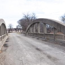
Visitors can access the river at more than 20 public points along the waterway where kayaking, canoeing, and fishing are possible in navigable sections. These access areas make it easy to explore the river at your own pace.

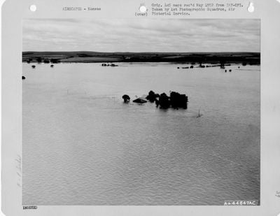
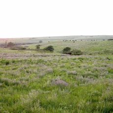
The river flows without significant engineering modifications, making it one of the longest prairie rivers in North America. This natural state allows visitors to see the landscape as it has existed for generations.

The community of curious travelers

AroundUs brings together thousands of curated places, local tips, and hidden gems, enriched daily by 60,000 contributors worldwide.

Start exploring
Location
GPS coordinates
39.06000,-96.80139
Latest update
December 17, 2025 10:46
Around this place
Bill Snyder Family Football Stadium
United States of America

Bill Snyder Family Football Stadium

23.9 km
Johnny Kaw
United States of America

Johnny Kaw

23.8 km
World War I Memorial Stadium
United States of America

World War I Memorial Stadium

23.5 km
Konza Prairie
United States of America

Konza Prairie

21.3 km
United States of America

Sunset Zoo

22 km
First Territorial Capitol of Kansas
United States of America

First Territorial Capitol of Kansas

4.4 km
Hale Library
United States of America

Hale Library

24 km
U.S. Cavalry Museum
United States of America

U.S. Cavalry Museum

1.7 km
Anderson Hall
United States of America

Anderson Hall

23.8 km
Seven Dolors Catholic Church
United States of America

Seven Dolors Catholic Church

24.2 km
Seaton Hall
United States of America

Seaton Hall

23.8 km
Goodnow House
United States of America

Goodnow House

23.1 km
First Congregational Church
United States of America

First Congregational Church

24.3 km
Dickens Hall
United States of America

Dickens Hall

24.1 km
Manhattan Carnegie Library Building
United States of America

Manhattan Carnegie Library Building

24.3 km
Milford State Park
United States of America

Milford State Park

9.8 km
Wilson Pratt Truss Bridge
United States of America

Wilson Pratt Truss Bridge

23.5 km
Bartell House
United States of America

Bartell House

4.8 km
Conroe Bridge
United States of America

Conroe Bridge

6.1 km
Chapman Creek Pratt Truss Bridge
United States of America

Chapman Creek Pratt Truss Bridge

21.1 km
Christian Wetzel Cabin
United States of America

Christian Wetzel Cabin

7 km
Jeremiah Platt House
United States of America

Jeremiah Platt House

23.5 km
Bluemont Hall
United States of America

Bluemont Hall

24 km
Grand Army of the Republic memorial
United States of America

Grand Army of the Republic memorial

4.3 km
Woman's Club House
United States of America

Woman's Club House

24 km
Cardwell Hall
United States of America

Cardwell Hall

24 km
Junction City Downtown Historic District
United States of America

Junction City Downtown Historic District

4 km
Houston and Pierre Streets Residential Historic District
United States of America

Houston and Pierre Streets Residential Historic District

24.1 km
Show the full map
Reviews
Share your experience

No review yet

Discussions
Start a discussion...

No discussion yet

« Kansas River - Waterway through northeastern Kansas, United States » is provided by Around Us (aroundus.com). Images and texts are derived from Wikimedia project under a Creative Commons license. You are allowed to copy, distribute, and modify copies of this page, under the conditions set by the license, as long as this note is clearly visible.

Discover hidden gems everywhere you go!

From secret cafés to breathtaking viewpoints, skip the crowded tourist spots and find places that match your style. Our app makes it easy with voice search, smart filtering, route optimization, and insider tips from travelers worldwide. Download now for the complete mobile experience.

Around Us App Screenshot

A unique approach to discovering new places

Le Figaro

All the places worth exploring

France Info

A tailor-made excursion in just a few clicks

20 Minutes

Around Us
Travel Guide & Maps
Download

Send to your phone

QR Code
1

Open the camera app on your mobile.

2

Point at the QR code with your camera. A notification will appear.

3

Tap the notification to open the link.