Enable Location

We need your location to show you interesting places around you

Discover nearby places

Find interesting locations and hidden gems around you

Precise directions

Get accurate directions and distances to places

Your location is never shared with other users. It's only used when you tap the location button.

Sleeping Bear Dunes National Lakeshore

Log in to your account

Start exploring — it's free

Trusted by 61,909 travelers worldwide

Continue with Google
Continue with Apple
or

We will send you a code to connect

By continuing, you accept our Terms and Conditions and our Privacy Policy

Check your inbox

We've sent a pincode in your inbox. Please enter the code below.

Sleeping Bear Dunes National Lakeshore, National seashore in Michigan, United States.

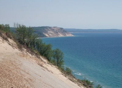
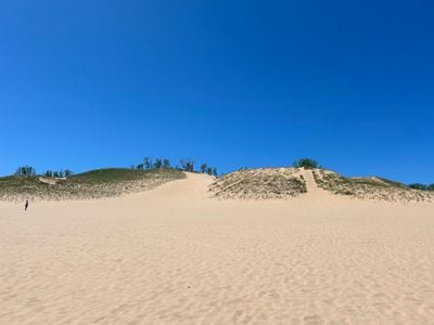
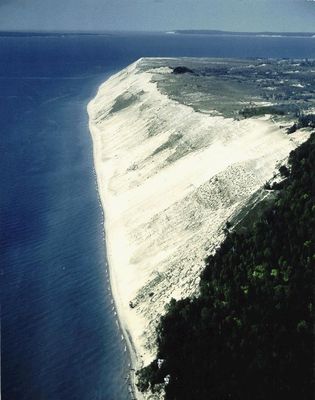
Sleeping Bear Dunes National Lakeshore is a coastal preserve along Lake Michigan's eastern shore with sand dunes rising up to 450 feet (137 m) above water level. The protected zone covers about 35 miles of coastline and includes two forested islands offshore.

The site became a National Lakeshore on October 21, 1970, following federal legislation that transformed private properties into protected public land. This action secured the preservation of the dune landscape and coastal habitats for future generations.

The name comes from an Ojibwe legend about a mother bear and cubs seeking refuge, now represented by a tree-covered knoll that resembles a sleeping bear. Visitors can observe this formation from several viewpoints along the coast and learn about the handed-down story.

The Philip A. Hart Visitor Center in Empire provides maps, permits, and information about camping, hiking trails, and seasonal activities throughout the park. The best time to visit is during summer months, when beaches and trails are easily accessible and weather remains stable.

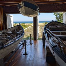
The protected area includes North and South Manitou islands, which host an 1871 lighthouse and former Life-Saving Service stations along the shore. These islands are accessible only by ferry and preserve a portion of the region's maritime history.

The community of curious travelers

AroundUs brings together thousands of curated places, local tips, and hidden gems, enriched daily by 60,000 contributors worldwide.

Start exploring
Location
Location
Inception
October 21, 1970
Operator
National Park Service
GPS coordinates
44.91306,-86.02028
Latest update
December 12, 2025 17:49
Michigan natural and historic sites

Michigan holds a wide array of natural and historical sites across its two peninsulas. The shoreline runs for hundreds of miles along the Great Lakes, showing sand beaches, rocky cliffs, and dune formations. In the north, dense forests, waterfalls, and rock formations shaped by erosion dominate the...

« Sleeping Bear Dunes National Lakeshore - National seashore in Michigan, United States » is provided by Around Us (aroundus.com). Images and texts are derived from Wikimedia project under a Creative Commons license. You are allowed to copy, distribute, and modify copies of this page, under the conditions set by the license, as long as this note is clearly visible.

Discover hidden gems everywhere you go!

From secret cafés to breathtaking viewpoints, skip the crowded tourist spots and find places that match your style. Our app makes it easy with voice search, smart filtering, route optimization, and insider tips from travelers worldwide. Download now for the complete mobile experience.

Around Us App Screenshot

A unique approach to discovering new places

Le Figaro

All the places worth exploring

France Info

A tailor-made excursion in just a few clicks

20 Minutes

Around Us
Travel Guide & Maps
Download

Send to your phone

QR Code
1

Open the camera app on your mobile.

2

Point at the QR code with your camera. A notification will appear.

3

Tap the notification to open the link.