Enable Location

We need your location to show you interesting places around you

Discover nearby places

Find interesting locations and hidden gems around you

Precise directions

Get accurate directions and distances to places

Your location is never shared with other users. It's only used when you tap the location button.

Glen Haven, Michigan

Log in to your account

Start exploring — it's free

Trusted by 62,832 travelers worldwide

Continue with Google
Continue with Apple
or

We will send you a code to connect

By continuing, you accept our Terms and Conditions and our Privacy Policy

Check your inbox

We've sent a pincode in your inbox. Please enter the code below.

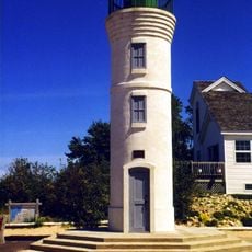
Glen Haven, Michigan, Historic district in Sleeping Bear Dunes National Lakeshore, United States.

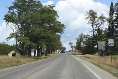
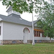
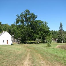
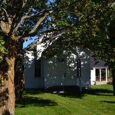
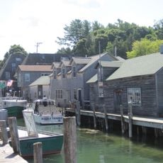
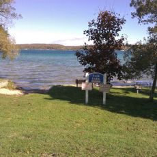
Glen Haven is a harbor village along Lake Michigan with preserved wooden buildings including a general store and canning factory. These structures date from the steamship era and show the functional layout of a working port settlement.

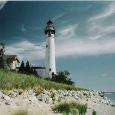
The settlement began in 1857 as a port village named Sleeping Bearville supplying cordwood fuel to steamships on the Great Lakes. After steam navigation declined in the late 1800s, the village lost importance but its buildings survived largely unchanged.

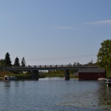
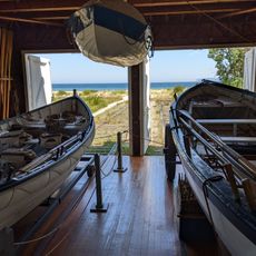
The village name Glen Haven reflects its role as a sheltered port, and the wooden structures show how residents lived directly from the lake. Visitors can observe the boats and storage buildings that tied daily life to the water.

The buildings are mainly open from late May through Labor Day, and many rooms have limited visiting hours that vary by the week. Plan enough time to walk through the different museums and buildings at your own pace.

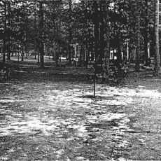
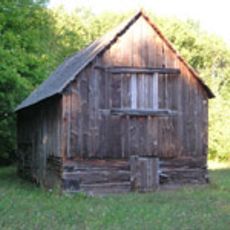
The cordwood storage facility here is one of the most complete wood stacking stations remaining on Lake Michigan's eastern shore from the steamship era. These specific structures were built to keep firewood stacked and ready to be loaded onto passing boats.

The community of curious travelers

AroundUs brings together thousands of curated places, local tips, and hidden gems, enriched daily by 60,000 contributors worldwide.

Start exploring
Inception
1857
GPS coordinates
44.89886,-86.03023
Latest update
December 11, 2025 11:02
Around this place
Point Betsie Light
United States of America

Point Betsie Light

29.2 km
South Manitou Island Lighthouse
United States of America

South Manitou Island Lighthouse

13.1 km
Platte River Campground Site
United States of America

Platte River Campground Site

21.4 km
Port Oneida Rural Historic District
United States of America

Port Oneida Rural Historic District

1.8 km
Leland Historic District
United States of America

Leland Historic District

25.3 km
SS Jarvis Lord
United States of America

SS Jarvis Lord

7.8 km
North Manitou Shoal Light Station
United States of America

North Manitou Shoal Light Station

14.7 km
North Manitou Island Lifesaving Station
United States of America

North Manitou Island Lifesaving Station

25.1 km
Saint Joseph's Catholic Church
United States of America

Saint Joseph's Catholic Church

11.6 km
Fountain Point
United States of America

Fountain Point

26.6 km
Empire School
United States of America

Empire School

10.1 km
Benzie County Courthouse
United States of America

Benzie County Courthouse

30.7 km
William and Margaret McFarland Core Farm
United States of America

William and Margaret McFarland Core Farm

27.3 km
Lake Leelanau Narrows Bridge
United States of America

Lake Leelanau Narrows Bridge

26.7 km
George Conrad Hutzler Farm
United States of America

George Conrad Hutzler Farm

15.8 km
Hutzler's Barn
United States of America

Hutzler's Barn

16.8 km
Bingham District No. 5 Schoolhouse
United States of America

Bingham District No. 5 Schoolhouse

28.2 km
Boathouse #2
United States of America

Boathouse #2

1 km
Van's Beach
United States of America

Van's Beach

25.2 km
Manning Memorial Light
United States of America

Manning Memorial Light

9.9 km
Crystal Beach
United States of America

Crystal Beach

29.6 km
Beulah Beach
United States of America

Beulah Beach

30.5 km
Pacific Salmon Historical Marker
United States of America

Pacific Salmon Historical Marker

27.3 km
Leland Historic District (Fishtown) Historical Marker
United States of America

Leland Historic District (Fishtown) Historical Marker

25.3 km
Fishtown Historic District
United States of America

Fishtown Historic District

25.3 km
Fair Park
United States of America

Fair Park

30.7 km
Trapp Park
United States of America

Trapp Park

30.5 km
Congressional Summer Assembly Crystal Lake Beach
United States of America

Congressional Summer Assembly Crystal Lake Beach

31 km
Show the full map
« Glen Haven, Michigan - Historic district in Sleeping Bear Dunes National Lakeshore, United States » is provided by Around Us (aroundus.com). Images and texts are derived from Wikimedia project under a Creative Commons license. You are allowed to copy, distribute, and modify copies of this page, under the conditions set by the license, as long as this note is clearly visible.

Discover hidden gems everywhere you go!

From secret cafés to breathtaking viewpoints, skip the crowded tourist spots and find places that match your style. Our app makes it easy with voice search, smart filtering, route optimization, and insider tips from travelers worldwide. Download now for the complete mobile experience.

Around Us App Screenshot

A unique approach to discovering new places

Le Figaro

All the places worth exploring

France Info

A tailor-made excursion in just a few clicks

20 Minutes

Around Us
Travel Guide & Maps
Download

Send to your phone

QR Code
1

Open the camera app on your mobile.

2

Point at the QR code with your camera. A notification will appear.

3

Tap the notification to open the link.