Enable Location

We need your location to show you interesting places around you

Discover nearby places

Find interesting locations and hidden gems around you

Precise directions

Get accurate directions and distances to places

Your location is never shared with other users. It's only used when you tap the location button.

Port Oneida Rural Historic District

Log in to your account

Start exploring — it's free

Trusted by 61,911 travelers worldwide

Continue with Google
Continue with Apple
or

We will send you a code to connect

By continuing, you accept our Terms and Conditions and our Privacy Policy

Check your inbox

We've sent a pincode in your inbox. Please enter the code below.

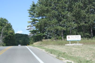
Port Oneida Rural Historic District, Historic district in Glen Arbor, Michigan, United States

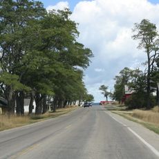
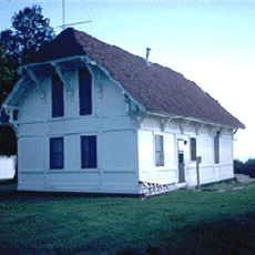
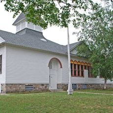
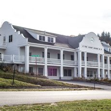
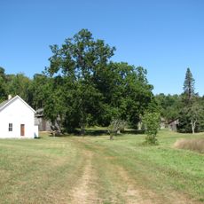
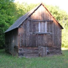
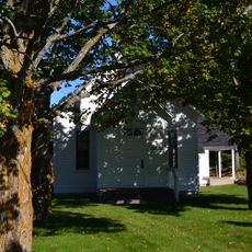
Port Oneida Rural Historic District is a large area with about 150 buildings spread across rolling farmland situated between several lakes. The site includes scattered homesteads, barns, outbuildings, and houses that represent how rural settlements were organized in this region.

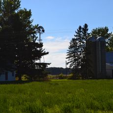
The area was founded in the 1850s by immigrants from Central Europe who built farming communities and began settling the land. Over time, it developed into a center for both agriculture and logging operations that shaped the regional economy.

The district reflects how settlers built and maintained farming communities through preserved homesteads and barns that show family life and agricultural work across generations. These structures reveal the traditions and daily routines that shaped the area over time.

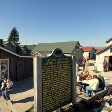
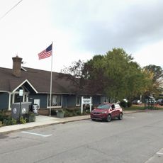
The best way to explore the district is by driving through on local roads that pass by farmsteads and old structures you can see from your car. A Heritage Center provides information and exhibits if you want to learn more about the area's history and settlement.

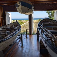
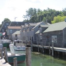
Hidden among the farmsteads are the remains of an old dock built in the 1800s that was used to transport logs from the forests. This connection between farming and logging shows how settlers adapted to use the resources around them.

The community of curious travelers

AroundUs brings together thousands of curated places, local tips, and hidden gems, enriched daily by 60,000 contributors worldwide.

Start exploring
Location
GPS coordinates
44.91310,-86.02030
Latest update
December 13, 2025 17:10
Around this place
Point Betsie Light
United States of America

Point Betsie Light

30.9 km
Glen Haven, Michigan
United States of America

Glen Haven, Michigan

1.8 km
Cherry Bowl Drive-In Theatre & Diner
United States of America

Cherry Bowl Drive-In Theatre & Diner

27.3 km
South Manitou Island Lighthouse
United States of America

South Manitou Island Lighthouse

12 km
Platte River Campground Site
United States of America

Platte River Campground Site

23.2 km
Leland Historic District
United States of America

Leland Historic District

23.8 km
SS Jarvis Lord
United States of America

SS Jarvis Lord

6.1 km
North Manitou Shoal Light Station
United States of America

North Manitou Shoal Light Station

12.9 km
North Manitou Island Lifesaving Station
United States of America

North Manitou Island Lifesaving Station

23.4 km
Saint Joseph's Catholic Church
United States of America

Saint Joseph's Catholic Church

11 km
Fountain Point
United States of America

Fountain Point

25.4 km
Empire School
United States of America

Empire School

11.8 km
Benzie County Courthouse
United States of America

Benzie County Courthouse

32.4 km
William and Margaret McFarland Core Farm
United States of America

William and Margaret McFarland Core Farm

26.6 km
Lake Leelanau Narrows Bridge
United States of America

Lake Leelanau Narrows Bridge

25.5 km
George Conrad Hutzler Farm
United States of America

George Conrad Hutzler Farm

14.8 km
Hutzler's Barn
United States of America

Hutzler's Barn

15.7 km
Bingham District No. 5 Schoolhouse
United States of America

Bingham District No. 5 Schoolhouse

27.6 km
Boathouse #2
United States of America

Boathouse #2

1.2 km
Manning Memorial Light
United States of America

Manning Memorial Light

11.6 km
Bay Theatre
United States of America

Bay Theatre

29.9 km
Beulah Beach
United States of America

Beulah Beach

32.2 km
Pacific Salmon Historical Marker
United States of America

Pacific Salmon Historical Marker

28.7 km
Fishtown Historic District
United States of America

Fishtown Historic District

23.8 km
Leland Historic District (Fishtown) Historical Marker
United States of America

Leland Historic District (Fishtown) Historical Marker

23.8 km
Trapp Park
United States of America

Trapp Park

32.2 km
Darcy Library Of Beulah
United States of America

Darcy Library Of Beulah

32.2 km
Suttons Bay-bingham District Library
United States of America

Suttons Bay-bingham District Library

30.1 km
Show the full map
« Port Oneida Rural Historic District - Historic district in Glen Arbor, Michigan, United States » is provided by Around Us (aroundus.com). Images and texts are derived from Wikimedia project under a Creative Commons license. You are allowed to copy, distribute, and modify copies of this page, under the conditions set by the license, as long as this note is clearly visible.

Discover hidden gems everywhere you go!

From secret cafés to breathtaking viewpoints, skip the crowded tourist spots and find places that match your style. Our app makes it easy with voice search, smart filtering, route optimization, and insider tips from travelers worldwide. Download now for the complete mobile experience.

Around Us App Screenshot

A unique approach to discovering new places

Le Figaro

All the places worth exploring

France Info

A tailor-made excursion in just a few clicks

20 Minutes

Around Us
Travel Guide & Maps
Download

Send to your phone

QR Code
1

Open the camera app on your mobile.

2

Point at the QR code with your camera. A notification will appear.

3

Tap the notification to open the link.