Enable Location

We need your location to show you interesting places around you

Discover nearby places

Find interesting locations and hidden gems around you

Precise directions

Get accurate directions and distances to places

Your location is never shared with other users. It's only used when you tap the location button.

Chester Township

Log in to your account

Start exploring — it's free

Trusted by 62,529 travelers worldwide

Continue with Google
Continue with Apple
or

We will send you a code to connect

By continuing, you accept our Terms and Conditions and our Privacy Policy

Check your inbox

We've sent a pincode in your inbox. Please enter the code below.

Chester Township, Administrative division in Morris County, New Jersey, US.

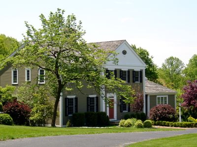
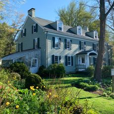
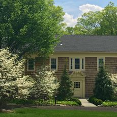
Chester Township is a municipality in Morris County in northern New Jersey that includes residential neighborhoods, commercial areas, and industrial zones. The township spans diverse neighborhoods with mixed uses that define this rural-leaning region.

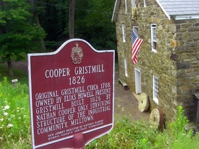
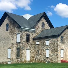
The township was founded in the early colonial period as part of Morris County settlement patterns. It evolved from an agricultural area into a mixed-use community with diverse economic activities.

The Chester Township community maintains connections through regular municipal court sessions, planning board meetings, and seasonal celebrations throughout the year.

The township administration office is located on North Road, where community services like road maintenance and public safety programs are managed. The area is best explored by car since the neighborhoods are spread across larger distances.

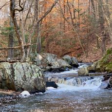
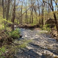
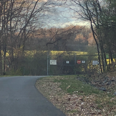
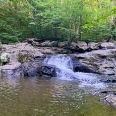
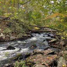
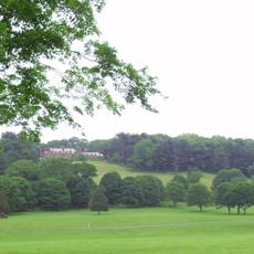
Black River Fields provides sports facilities and outdoor spaces where residents can engage in various activities. This recreation area serves as a gathering point for community activities in the township.

The community of curious travelers

AroundUs brings together thousands of curated places, local tips, and hidden gems, enriched daily by 60,000 contributors worldwide.

Start exploring
Location
Inception
April 1, 1799
Shares border with
Mount Olive Township, Washington Township, Tewksbury Township, Bedminster, Peapack-Gladstone, Mendham Township, Randolph, Roxbury Township, Chester Borough
GPS coordinates
40.77630,-74.68760
Latest update
December 14, 2025 14:45
Around this place
Hacklebarney State Park
United States of America

Hacklebarney State Park

4.9 km
Blairsden
United States of America

Blairsden

8.1 km
Willowwood Arboretum
United States of America

Willowwood Arboretum

5.7 km
Seward Mansion
United States of America

Seward Mansion

10.6 km
Black River County Park
United States of America

Black River County Park

2.8 km
United States of America

Turkey Brook Park

10.3 km
Bamboo Brook Outdoor Education Center
United States of America

Bamboo Brook Outdoor Education Center

5.3 km
German Valley Historic District
United States of America

German Valley Historic District

7.8 km
Nathan Cooper Gristmill
United States of America

Nathan Cooper Gristmill

2.8 km
Chester House Inn
United States of America

Chester House Inn

1.3 km
Elizabeth D. Kay Environmental Center
United States of America

Elizabeth D. Kay Environmental Center

2.5 km
Mount Freedom Presbyterian Church
United States of America

Mount Freedom Presbyterian Church

10.5 km
Combe Fill South Superfund Site
United States of America

Combe Fill South Superfund Site

4.3 km
Sharpenstine Farmstead
United States of America

Sharpenstine Farmstead

6.5 km
Combs Hollow Historic District
United States of America

Combs Hollow Historic District

7.6 km
Mount Olive Village Historic District
United States of America

Mount Olive Village Historic District

9.2 km
Anthony-Corwin Farm
United States of America

Anthony-Corwin Farm

9.9 km
General Nathan Cooper Mansion
United States of America

General Nathan Cooper Mansion

1.7 km
Craft-Clausen House
United States of America

Craft-Clausen House

6.9 km
Leonard Neighbor Farmstead
United States of America

Leonard Neighbor Farmstead

8.9 km
Flocktown Schoolhouse
United States of America

Flocktown Schoolhouse

9.5 km
Jacob Wise Neighbor House
United States of America

Jacob Wise Neighbor House

8.7 km
Buttermilk Falls Natural Area
United States of America

Buttermilk Falls Natural Area

6.4 km
Buttermilk Falls
United States of America

Buttermilk Falls

6.1 km
Elizabeth D. Kay Environmental Center
United States of America

Elizabeth D. Kay Environmental Center

2.1 km
Natirar
United States of America

Natirar

9.2 km
India Brook Park
United States of America

India Brook Park

5.7 km
Brookside Historic District
United States of America

Brookside Historic District

10.2 km
Show the full map
« Chester Township - Administrative division in Morris County, New Jersey, US » is provided by Around Us (aroundus.com). Images and texts are derived from Wikimedia project under a Creative Commons license. You are allowed to copy, distribute, and modify copies of this page, under the conditions set by the license, as long as this note is clearly visible.

Discover hidden gems everywhere you go!

From secret cafés to breathtaking viewpoints, skip the crowded tourist spots and find places that match your style. Our app makes it easy with voice search, smart filtering, route optimization, and insider tips from travelers worldwide. Download now for the complete mobile experience.

Around Us App Screenshot

A unique approach to discovering new places

Le Figaro

All the places worth exploring

France Info

A tailor-made excursion in just a few clicks

20 Minutes

Around Us
Travel Guide & Maps
Download

Send to your phone

QR Code
1

Open the camera app on your mobile.

2

Point at the QR code with your camera. A notification will appear.

3

Tap the notification to open the link.