Chest opened
+${chestReward.xp} XP
Explorer
NOUVEAU ×${chestReward.collectible.quantity}
tapez pour fermer
Chest locked

Open chests in the app

Around Us is built for your phone — chests unlock when you walk, explore and capture nearby places.

Enable Location

We need your location to show you interesting places around you

Discover nearby places

Find interesting locations and hidden gems around you

Precise directions

Get accurate directions and distances to places

Your location is never shared with other users. It's only used when you tap the location button.

Chatham

Log in to your account

Start exploring — it's free

Trusted by 72,881 travelers worldwide

Continue with Google
Continue with Apple
or

We will send you a code to connect

By continuing, you accept our Terms and Conditions and our Privacy Policy

Check your inbox

We've sent a pincode in your inbox. Please enter the code below.

Discussion Reviews 1 Photos
41.2k Popularity

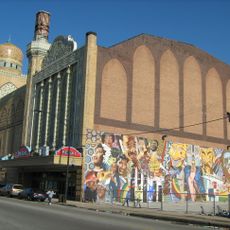
Chatham, Community area in South Side Chicago, US.

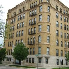
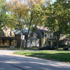
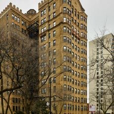
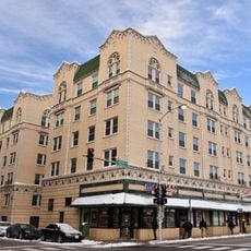
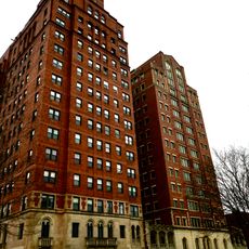
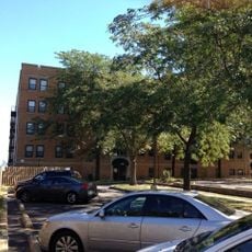
Chatham runs between 79th and 95th Streets on the South Side of Chicago, with the Illinois Central Railroad and Dan Ryan Expressway marking its edges. The area contains residential blocks, neighborhood shops, and a mix of housing styles from different periods.

Growth in the area began in the early 1860s when the Illinois Central Railroad constructed infrastructure along its tracks between 75th and 95th Streets. This railroad development sparked residential settlement and shaped how the neighborhood would later expand.

The neighborhood has deep roots in the African American middle-class community that took hold in the 1950s. This heritage continues to shape how residents live together and see themselves today.

Visitors can reach the area via two CTA Red Line stations at 79th and 87th Streets, with additional service from the Metra Electric District line. This makes getting to downtown Chicago straightforward and frequent throughout the day.

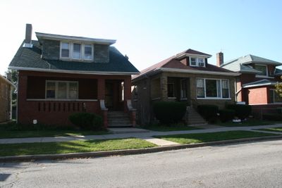
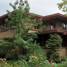
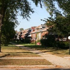
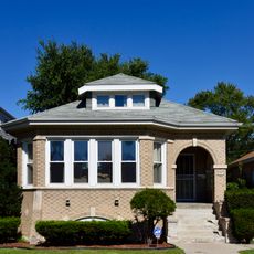
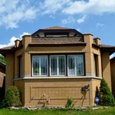
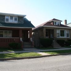
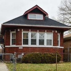
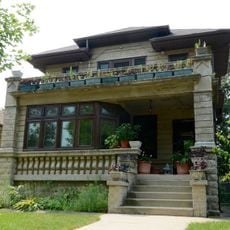
The West Chatham Bungalow Historic District preserves roughly 283 Chicago bungalows built between 1913 and 1930. This collection represents one of the city's best-surviving examples of early 20th-century residential building styles.

The community of curious travelers

AroundUs brings together thousands of curated places, local tips, and hidden gems, enriched daily by 60,000 contributors worldwide.

Start exploring
Location
GPS coordinates
41.74000,-87.61167
Latest update
December 17, 2025 08:16
Around this place
Barack Obama Presidential Center
United States of America

Barack Obama Presidential Center

5.2 km
Mosque Maryam
United States of America

Mosque Maryam

3.2 km
Oak Woods Cemetery
United States of America

Oak Woods Cemetery

3.5 km
Fountain of Time
United States of America

Fountain of Time

5.2 km
Avalon Regal Theater
United States of America

Avalon Regal Theater

2.7 km
Statue of the Republic
United States of America

Statue of the Republic

5.1 km
Lorado Taft Midway Studios
United States of America

Lorado Taft Midway Studios

5.1 km
William and Jessie M. Adams House
United States of America

William and Jessie M. Adams House

5.2 km
Bronzeville Children's Museum
United States of America

Bronzeville Children's Museum

2.8 km
Allan Miller House
United States of America

Allan Miller House

4.4 km
Yale Apartments
United States of America

Yale Apartments

4.2 km
Drake Fountain
United States of America

Drake Fountain

5.1 km
Carter G. Woodson Regional Library
United States of America

Carter G. Woodson Regional Library

3.3 km
South Park Manor Historic District
United States of America

South Park Manor Historic District

2 km
Garden Homes Historic District
United States of America

Garden Homes Historic District

923 m
United States of America

Loretto Academy

4.5 km
Administration Building
United States of America

Administration Building

5.2 km
Brainerd Bungalow Historic District
United States of America

Brainerd Bungalow Historic District

3.9 km
Stony Island Trust and Savings Bank Building
United States of America

Stony Island Trust and Savings Bank Building

4.1 km
South Shore Bungalow Historic District
United States of America

South Shore Bungalow Historic District

3.9 km
Windsor Beach Apartments
United States of America

Windsor Beach Apartments

5.1 km
Grand Crossing Park
United States of America

Grand Crossing Park

2 km
Jeffery–Cyril Historic District
United States of America

Jeffery–Cyril Historic District

4 km
Shoreline Apartments
United States of America

Shoreline Apartments

5.1 km
West Chatham Bungalow Historic District
United States of America

West Chatham Bungalow Historic District

1.8 km
Lake-Side Terrace Apartments
United States of America

Lake-Side Terrace Apartments

5.2 km
Auburn Gresham Bungalow Historic District
United States of America

Auburn Gresham Bungalow Historic District

5 km
Anton E. Hanson House
United States of America

Anton E. Hanson House

3.1 km
Show the full map
Reviews
Share your experience

No review yet

Discussions
Start a discussion...

No discussion yet

« Chatham - Community area in South Side Chicago, US » is provided by Around Us (aroundus.com). Images and texts are derived from Wikimedia project under a Creative Commons license. You are allowed to copy, distribute, and modify copies of this page, under the conditions set by the license, as long as this note is clearly visible.

Discover hidden gems everywhere you go!

From secret cafés to breathtaking viewpoints, skip the crowded tourist spots and find places that match your style. Our app makes it easy with voice search, smart filtering, route optimization, and insider tips from travelers worldwide. Download now for the complete mobile experience.

Around Us App Screenshot

A unique approach to discovering new places

Le Figaro

All the places worth exploring

France Info

A tailor-made excursion in just a few clicks

20 Minutes

Around Us
Travel Guide & Maps
Download

Send to your phone

QR Code
1

Open the camera app on your mobile.

2

Point at the QR code with your camera. A notification will appear.

3

Tap the notification to open the link.