Chest opened
+${chestReward.xp} XP
Explorer
NOUVEAU ×${chestReward.collectible.quantity}
tapez pour fermer
Chest locked

Open chests in the app

Around Us is built for your phone — chests unlock when you walk, explore and capture nearby places.

Enable Location

We need your location to show you interesting places around you

Discover nearby places

Find interesting locations and hidden gems around you

Precise directions

Get accurate directions and distances to places

Your location is never shared with other users. It's only used when you tap the location button.

Log in to your account

Start exploring — it's free

Trusted by 73,043 travelers worldwide

Continue with Google
Continue with Apple
or

We will send you a code to connect

By continuing, you accept our Terms and Conditions and our Privacy Policy

Check your inbox

We've sent a pincode in your inbox. Please enter the code below.

Discussion Reviews Photo
1.2k Popularity

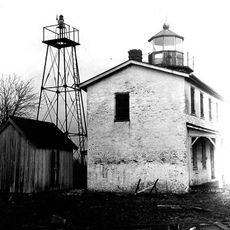
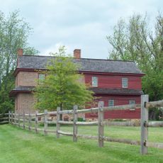
Charlestown Historic District, Historic district in Cecil County, Maryland, US.

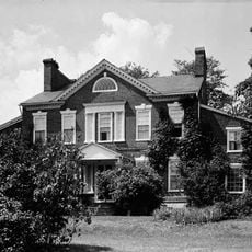
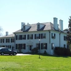
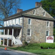
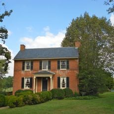
Charlestown Historic District is a protected 150-acre area in Cecil County that contains numerous buildings from the 1700s, including colonial-era inns and homes. The district stretches between Tasker and Ogle Streets, with Louisa Lane and the North East River marking its boundaries.

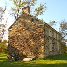
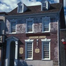
The district developed as a regional trading center during the colonial period, centered around the Charlestown Fair. It was added to the National Register of Historic Places in 1975 and still preserves about 14 houses from the 1700s.

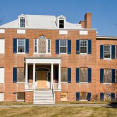
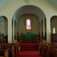
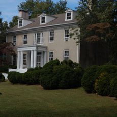
The buildings here showcase Georgian and Late Victorian styles side by side as you walk through the streets. These different architectural approaches tell the story of how the area changed over time.

Multiple entry points around the district boundaries make it easy to start exploring from different directions. Walking through the area lets you observe the architectural details and street layout at a comfortable pace.

The buildings here are directly tied to the colonial Charlestown Fair, an important regional marketplace of that era. This connection to early commercial activity is often overlooked, but it explains why the settlement developed in this particular location.

The community of curious travelers

AroundUs brings together thousands of curated places, local tips, and hidden gems, enriched daily by 60,000 contributors worldwide.

Start exploring
Location
GPS coordinates
39.57390,-75.97560
Latest update
December 14, 2025 18:00
Around this place
Millard E. Tydings Memorial Bridge
United States of America

Millard E. Tydings Memorial Bridge

11 km
Elk Neck State Park
United States of America

Elk Neck State Park

10.2 km
Tome School
United States of America

Tome School

11.7 km
Thomas J. Hatem Memorial Bridge
United States of America

Thomas J. Hatem Memorial Bridge

9.9 km
Garrett Island
United States of America

Garrett Island

9.8 km
Amtrak Susquehanna River Bridge
United States of America

Amtrak Susquehanna River Bridge

9.7 km
Concord Point Light
United States of America

Concord Point Light

10.1 km
Sion Hill
United States of America

Sion Hill

12.9 km
CSX Susquehanna River Bridge
United States of America

CSX Susquehanna River Bridge

9.6 km
P.W. & B. Railroad Bridge
United States of America

P.W. & B. Railroad Bridge

9.5 km
Gilpin's Falls Covered Bridge
United States of America

Gilpin's Falls Covered Bridge

8.5 km
Perry Point Mansion House and Mill
United States of America

Perry Point Mansion House and Mill

8.6 km
Rodgers Tavern
United States of America

Rodgers Tavern

9 km
Fishing Battery Light
United States of America

Fishing Battery Light

12.7 km
Holly Hall
United States of America

Holly Hall

13 km
United States of America

Susquehanna River National Wildlife Refuge

12.8 km
Elk Landing
United States of America

Elk Landing

11.8 km
Havre de Grace Historic District
United States of America

Havre de Grace Historic District

10.4 km
St. Mark's Episcopal Church
United States of America

St. Mark's Episcopal Church

8.5 km
Woodlands
United States of America

Woodlands

7 km
Isaac England House
United States of America

Isaac England House

11.3 km
Southern Terminal, Susquehanna and Tidewater Canal
United States of America

Southern Terminal, Susquehanna and Tidewater Canal

10.4 km
Mercer Brown House
United States of America

Mercer Brown House

13.2 km
Paw Paw Building
United States of America

Paw Paw Building

12.8 km
Edward W. Haviland House
United States of America

Edward W. Haviland House

11.4 km
Chesapeake House
United States of America

Chesapeake House

5.1 km
Elk Lanes Bowling
United States of America

Elk Lanes Bowling

13.2 km
Havre De Grace Decoy Museum
United States of America

Havre De Grace Decoy Museum

10.3 km
Show the full map
Reviews
Share your experience

No review yet

Discussions
Start a discussion...

No discussion yet

« Charlestown Historic District - Historic district in Cecil County, Maryland, US » is provided by Around Us (aroundus.com). Images and texts are derived from Wikimedia project under a Creative Commons license. You are allowed to copy, distribute, and modify copies of this page, under the conditions set by the license, as long as this note is clearly visible.

Discover hidden gems everywhere you go!

From secret cafés to breathtaking viewpoints, skip the crowded tourist spots and find places that match your style. Our app makes it easy with voice search, smart filtering, route optimization, and insider tips from travelers worldwide. Download now for the complete mobile experience.

Around Us App Screenshot

A unique approach to discovering new places

Le Figaro

All the places worth exploring

France Info

A tailor-made excursion in just a few clicks

20 Minutes

Around Us
Travel Guide & Maps
Download

Send to your phone

QR Code
1

Open the camera app on your mobile.

2

Point at the QR code with your camera. A notification will appear.

3

Tap the notification to open the link.