Chest opened
+${chestReward.xp} XP
Explorer
NOUVEAU ×${chestReward.collectible.quantity}
tapez pour fermer
Chest locked

Open chests in the app

Around Us is built for your phone — chests unlock when you walk, explore and capture nearby places.

Enable Location

We need your location to show you interesting places around you

Discover nearby places

Find interesting locations and hidden gems around you

Precise directions

Get accurate directions and distances to places

Your location is never shared with other users. It's only used when you tap the location button.

Log in to your account

Start exploring — it's free

Trusted by 72,876 travelers worldwide

Continue with Google
Continue with Apple
or

We will send you a code to connect

By continuing, you accept our Terms and Conditions and our Privacy Policy

Check your inbox

We've sent a pincode in your inbox. Please enter the code below.

Delabar State Park
Discussion Reviews Photo
2.3k Popularity

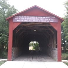
Delabar State Park, State park near Oquawka, United States

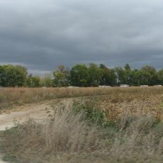
Delabar State Park is an 89-acre preserve stretching along the Mississippi River, where oak, birch, and hickory trees form the forest canopy and wetland areas are protected for wildlife. The park sits where river backwaters meet dense woodlands.

Brothers Roy and Jack Delabar gave the land to Illinois in 1959, and the state officially recognized it as a park in 1960. Their gift made it possible to preserve this riverside area for the future.

The park draws birders who come to watch over fifty bird species in their natural surroundings throughout the year. Open meadows and thick woodlands give visitors different ways to experience wildlife along the river.

The park has camping spots with electrical service, drinking water, and two marked trails totaling almost 2 miles for hiking. Visitors can also launch boats to explore the river area.

During winter, the river backwaters freeze over, creating conditions for ice fishing and ice skating activities. This seasonal change draws many visitors who want to experience the frozen landscape.

The community of curious travelers

AroundUs brings together thousands of curated places, local tips, and hidden gems, enriched daily by 60,000 contributors worldwide.

Start exploring
Location
Inception
1960
GPS coordinates
40.96220,-90.93940
Latest update
December 13, 2025 12:41
Around this place
Great River Bridge
United States of America

Great River Bridge

21.3 km
Burlington Rail Bridge
United States of America

Burlington Rail Bridge

22.3 km
Lock and Dam No. 18
United States of America

Lock and Dam No. 18

11.5 km
St. Paul's Catholic Church
United States of America

St. Paul's Catholic Church

21.6 km
First Congregational Church
United States of America

First Congregational Church

21.8 km
Capitol Theater
United States of America

Capitol Theater

21.9 km
Keithsburg Rail Bridge
United States of America

Keithsburg Rail Bridge

15.9 km
German Methodist Episcopal Church
United States of America

German Methodist Episcopal Church

21.9 km
Des Moines County Court House
United States of America

Des Moines County Court House

21.6 km
Oquawka Wagon Bridge
United States of America

Oquawka Wagon Bridge

7.6 km
Burlington Public Library
United States of America

Burlington Public Library

21.7 km
South Henderson Church
United States of America

South Henderson Church

10.2 km
Heritage Hill Historic District
United States of America

Heritage Hill Historic District

21.7 km
Alexis Phelps House
United States of America

Alexis Phelps House

2.9 km
Christ Episcopal Church
United States of America

Christ Episcopal Church

21.6 km
Snake Alley Historic District
United States of America

Snake Alley Historic District

21.8 km
Hawkeye Creek Bridge
United States of America

Hawkeye Creek Bridge

13.3 km
Downtown Commercial Historic District
United States of America

Downtown Commercial Historic District

21.8 km
Augustus Caesar Dodge House
United States of America

Augustus Caesar Dodge House

21.3 km
Baptist Church
United States of America

Baptist Church

21.8 km
Henderson County Courthouse
United States of America

Henderson County Courthouse

3.2 km
Florence-Council On The Iowa Site
United States of America

Florence-Council On The Iowa Site

22 km
West Jefferson Street Historic District
United States of America

West Jefferson Street Historic District

22 km
Jagger-Churchill House
United States of America

Jagger-Churchill House

21.2 km
Commercial House
United States of America

Commercial House

15.4 km
Abiathar and Nancy White House
United States of America

Abiathar and Nancy White House

21.4 km
Burlington Rail Bridge (1893)
United States of America

Burlington Rail Bridge (1893)

22.3 km
Burlington Rail Bridge (1867)
United States of America

Burlington Rail Bridge (1867)

22.3 km
Show the full map
Reviews
Share your experience

No review yet

Discussions
Start a discussion...

No discussion yet

« Delabar State Park - State park near Oquawka, United States » is provided by Around Us (aroundus.com). Images and texts are derived from Wikimedia project under a Creative Commons license. You are allowed to copy, distribute, and modify copies of this page, under the conditions set by the license, as long as this note is clearly visible.

Discover hidden gems everywhere you go!

From secret cafés to breathtaking viewpoints, skip the crowded tourist spots and find places that match your style. Our app makes it easy with voice search, smart filtering, route optimization, and insider tips from travelers worldwide. Download now for the complete mobile experience.

Around Us App Screenshot

A unique approach to discovering new places

Le Figaro

All the places worth exploring

France Info

A tailor-made excursion in just a few clicks

20 Minutes

Around Us
Travel Guide & Maps
Download

Send to your phone

QR Code
1

Open the camera app on your mobile.

2

Point at the QR code with your camera. A notification will appear.

3

Tap the notification to open the link.