Dolliver Memorial State Park, State park near Fort Dodge, Iowa, United States
Dolliver Memorial State Park is a wooded nature preserve featuring tall sandstone cliffs, narrow ravines, and thick forest cover along the Des Moines River. The terrain offers varied trails that wind through the dense woodland and past geological formations.
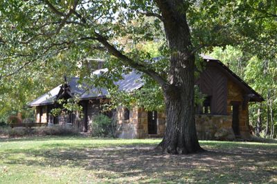
The park was developed during the Great Depression when the Civilian Conservation Corps built two lodges and laid out trails in the early 1930s. This infrastructure made it possible to open the natural area to the public for recreation.
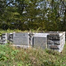
The burial mounds reflect how Indigenous peoples held this land sacred and used it for ceremonies. These earthen structures show the spiritual importance of the river valley to earlier communities.
Visitors can camp at sites with electrical hookups or rent two simple cabins, each with access to modern restroom facilities and showers. The trails are accessible year-round, though warmer months provide the most comfortable hiking conditions.
Boneyard Hollow contains scattered bison bones that early settlers discovered, suggesting Indigenous hunters used the narrow ravine as a hunting ground. The site hints at ancient hunting strategies and the wildlife that once roamed the region.
Location: Iowa
Inception: 1925
Architects: Central Design Office, Ames
Elevation above the sea: 300 m
Website: https://iowadnr.gov/Places-to-Go/State-Parks/Iowa-State-Parks/Dolliver-Memorial-State-Park
GPS coordinates: 42.38690,-94.08360
Latest update: December 12, 2025 09:05
Kate Shelley High Bridge
37.7 km
Pilot Mound State Forest
26.8 km
Webster County Courthouse
15.7 km
Oleson Park Music Pavilion
13.5 km
William J. and Hattie J. Zitterell House
23.1 km
Humboldt County Courthouse
38.9 km
Kendall Young Public Library
23.4 km
Boone County Courthouse
39.3 km
William Oakland Round Barn
38.6 km
Humboldt Public Library
38.8 km
Webster City Post Office
23.5 km
Corydon Brown House
38.6 km
Boone Bridge 2
37.2 km
Stoll Bottling Works
39.6 km
Beaver Creek Bridge
37.9 km
Hamilton County Courthouse
23.3 km
First National Bank Building
15.7 km
Albright Bridge
22.6 km
Tremaine Bridge
22.6 km
Eagle Grove Public Library
34.2 km
Vincent House
15.4 km
Ericson Public Library
39.7 km
Oak Hill Historic District
15.3 km
Stephen Harris Taft House
39 km
Perrigo-Holmes House
39.6 km
Lorenzo S. Coffin Burial Plot
20.3 km
Squaw Creek Bridge 2
33.1 km
B&SV Bass Point High Bridge
35.4 kmVisited this place? Tap the stars to rate it and share your experience / photos with the community! Try now! You can cancel it anytime.
Discover hidden gems everywhere you go!
From secret cafés to breathtaking viewpoints, skip the crowded tourist spots and find places that match your style. Our app makes it easy with voice search, smart filtering, route optimization, and insider tips from travelers worldwide. Download now for the complete mobile experience.
A unique approach to discovering new places❞
— Le Figaro
All the places worth exploring❞
— France Info
A tailor-made excursion in just a few clicks❞
— 20 Minutes