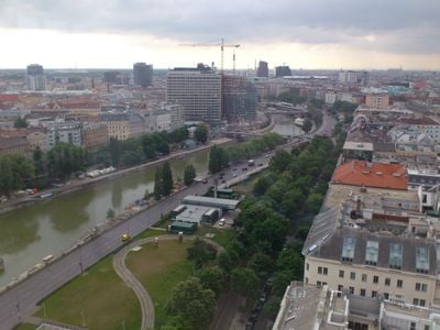
Donaukanal, Regulated water channel in central Vienna, Austria
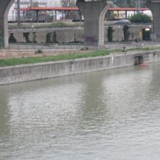
The Donaukanal is a regulated waterway that runs for 17 kilometers through Vienna, separating the city center from the districts of Leopoldstadt and Brigittenau. Its banks feature walkways, cycling paths, and green spaces where residents and visitors gather throughout the year.
The waterway was regulated between 1598 and 1600 when Baron von Hoyos transformed the wild Danube branch into a controlled canal to help manage flooding and open new areas for settlement. This early hydraulic work laid the foundation for Vienna's modern urban development along its banks.
The banks of this waterway showcase colorful murals and street art that change with the seasons, creating open-air galleries where artists and visitors interact. Local communities gather here to celebrate, perform, and display their creative work in informal settings.
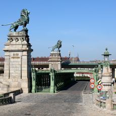
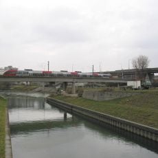
About 15 road bridges and 5 rail bridges connect both sides, while dedicated cycling paths run mainly along the southern bank to help you navigate. The southern bank is better developed with more amenities and is ideal for walking or cycling longer distances.
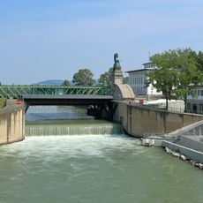
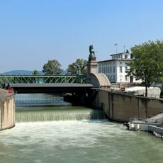
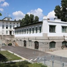
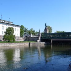
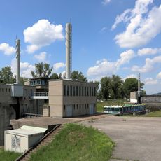
The Nussdorf weir and lock complex at the northern entrance has managed water flow since 1899 and protects the city from flooding. This imposing structure with its massive gates remains visible to visitors and stands as a remarkable example of late 19th-century engineering.
Location: Vienna
Address: Donaukanal, Vienna, Austria
GPS coordinates: 48.25860,16.36930
Latest update: January 27, 2026 14:04
This collection guides you through about thirty places around Vienna, between the old town and the forests surrounding the city. You will see the Habsburg palaces, the wooded hills of the Vienna Woods, the banks of the Danube, and small thermal towns like Baden or Mödling. The villages of Grinzing...
Nußdorf weir and lock
67 m
Nussdorfer Pfarrkirche
345 m
Schemerlbrücke
67 m
Vorortelinie-Donaukanalbrücke
380 m
Neudeckerhof
317 m
Edwin-Schuster-Hof, Vienna
334 m
Straßenbrücke, Josef von Schemmerl-Brücke und Wehranlage Nußdorf
69 m
Nebengebäude Nußdorfer Wehr
76 m
Verwaltungsgebäude der Nußdorfer Wehr
115 m
Greinergasse 23
356 m
Kommunaler Wohnbau
346 m
Zwettler Freihof
351 m
Straßenbrücke, Josef von Schemmerl-Brücke und Wehranlage Nußdorf
72 m
Greinergasse 30
342 m
Donaukanalregulierung und -verbauung (samt Brücken, Geländer und sonstigem), KG Nußdorf
222 m
Kahlenberger Straße 1
364 m
Hackhofergasse 10
356 m
Kahlenberger Straße 3
379 m
Hackhofergasse 3
329 m
Sickenberggasse 1-5
301 m
Greinergasse 39
368 m
Greinergasse 29
343 m
Schleuse der Nußdorfer Wehr- und Schleusenanlage
64 m
Ehem. Handschuhfabrik Zacharias
216 m
Pfarrhof Nussdorf
350 m
Greinergasse 42
314 m
Wohnhausanlage Sickenberggasse 11a
155 m
Bürgerhaus
374 mVisited this place? Tap the stars to rate it and share your experience / photos with the community! Try now! You can cancel it anytime.
Discover hidden gems everywhere you go!
From secret cafés to breathtaking viewpoints, skip the crowded tourist spots and find places that match your style. Our app makes it easy with voice search, smart filtering, route optimization, and insider tips from travelers worldwide. Download now for the complete mobile experience.
A unique approach to discovering new places❞
— Le Figaro
All the places worth exploring❞
— France Info
A tailor-made excursion in just a few clicks❞
— 20 Minutes