Enable Location

We need your location to show you interesting places around you

Discover nearby places

Find interesting locations and hidden gems around you

Precise directions

Get accurate directions and distances to places

Your location is never shared with other users. It's only used when you tap the location button.

Log in to your account

Start exploring — it's free

Trusted by 63,026 travelers worldwide

Continue with Google
Continue with Apple
or

We will send you a code to connect

By continuing, you accept our Terms and Conditions and our Privacy Policy

Check your inbox

We've sent a pincode in your inbox. Please enter the code below.

Mainzer Höhenweg
Discussion Reviews Photo
4.5k Popularity

Mainzer Höhenweg, hochalpiner, anspruchsvoller Höhenweg in den Ötztaler Alpen in Tirol

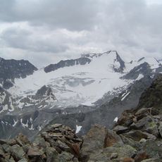
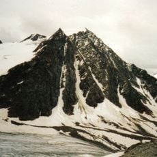
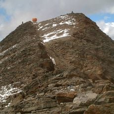
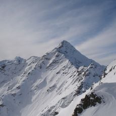
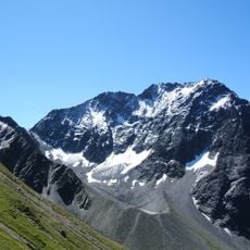
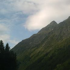
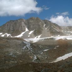
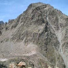
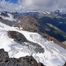
The Mainzer Höhenweg is a mountain trail in the Tyrol region of Austria that passes through grassy slopes, rocky terrain, and high alpine ridges. The route crosses snow fields and glaciers at altitude, with exposed climbing sections protected by fixed ropes and ladders.

The path was historically used by herders and farmers to access grazing land and move between valleys. It later developed into a recognized high-altitude mountaineering route in the Ötztal region for experienced climbers.

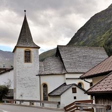
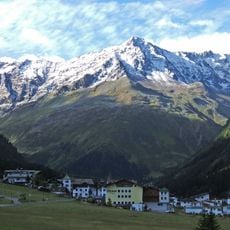
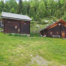
The trail passes by traditional Tyrolean farmhouses with wooden facades and sloping roofs that reflect the local building style. This architecture has been preserved for centuries and represents how people in the region have adapted to the mountain environment.

The trail is accessible from early spring to late autumn, but requires sturdy boots, water, and a light jacket or rain protection. The route is long and demanding, so plan for a full day and check weather conditions before setting out.

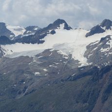
The route crosses two glaciers and requires equipment like crampons and an ice axe, setting it apart from many other alpine trails. The Rheinland-Pfalz-Biwak on the Wassertalkogel provides hikers with a small emergency shelter if the route takes longer than expected.

The community of curious travelers

AroundUs brings together thousands of curated places, local tips, and hidden gems, enriched daily by 60,000 contributors worldwide.

Start exploring
Location
GPS coordinates
46.96690,10.90500
Latest update
February 7, 2026 11:00
Reviews
Share your experience

No review yet

Discussions
Start a discussion...

No discussion yet

« Mainzer Höhenweg - hochalpiner, anspruchsvoller Höhenweg in den Ötztaler Alpen in Tirol » is provided by Around Us (aroundus.com). Images and texts are derived from Wikimedia project under a Creative Commons license. You are allowed to copy, distribute, and modify copies of this page, under the conditions set by the license, as long as this note is clearly visible.

Discover hidden gems everywhere you go!

From secret cafés to breathtaking viewpoints, skip the crowded tourist spots and find places that match your style. Our app makes it easy with voice search, smart filtering, route optimization, and insider tips from travelers worldwide. Download now for the complete mobile experience.

Around Us App Screenshot

A unique approach to discovering new places

Le Figaro

All the places worth exploring

France Info

A tailor-made excursion in just a few clicks

20 Minutes

Around Us
Travel Guide & Maps
Download

Send to your phone

QR Code
1

Open the camera app on your mobile.

2

Point at the QR code with your camera. A notification will appear.

3

Tap the notification to open the link.