Enable Location

We need your location to show you interesting places around you

Discover nearby places

Find interesting locations and hidden gems around you

Precise directions

Get accurate directions and distances to places

Your location is never shared with other users. It's only used when you tap the location button.

San Fernando de Henares

Log in to your account

Start exploring — it's free

Trusted by 62,061 travelers worldwide

Continue with Google
Continue with Apple
or

We will send you a code to connect

By continuing, you accept our Terms and Conditions and our Privacy Policy

Check your inbox

We've sent a pincode in your inbox. Please enter the code below.

San Fernando de Henares

San Fernando de Henares, Municipality in Madrid Metropolitan Area, Spain

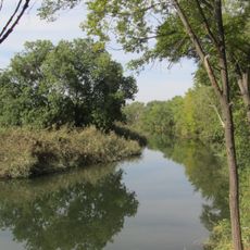
San Fernando de Henares is a municipality in the Madrid Metropolitan Area that stretches across its territory with natural areas along the Henares River. The town combines residential neighborhoods with green spaces that follow the river's path.

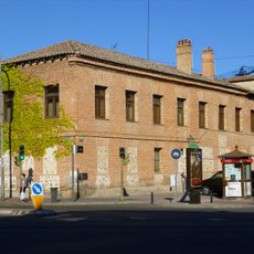
King Philip V acquired the land in 1746 to establish a royal textile factory that became the foundation for developing the entire municipality. This factory drew workers and led to the creation of an organized settlement.

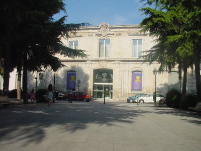
The historic center features two connected squares, Plaza de España and Plaza de Fernando VI, where original worker residences from the 18th century still stand around them. These homes show the building techniques of that era and shape how the town center looks today.

The location connects to Madrid through metro line 7 and several highways, making access straightforward. Visitors should use these transport options to move around the wider region.

The Castle of Aldovea dates from the 11th century and was later transformed from a fortress into a palace during the 18th-century renovation period. This transformation shows how the building's use changed over time.

The community of curious travelers

AroundUs brings together thousands of curated places, local tips, and hidden gems, enriched daily by 60,000 contributors worldwide.

Start exploring
Location
Madrid Metropolitan Area
Capital city
San Fernando de Henares
Elevation above the sea
580 m
Part of
Združenje občin Jarama za vzpostavitev in razvoj službe ravnanja s komunalnimi odpadki, Mancomunidade do Leste, Mancomunitat «Henares-Jarama»
Shares border with
Coslada, Madrid, Paracuellos de Jarama, Torrejón de Ardoz, Torres de la Alameda, Loeches, Mejorada del Campo, Rivas-Vaciamadrid, Alcalá de Henares, Barajas, Vicálvaro
GPS coordinates
40.42556,-3.53528
Latest update
December 19, 2025 23:05
« San Fernando de Henares - Municipality in Madrid Metropolitan Area, Spain » is provided by Around Us (aroundus.com). Images and texts are derived from Wikimedia project under a Creative Commons license. You are allowed to copy, distribute, and modify copies of this page, under the conditions set by the license, as long as this note is clearly visible.

Discover hidden gems everywhere you go!

From secret cafés to breathtaking viewpoints, skip the crowded tourist spots and find places that match your style. Our app makes it easy with voice search, smart filtering, route optimization, and insider tips from travelers worldwide. Download now for the complete mobile experience.

Around Us App Screenshot

A unique approach to discovering new places

Le Figaro

All the places worth exploring

France Info

A tailor-made excursion in just a few clicks

20 Minutes

Around Us
Travel Guide & Maps
Download

Send to your phone

QR Code
1

Open the camera app on your mobile.

2

Point at the QR code with your camera. A notification will appear.

3

Tap the notification to open the link.