Enable Location

We need your location to show you interesting places around you

Discover nearby places

Find interesting locations and hidden gems around you

Precise directions

Get accurate directions and distances to places

Your location is never shared with other users. It's only used when you tap the location button.

Fregenal de la Sierra

Log in to your account

Start exploring — it's free

Trusted by 63,414 travelers worldwide

Continue with Google
Continue with Apple
or

We will send you a code to connect

By continuing, you accept our Terms and Conditions and our Privacy Policy

Check your inbox

We've sent a pincode in your inbox. Please enter the code below.

Fregenal de la Sierra
Discussion Reviews 1 Photos
26.6k Popularity

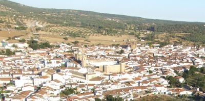
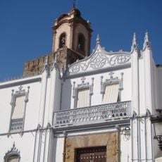
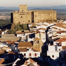
Fregenal de la Sierra, Municipality in Badajoz Province, Spain

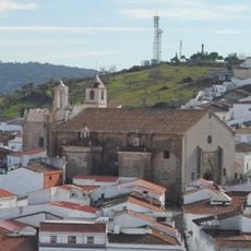
Fregenal de la Sierra is a municipality in Badajoz Province situated in the Sierra Suroeste region at an elevation of around 579 meters. The area features forests and farmland that form the landscape surrounding the town.

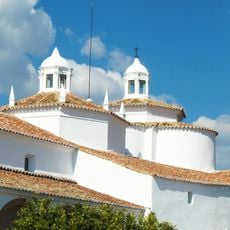
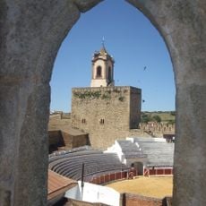
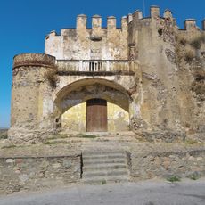
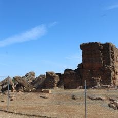
The territory came under control of the Knights Templar in 1283 when King Alfonso X of Castile granted them the land following their efforts during the Reconquista. This arrangement shaped the settlement's early development.

The town centers on cork harvesting and the preparation of Iberian pork products, skills that local families have maintained through their daily work in surrounding forests and workshops.

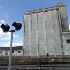
The town is accessible via several main roads including EX-101, EX-201, and N-435 highways that connect to larger cities. Rail service on the Zafra-Huelva line also provides a transportation option for those arriving by train.

Over one hundred residents departed from this place during the colonization of the Americas, seeking opportunities across the Atlantic. Among them was Benito Arias Montano, who became a notable figure in the historical record.

The community of curious travelers

AroundUs brings together thousands of curated places, local tips, and hidden gems, enriched daily by 60,000 contributors worldwide.

Start exploring
Capital city
Fregenal de la Sierra
Elevation above the sea
579 m
Part of
Mancomunidad de Municipios de la Comarca de Fregenal de la Sierra
Shares border with
Fuentes de León, Cumbres Mayores, Higuera la Real, Jerez de los Caballeros, Burguillos del Cerro, Valencia del Ventoso, Segura de León, Bodonal de la Sierra
GPS coordinates
38.16667,-6.65000
Latest update
December 20, 2025 14:53
Reviews
Share your experience

No review yet

Discussions
Start a discussion...

No discussion yet

« Fregenal de la Sierra - Municipality in Badajoz Province, Spain » is provided by Around Us (aroundus.com). Images and texts are derived from Wikimedia project under a Creative Commons license. You are allowed to copy, distribute, and modify copies of this page, under the conditions set by the license, as long as this note is clearly visible.

Discover hidden gems everywhere you go!

From secret cafés to breathtaking viewpoints, skip the crowded tourist spots and find places that match your style. Our app makes it easy with voice search, smart filtering, route optimization, and insider tips from travelers worldwide. Download now for the complete mobile experience.

Around Us App Screenshot

A unique approach to discovering new places

Le Figaro

All the places worth exploring

France Info

A tailor-made excursion in just a few clicks

20 Minutes

Around Us
Travel Guide & Maps
Download

Send to your phone

QR Code
1

Open the camera app on your mobile.

2

Point at the QR code with your camera. A notification will appear.

3

Tap the notification to open the link.