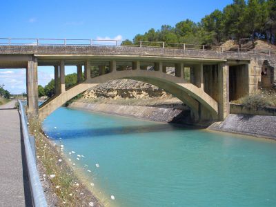
Canal de Bardenas, Irrigation canal in Navarre, Spain.
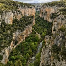
The Canal de Bardenas is an irrigation system stretching roughly 130 kilometers from northern mountains to southern plains, moving water through tunnels and open channels across varied terrain. The network supplies water to extensive farmland in Navarre and Aragon, demonstrating how water is directed over long distances to make dry areas productive.
The idea of using water from the Aragón River emerged in the 15th century, but the actual construction of the canal took many decades into the 20th century. The project became tied to the development of modern agriculture in Navarre and fundamentally reshaped the region.
The canal transformed how people live and farm in this region, turning dry areas into productive land and creating new communities where there were once only scattered settlements. Today you can see how water shaped the local landscape and remains central to how the region works.
The canal is partly accessible to visitors, with various sections available for walking or cycling, especially in warmer months. It is best to wear comfortable shoes and bring plenty of water, as many areas are exposed to sun with little shade available.
The Cáseda tunnel, stretching about 6 kilometers underground, is one of Europe's longest irrigation tunnels and pierces through the mountain ridge separating north from south. This hidden section allows water to bypass elevation differences that would have otherwise made the project impossible.
The community of curious travelers
AroundUs brings together thousands of curated places, local tips, and hidden gems, enriched daily by 60,000 contributors worldwide.