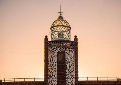
Punta La Entallada Lighthouse, Maritime lighthouse in Tuineje, Canary Islands, Spain.
Punta La Entallada is a lighthouse at the easternmost tip of Fuerteventura with three square towers on its seaward side. The central tower supports a glass lantern dome and rises 196 meters above sea level.
The lighthouse opened on December 3, 1954, and played a navigation role during military operations in Spanish Sahara in the 1950s. Its construction marked the advanced infrastructure development of the Canary Islands during that period.
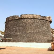
The structure shows Moorish architectural elements and was built from local stone sourced from Tetir village, creating a distinctive pattern with white mortar on the exterior walls. You can see this craftsmanship clearly when exploring the building and its surroundings.
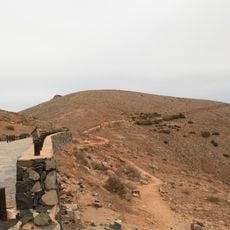
The lighthouse sits at the easternmost point of Fuerteventura and remains active, with visitor access available on certain days. You should know that conditions at this exposed location can be windy, and sturdy footwear is recommended.
The lighthouse stands closer to the African continent than any other point in the Canary Islands, only about 100 kilometers away. The signal sends out three white flashes and marks one of Spain's easternmost points.
Location: Tuineje
Inception: December 3, 1954
Address: 35629, Las Palmas, Spain
Opening Hours: Tuesday-Saturday 10:00-17:00
GPS coordinates: 28.23034,-13.94856
Latest update: December 6, 2025 17:43
Fuerteventura, the second largest island in the Canary Islands, is characterized by its diverse landscapes and notable geological features. The island houses spectacular formations such as the white dunes of Corralejo Natural Park, extending over more than 10 kilometers, the 70-million-year-old Ajuy...
Museo de las Salinas del Carmen
17.1 km
Oasis Park
21.6 km
Parque Rural de Betancuria
25.1 km
Castillo de Fuste
20.3 km
Iglesia de Nuestra Señora de Regla
20.5 km
Morro Velosa
25.2 km
Iglesia de Nuestra Señora (Antigua (Fuerteventura))
22.4 km
Hornos de cal de la Guirra
19.2 km
Tuineje church
14.5 km
Barranco de las Peñitas
22.5 km
Molino de Antigua
23.2 km
Windmill at Calle Isla De Montaña Clara
18.8 km
Windmill at La Corte
21 km
Windmill of Durazno
22.5 km
Windmill at Lugar Teguitar
19.2 km
Windmill at Calle General Moscardol
18.9 km
Ermita de Nuestra Senora de Guadalupe
17.7 km
Salinas del Carmen
17 km
Windmill in Tiscamanita
16.1 km
Iglesia de la Inmaculada Concepción
20.6 km
Conjunto Histórico Artístico la Villa
24.1 km
Molino de Tiscamanita
16.3 km
Astronomical viewpoint Sicasumbre
21.7 km
Biblioteca Pública Municipal de Pájara
20.5 km
Biblioteca Pública Municipal de Antigua
22.3 km
La Lajita
20.8 km
Gran Tarajal
7.3 km
Castillo Caleta de Fuste
20.3 kmVisited this place? Tap the stars to rate it and share your experience / photos with the community! Try now! You can cancel it anytime.
Discover hidden gems everywhere you go!
From secret cafés to breathtaking viewpoints, skip the crowded tourist spots and find places that match your style. Our app makes it easy with voice search, smart filtering, route optimization, and insider tips from travelers worldwide. Download now for the complete mobile experience.
A unique approach to discovering new places❞
— Le Figaro
All the places worth exploring❞
— France Info
A tailor-made excursion in just a few clicks❞
— 20 Minutes