Enable Location

We need your location to show you interesting places around you

Discover nearby places

Find interesting locations and hidden gems around you

Precise directions

Get accurate directions and distances to places

Your location is never shared with other users. It's only used when you tap the location button.

Acueductos de la rambla de Carcauz

Log in to your account

Start exploring — it's free

Trusted by 63,009 travelers worldwide

Continue with Google
Continue with Apple
or

We will send you a code to connect

By continuing, you accept our Terms and Conditions and our Privacy Policy

Check your inbox

We've sent a pincode in your inbox. Please enter the code below.

Acueductos de la rambla de Carcauz
Discussion Reviews 1 Photos
2.1k Popularity

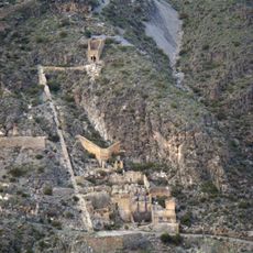
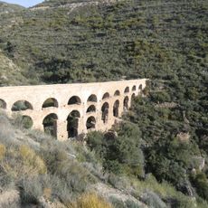
Acueductos de la rambla de Carcauz, Ancient Roman aqueduct system in Vícar and Felix, Spain.

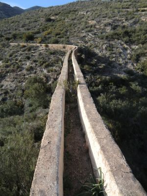
The Acueductos de la rambla de Carcauz consist of three stone aqueducts connected by irrigation channels that follow the natural watercourse through the region. The largest structure, the Twenty Arches Aqueduct, demonstrates the precision and scale of the engineering work that made this system function.

These structures were built during the Roman period, between the 1st century BC and the 2nd century AD, to supply water for the region's growing settlements and farms. The engineering knowledge required to construct them represented the advanced capabilities of Roman builders in managing water across difficult terrain.

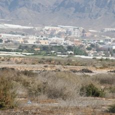
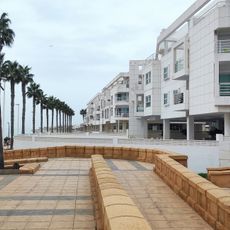
The water system shaped how people farmed and lived in this region for many centuries, making it central to local survival and prosperity. The structures remain deeply connected to how residents view their landscape and water resources.

The site can be reached from highway A-7 exit 420, then through La Mojonera to Avenida de las Cantinas and Camino de las Camaras, where parking is available. Walking around the ruins works best in dry weather and comfortable shoes help when exploring the uneven stone surfaces.

While the original water channels transported irrigation water for centuries, the system was partially modernized in the 20th century and now carries water through modern plastic pipes alongside the ancient stone structures. This blend of Roman engineering and contemporary infrastructure creates an unusual layering of different time periods in one place.

The community of curious travelers

AroundUs brings together thousands of curated places, local tips, and hidden gems, enriched daily by 60,000 contributors worldwide.

Start exploring
Location
Location
GPS coordinates
36.82675,-2.70435
Latest update
December 13, 2025 17:03
Reviews
Share your experience

No review yet

Discussions
Start a discussion...

No discussion yet

« Acueductos de la rambla de Carcauz - Ancient Roman aqueduct system in Vícar and Felix, Spain » is provided by Around Us (aroundus.com). Images and texts are derived from Wikimedia project under a Creative Commons license. You are allowed to copy, distribute, and modify copies of this page, under the conditions set by the license, as long as this note is clearly visible.

Discover hidden gems everywhere you go!

From secret cafés to breathtaking viewpoints, skip the crowded tourist spots and find places that match your style. Our app makes it easy with voice search, smart filtering, route optimization, and insider tips from travelers worldwide. Download now for the complete mobile experience.

Around Us App Screenshot

A unique approach to discovering new places

Le Figaro

All the places worth exploring

France Info

A tailor-made excursion in just a few clicks

20 Minutes

Around Us
Travel Guide & Maps
Download

Send to your phone

QR Code
1

Open the camera app on your mobile.

2

Point at the QR code with your camera. A notification will appear.

3

Tap the notification to open the link.