Enable Location

We need your location to show you interesting places around you

Discover nearby places

Find interesting locations and hidden gems around you

Precise directions

Get accurate directions and distances to places

Your location is never shared with other users. It's only used when you tap the location button.

Cap Fréhel

Log in to your account

Start exploring — it's free

Trusted by 61,389 travelers worldwide

Continue with Google
Continue with Apple
or

We will send you a code to connect

By continuing, you accept our Terms and Conditions and our Privacy Policy

Check your inbox

We've sent a pincode in your inbox. Please enter the code below.

Cap Fréhel

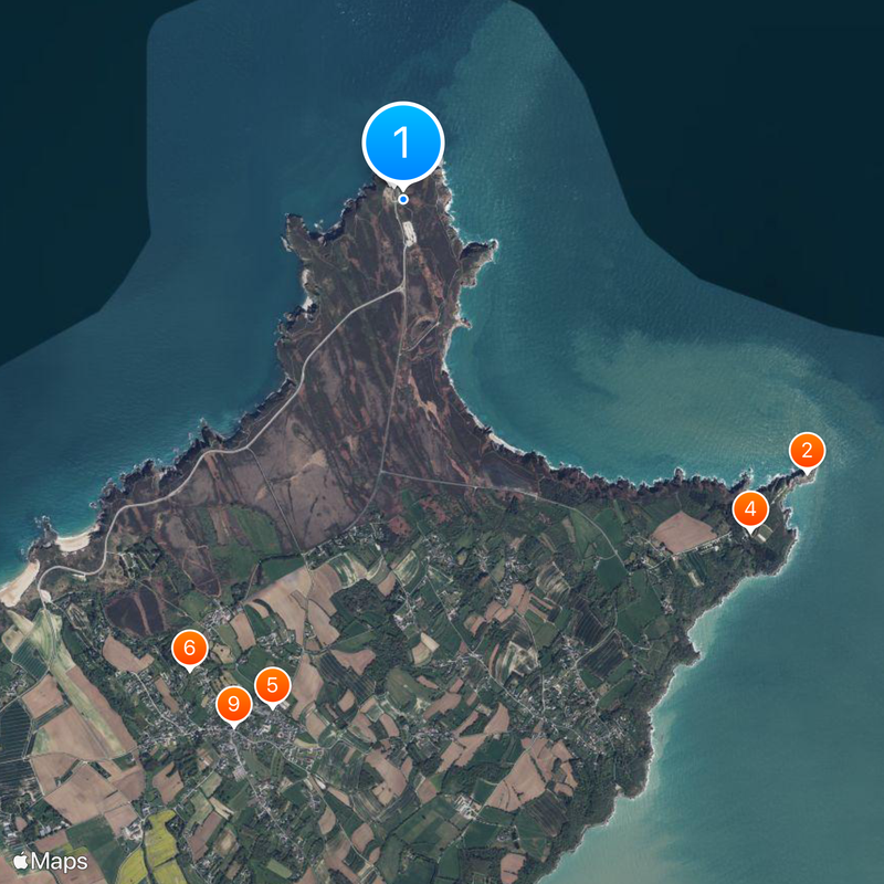
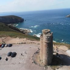
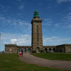
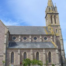
Cap Fréhel, Coastal promontory in Côtes-d'Armor, France

Description

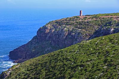
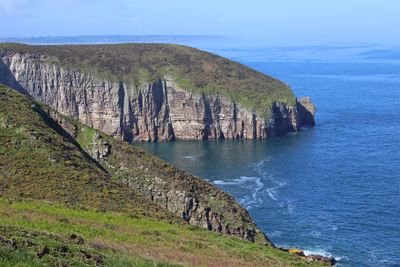
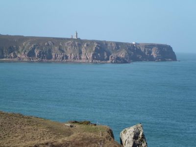
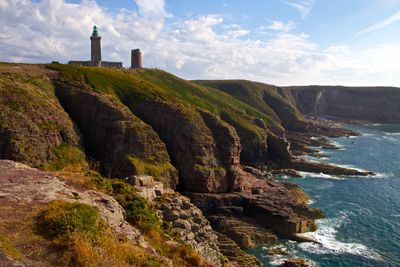
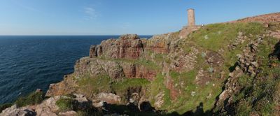
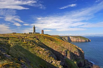
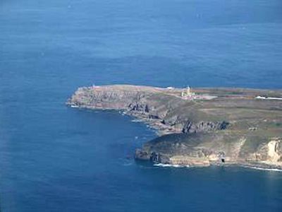
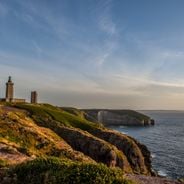
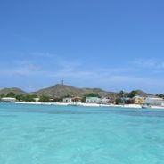
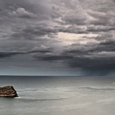
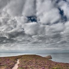
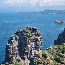
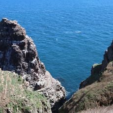
Cap Fréhel is a rocky headland on the northern Breton coast where sandstone cliffs rise about 70 meters above the water, creating a striking natural barrier. A tall lighthouse crowns the site, and several walking paths wind along the jagged coastline offering views of the surrounding waters.

History

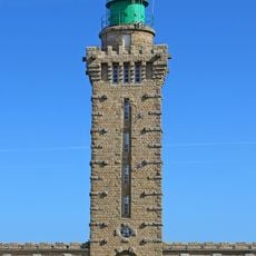
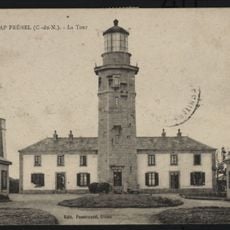
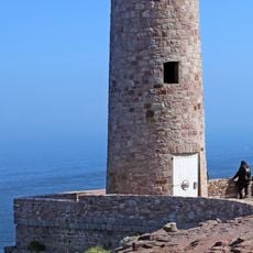
The first lighthouse was built in 1685 to warn ships away from this treacherous coastline, but was later replaced by a modern structure. The current tower was erected in 1950 and has guided maritime traffic at this exposed promontory ever since.

Culture

The promontory serves as a nesting ground for seabirds like northern fulmars and cormorants, which inhabit the rocky faces year-round. Visitors often spot these colonies during warmer months when activity is most visible along the cliff faces.

Practical

The site is accessible via the GR34 hiking trail, which extends from Fort La Latte and offers a coastal walk lasting roughly 90 minutes. The path crosses varied terrain and changes elevation several times, so sturdy footwear and reasonable fitness are recommended.

Did you know?

The lighthouse here has one of the most powerful light beams on the French coast and can warn ships from a great distance away. This powerful system is necessary because of the dangerous rock formations and strong currents that threaten vessels at this exposed location.

Location
Inception
2012
Address
Cap Fréhel, France
GPS coordinates
48.68333,-2.31806
Latest update
December 19, 2025 23:30

AroundUs brings together thousands of curated places, local tips, and hidden gems, enriched daily by 60,000 contributors worldwide. Discover all places nearby (Côtes-d'Armor).

Historical sites and landscapes in Brittany

Brittany combines medieval architecture with natural landscapes that shape the region's character. Granite cliffs, forests, lighthouses, and fishing villages dot the coastline. Visitors discover Celtic megaliths, castles, abbeys, and museums filled with maritime history. The shoreline displays...

« Cap Fréhel - Coastal promontory in Côtes-d'Armor, France » is provided by Around Us (aroundus.com). Images and texts are derived from Wikimedia project under a Creative Commons license. You are allowed to copy, distribute, and modify copies of this page, under the conditions set by the license, as long as this note is clearly visible.

Discover hidden gems everywhere you go!

From secret cafés to breathtaking viewpoints, skip the crowded tourist spots and find places that match your style. Our app makes it easy with voice search, smart filtering, route optimization, and insider tips from travelers worldwide. Download now for the complete mobile experience.

Around Us App Screenshot

A unique approach to discovering new places

Le Figaro

All the places worth exploring

France Info

A tailor-made excursion in just a few clicks

20 Minutes

Around Us
Travel Guide & Maps
Download

Send to your phone

QR Code
1

Open the camera app on your mobile.

2

Point at the QR code with your camera. A notification will appear.

3

Tap the notification to open the link.