·

Enable Location

We need your location to show you interesting places around you

Discover nearby places

Find interesting locations and hidden gems around you

Precise directions

Get accurate directions and distances to places

Your location is never shared with other users. It's only used when you tap the location button.

Saint-Astier

Log in to your account

Start exploring — it's free

Trusted by 62,645 travelers worldwide

Continue with Google
Continue with Apple
or

We will send you a code to connect

By continuing, you accept our Terms and Conditions and our Privacy Policy

Check your inbox

We've sent a pincode in your inbox. Please enter the code below.

Saint-Astier, Administrative commune in Nouvelle-Aquitaine, France

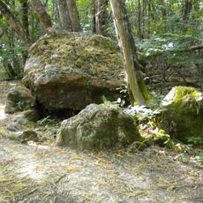
Saint-Astier is a rural commune in Nouvelle-Aquitaine that spreads across the Isle River valley, mixing residential neighborhoods with farm country. Water courses including the Isle and Salembre rivers flow through the area, shaping how the landscape is organized.

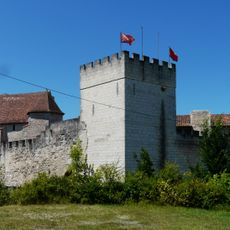
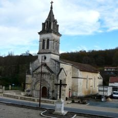
The town grew around a hermit's burial site in the 6th century, which became sacred to the local people. An abbey was later built at this location and became influential in shaping the region's development.

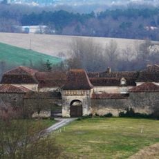
Local markets and festivals take place throughout the year, showing how the community values its farming traditions. Visitors can see how daily life here remains tied to agricultural practices and seasonal rhythms.

A train station in town offers direct connections to larger cities like Bordeaux, Périgueux, and Limoges. This makes it straightforward to travel beyond the commune if needed.

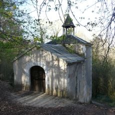
The name comes from Saint Asterius, an early hermit saint whose tomb attracted pilgrims centuries ago. This religious connection remains part of the local identity today.

The community of curious travelers

AroundUs brings together thousands of curated places, local tips, and hidden gems, enriched daily by 60,000 contributors worldwide.

Start exploring
Location
Elevation above the sea
122 m
Shares border with
Léguillac-de-l'Auche, Annesse-et-Beaulieu, Montrem, Grignols, Saint-Léon-sur-l'Isle, Saint-Germain-du-Salembre, Chantérac, Saint-Aquilin
Address
24110 Saint-Astier, France
Phone
GPS coordinates
45.14528,0.52806
Latest update
December 7, 2025 10:07
« Saint-Astier - Administrative commune in Nouvelle-Aquitaine, France » is provided by Around Us (aroundus.com). Images and texts are derived from Wikimedia project under a Creative Commons license. You are allowed to copy, distribute, and modify copies of this page, under the conditions set by the license, as long as this note is clearly visible.

Discover hidden gems everywhere you go!

From secret cafés to breathtaking viewpoints, skip the crowded tourist spots and find places that match your style. Our app makes it easy with voice search, smart filtering, route optimization, and insider tips from travelers worldwide. Download now for the complete mobile experience.

Around Us App Screenshot

A unique approach to discovering new places

Le Figaro

All the places worth exploring

France Info

A tailor-made excursion in just a few clicks

20 Minutes

Around Us
Travel Guide & Maps
Download

Send to your phone

QR Code
1

Open the camera app on your mobile.

2

Point at the QR code with your camera. A notification will appear.

3

Tap the notification to open the link.