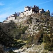
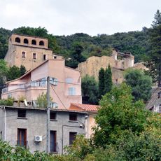
Érone, Mountain village in Haute-Corse, France
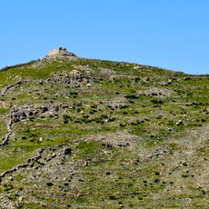
Érone is a small mountain commune in Haute-Corse that covers an area of 3.89 square kilometers and sits at an elevation of approximately 700 meters above sea level in the Corsican interior.
The village has experienced significant population decline over several decades, decreasing from 32 inhabitants in 1968 to just 12 residents today, reflecting the rural depopulation trend affecting many Corsican mountain communities.
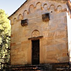
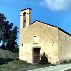
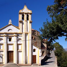
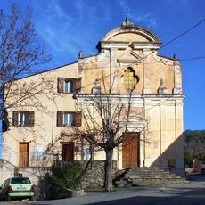
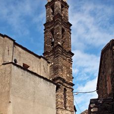
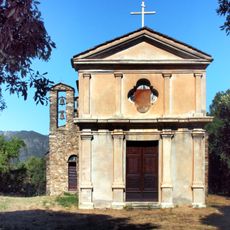
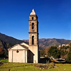
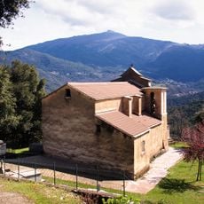
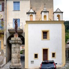
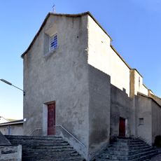
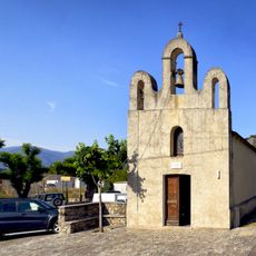
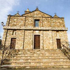
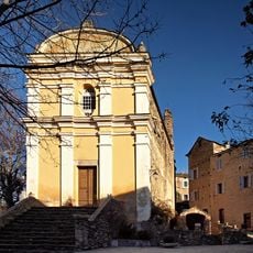
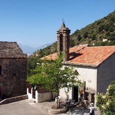
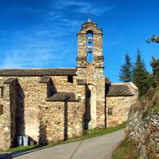
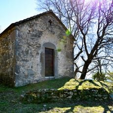
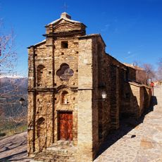
The commune hosts the church of Sant'Andrea, a religious monument that illustrates the local spiritual heritage and serves as a gathering place for traditional Corsican festivities and communal celebrations throughout the year.
Érone is located approximately 20 kilometers northeast of Corte, with the nearest train station situated 12 kilometers away in Corte, providing access to larger urban centers and transportation networks across Corsica.
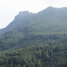
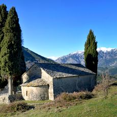
The territory features elevation variations ranging from 429 meters to 982 meters at nearby summits, offering challenging hiking opportunities and access to natural viewpoints overlooking the mountainous Corsican landscape and surrounding valleys.
Location: Haute-Corse
Location: canton of Bustanico
Location: arrondissement of Corte
Elevation above the sea: 668 m
Shares border with: San-Lorenzo, Cambia, Lano, Rusio
Address: 20244 Érone, France
Phone: +33420047311
Email: mairie.erone@orange.fr
GPS coordinates: 42.37246,9.27094
Latest update: November 26, 2025 11:04
France has some municipalities with extremely low populations, not exceeding 12 residents. These villages reflect the demographic shifts in rural France and provide insight into a lifestyle that has become rare. Rochefourchat in Drôme holds the record with just one inhabitant, while Aingoulaincourt...
Monte San Petrone
5.3 km
Chapelle San Quilico de Cambia
2 km
Santa Maria statue menhir
1.6 km
Église Saint-André d'Omessa
6 km
Chapelle San Pantaleo de Gavignano
5.2 km
Chapelle Santa Maria de Cambia
1.6 km
Église Saint-Étienne d'Aiti
3.7 km
Église San Bernardinu de Tralonca
6.1 km
Église de l'Annonciation de Gavignano
5.3 km
Église Sainte-Marie de Rusio
1.4 km
Église San Martino d'Érone
266 m
Église San Lorenzo de San-Lorenzo
1.8 km
Église Saint-Clément de Lano
2.2 km
Chapelle de l'Annonciation d'Omessa
5.9 km
Église Sainte-Lucie de Santa-Lucia-di-Mercurio
6.5 km
Chapelle Sainte-Marie de Francardo
7.1 km
Chapelle Sainte-Croix d'Omessa
6 km
Chapelle Santa Servanda de Santa-Lucia-di-Mercurio
5.8 km
Église de l'Annonciation de Carticasi
2.3 km
Église Saint Sébastien de Castineta
6.1 km
Chapelle Saint-Antoine de Piedivaldo
6.3 km
Chapelle Saint-Vincent de Bustanico
6 km
Chapelle St-Antoine de Forci
2.8 km
Ancien couvent des Récollets d'Omessa
5.7 km
Église Saint-Césaire de Saliceto
4 km
Chapelle San Lorenzo de Tralonca
6.5 km
Chapelle San Michele de Castellare-di-Mercurio
5.6 km
Église Santa Catalina de Loriani
2.3 kmVisited this place? Tap the stars to rate it and share your experience / photos with the community! Try now! You can cancel it anytime.
Discover hidden gems everywhere you go!
From secret cafés to breathtaking viewpoints, skip the crowded tourist spots and find places that match your style. Our app makes it easy with voice search, smart filtering, route optimization, and insider tips from travelers worldwide. Download now for the complete mobile experience.
A unique approach to discovering new places❞
— Le Figaro
All the places worth exploring❞
— France Info
A tailor-made excursion in just a few clicks❞
— 20 Minutes