Crêt Monniot, Mountain summit in Doubs, France.
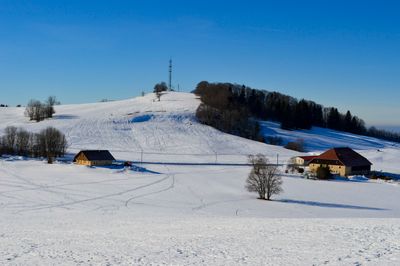
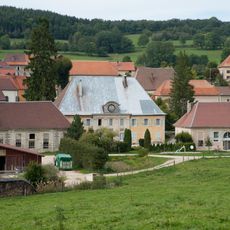
Crêt Monniot is a mountain summit standing at 1141 meters (3743 feet) with two orientation tables offering views across the Jura ridges and Alpine ranges. The surrounding landscape features rolling pastures and forested areas that create the backdrop from the top.
For centuries, this peak served as a geographical marker within the Canton of Montbenoît, defining its highest boundary. Its role as a landmark shaped how people understood the connection between the mountain region and the plains beyond.
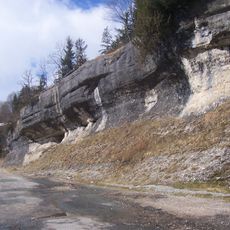
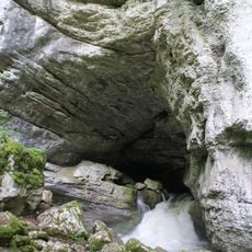
The place tells the story of water shaping the Jura landscape through five interpretation markers along a themed trail. Each stop reveals how natural forces have molded the rock formations and valleys that surround the region.
You can reach the summit through a 3.4-kilometer loop hike starting from Arc-sous-Cicon, marked with yellow and blue signs. The trail passes through open pastures and forest sections, making it accessible for hikers of different abilities.
From the two orientation tables at the summit, you can see four distinct landscapes simultaneously: the Haut Doubs plateaus, the Loue Valley, the Franche-Comté plains, and the Alpine mountains. This rare vantage point makes the location valuable for understanding the region's broader geography.
Location: Doubs
Elevation above the sea: 1,141 m
GPS coordinates: 47.03664,6.41233
Latest update: December 14, 2025 20:32
Grotte-chapelle de Remonot
7.6 km
Abbaye de Montbenoît
6.2 km
Défilé d'Entre-Roches
6.2 kmGorges de Remonot
7.6 km
Source du Pontet
9.4 km
Château d'Aubonne
6.4 km
École-mairie d'Arc-sous-Cicon
3 km
Église Saints-Pierre-et-Paul de Nods
8.6 km
Église des Rois-Mages de Rantechaux
8.8 km
Église Saint-Gorgon de Saint-Gorgon-Main
7 km
Église de l'Assomption d'Athose
9.1 km
Église Saint-Antide
6.4 km
Église Saint-Martin de Passonfontaine
7.8 km
Église du Saint-Esprit de Rémonot
7.7 km
Église Sainte-Anne de Gilley
5.2 km
Église de l'Immaculée-Conception de Longemaison
6.1 km
Église de l'Immaculée-Conception de Bugny
6.4 km
Église de l'Assomption de Lièvremont
6.9 km
Église Saint-Étienne d'Arc-sous-Cicon
2.9 km
Passonfontaine - ferme
8 km
Église Notre-Dame-des-Anges
8 km
Chapelle du Sausset de Passonfontaine
6.3 km
Église Saint-Antide de La Chaux
2.3 km
Chapelle Saint-Joseph de Ville-du-Pont
6.2 km
Chapelle Sainte-Anne de Gilley
5.1 km
Chapelle Notre-Dame de Vaux Navier
4.3 km
Mairie-lavoir de Nods
8.5 km
Chapelle Notre-Dame de Montflovin
6.1 kmVisited this place? Tap the stars to rate it and share your experience / photos with the community! Try now! You can cancel it anytime.
Discover hidden gems everywhere you go!
From secret cafés to breathtaking viewpoints, skip the crowded tourist spots and find places that match your style. Our app makes it easy with voice search, smart filtering, route optimization, and insider tips from travelers worldwide. Download now for the complete mobile experience.
A unique approach to discovering new places❞
— Le Figaro
All the places worth exploring❞
— France Info
A tailor-made excursion in just a few clicks❞
— 20 Minutes