Plages du débarquement allié en Normandie
Plages du débarquement allié en Normandie, World War II landing sites in Normandy, France
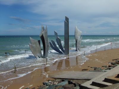
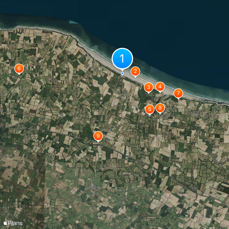
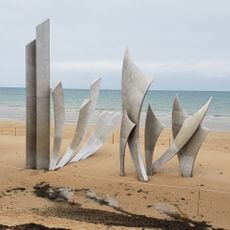
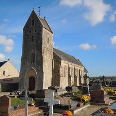
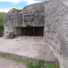
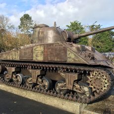
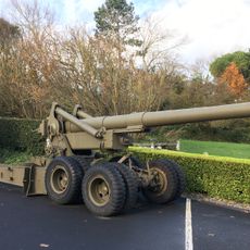
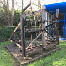
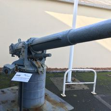
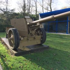
The Plages du débarquement allié en Normandie form a series of five coastal sectors spread across more than 80 kilometers of the Norman shoreline, where wartime fortifications, concrete shelters, and memorial monuments remain intact. Each sector carries its own designation and displays different installations, from gun emplacements and tank obstacles to remnants of defensive lines carved into the cliffs.
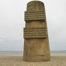
On June 6, 1944, Allied armies launched Operation Overlord and landed on these five stretches, codenamed Utah, Omaha, Gold, Juno, and Sword, to begin the liberation of Western Europe from German occupation. In the days following the initial assault, engineer corps built artificial harbors and secured supply lines that enabled the push inland.
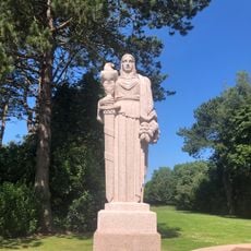
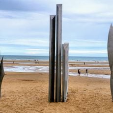
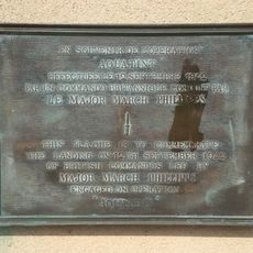
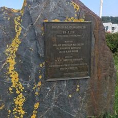
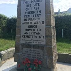
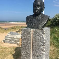
Locals refer to these sites as"D-Day beaches," and each coastline section carries distinct national memories tied to the troops who landed there. Visitors today walk paths marked by preserved command posts and observation points that remain as they were left decades ago.
Visiting all five beach sectors requires several days or focused planning, as they span a long stretch of coast with separate access roads and parking areas. Walking allows close inspection of the installations at each site, but a car is helpful for traveling between sectors.
The remains of the temporary harbor at Arromanches still rise from the water, showing the massive concrete boxes sunk within weeks of the landings. At Pointe du Hoc, deep bomb craters remain visible on the cliffs, left by the fierce fight for German gun positions.
Location: Normandy
GPS coordinates: 49.37085,-0.87959
Latest update: December 4, 2025 23:40
France offers motorcyclists a diverse landscape, from Alpine peaks to Mediterranean coasts, including wine regions. The country is suitable for all riding styles, with demanding mountain roads, winding coastal routes, and rural paths. Key routes include the Col de la Bonette, reaching 2802 meters and connecting Ubaye to Tinée over 26 kilometers. The Gorges du Verdon feature 21 kilometers of rock-carved road, passing through tunnels and 700-meter-high cliffs. The Routes of the Great Alps cross 16 passes over 684 kilometers between Lake Geneva and the Mediterranean, with a total ascent of 15,700 meters. Mount Ventoux, accessible via three routes and standing at 1912 meters, passes through lavender fields and vineyards in Provence. Regions display striking contrasts: Corsica alternates between cliff roads and pine forests, the French Riviera combines coast and mountainous hinterland, and Dordogne winds between limestone cliffs and medieval villages. Lake Annecy connects water bodies with forested mountain passes. These routes feature technical curves, varied landscapes, and cultural sites.
Omaha Beach
825 m
Normandy American Cemetery and Memorial
2 km
Resistance Nest 62
2.6 km
Overlord Museum
3.1 km
Château de Beaumont-le-Richard
6.4 km
Widerstandsnest 60
3.8 km
Église Notre-Dame de l'Assomption de Colleville-sur-Mer
3.4 km
Monument to the Battle of Formigny
4.5 km
Musée D-Day Omaha
2.1 km
Église Saint-Martin de Formigny
4 km
Manoir de Vaumicel
2.2 km
Église Saint-Laurent de Saint-Laurent-sur-Mer
1.3 km
Église Saint-André de Vierville-sur-Mer
1.9 km
Église Notre-Dame de Louvières
3 km
Église Saint-Vigor d'Asnières-en-Bessin
4.3 km
Église Saint-Pierre d'Engranville
5.7 km
Église Sainte-Honorine de Sainte-Honorine-des-Pertes
5.9 km
Widerstandsnest 65
1.4 km
Église Saint-Éloi de Russy
6.1 km
Manoir de Saint-Laurent-sur-Mer
1.3 km
Omaha beach Signal memorial
16 m
Église Saint-Martin de Surrain
4.9 km
Église Saint-Vigor d’Englesqueville-la-Percée
5.4 km
Omaha Beach Memorial Museum
460 m
Les Braves
12 m
Borne de la bataille de Formigny
4.6 km
Chapelle Saint-Louis de Formigny
4.6 km
Chapelle Saint-Siméon de Sainte-Honorine-des-Pertes
4.5 kmReviews
Visited this place? Tap the stars to rate it and share your experience / photos with the community! Try now! You can cancel it anytime.
Discover hidden gems everywhere you go!
From secret cafés to breathtaking viewpoints, skip the crowded tourist spots and find places that match your style. Our app makes it easy with voice search, smart filtering, route optimization, and insider tips from travelers worldwide. Download now for the complete mobile experience.
A unique approach to discovering new places❞
— Le Figaro
All the places worth exploring❞
— France Info
A tailor-made excursion in just a few clicks❞
— 20 Minutes