Enable Location

We need your location to show you interesting places around you

Discover nearby places

Find interesting locations and hidden gems around you

Precise directions

Get accurate directions and distances to places

Your location is never shared with other users. It's only used when you tap the location button.

Kanisfluh

Log in to your account

Start exploring — it's free

Trusted by 62,545 travelers worldwide

Continue with Google
Continue with Apple
or

We will send you a code to connect

By continuing, you accept our Terms and Conditions and our Privacy Policy

Check your inbox

We've sent a pincode in your inbox. Please enter the code below.

Kanisfluh

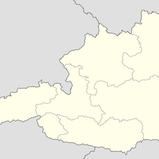
Kanisfluh, massif of the Bregenz Forest Mountains in Vorarlberg, Austria

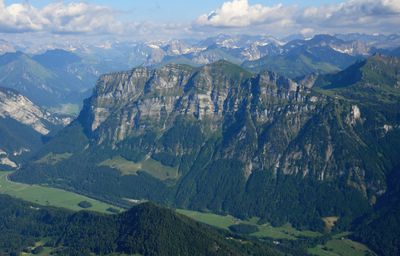
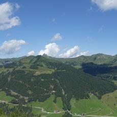
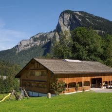
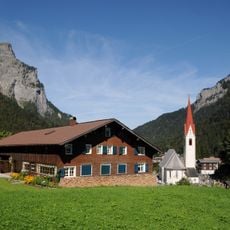
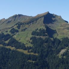
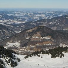
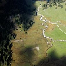
The Kanisfluh is a mountain massif in the Bregenzerwald area of Vorarlberg located between Mellau, Schnepfau, and Au. Its north face drops sharply with exposed limestone cliffs, while the south side slopes gently with grass-covered terrain.

The name Kanisfluh appears in documents dating back to around 1340, with 'Fluh' being a local term for cliff. The mountain is composed of Jurassic limestone, which gives it a different geological character from nearby mountain ranges.

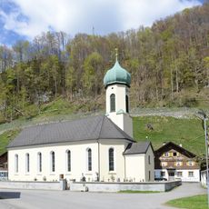
The Kanisfluh has shaped the identity of the surrounding villages of Mellau, Schnepfau, and Au for generations. Its distinctive silhouette is so recognizable that locals and visitors alike can identify it from a distance, making it a symbol of the region's natural character.

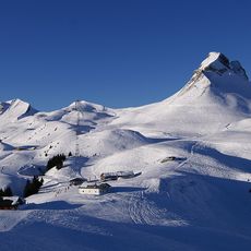
Access is via marked hiking trails from Mellau or Au, with a cable car from Mellau offering a shortcut for the initial climb. Most routes are rated T2 difficulty, though some steep sections near the summit require careful footing and attention.

An artwork by artist Antony Gormley stood just below the summit from 2010 to 2012 as part of the Horizon Field project. The sculpture attracted visitors interested in experiencing art within the mountain landscape.

The community of curious travelers

AroundUs brings together thousands of curated places, local tips, and hidden gems, enriched daily by 60,000 contributors worldwide.

Start exploring
Location
Location
Location
Au
Elevation above the sea
2,044 m
Part of
Damüls Mountains
GPS coordinates
47.33168,9.92817
Latest update
February 7, 2026 11:20
« Kanisfluh - massif of the Bregenz Forest Mountains in Vorarlberg, Austria » is provided by Around Us (aroundus.com). Images and texts are derived from Wikimedia project under a Creative Commons license. You are allowed to copy, distribute, and modify copies of this page, under the conditions set by the license, as long as this note is clearly visible.

Discover hidden gems everywhere you go!

From secret cafés to breathtaking viewpoints, skip the crowded tourist spots and find places that match your style. Our app makes it easy with voice search, smart filtering, route optimization, and insider tips from travelers worldwide. Download now for the complete mobile experience.

Around Us App Screenshot

A unique approach to discovering new places

Le Figaro

All the places worth exploring

France Info

A tailor-made excursion in just a few clicks

20 Minutes

Around Us
Travel Guide & Maps
Download

Send to your phone

QR Code
1

Open the camera app on your mobile.

2

Point at the QR code with your camera. A notification will appear.

3

Tap the notification to open the link.