Enable Location

We need your location to show you interesting places around you

Discover nearby places

Find interesting locations and hidden gems around you

Precise directions

Get accurate directions and distances to places

Your location is never shared with other users. It's only used when you tap the location button.

Georgsmarienhütte

Log in to your account

Start exploring — it's free

Trusted by 62,856 travelers worldwide

Continue with Google
Continue with Apple
or

We will send you a code to connect

By continuing, you accept our Terms and Conditions and our Privacy Policy

Check your inbox

We've sent a pincode in your inbox. Please enter the code below.

Georgsmarienhütte, Industrial municipality in Osnabrück district, Germany.

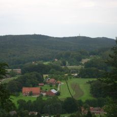
Georgsmarienhütte is a municipality in Osnabrück district, Lower Saxony, sitting along the northern edge of the Teutoburg Forest. The settlement rests at about one hundred ten meters above sea level and covers several neighborhoods that together form a compact industrial town.

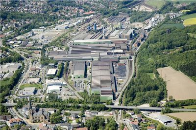
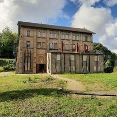
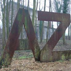
The town began in 1856 when the Georgs-Marien-Bergwerks ironworks opened here, named after King George V of Hanover and Queen Marie. This founding shaped the settlement permanently and turned it into a center for metalworking in the region.

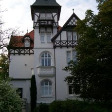
The Museum Villa Stahmer, housed in a 1900 building, presents exhibitions about local history and maintains collections related to the industrial heritage.

The Osnabrück-Brackwede railway line runs through the town and provides regular connections to larger places nearby. Motorways A1, A30 and A33 lie close by and make arrival by car straightforward.

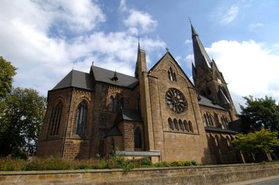
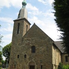
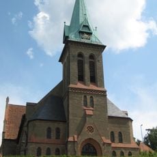
The church at Kloster Oesede holds a medieval hagioscope, a small opening in the wall that allowed people with leprosy to follow services from outside. This architectural feature recalls the social exclusion of the sick during medieval times.

The community of curious travelers

AroundUs brings together thousands of curated places, local tips, and hidden gems, enriched daily by 60,000 contributors worldwide.

Start exploring
Location
Location
Inception
1856
Elevation above the sea
110 m
Shares border with
Hasbergen, Hagen am Teutoburger Wald, Bad Iburg, Hilter, Bissendorf, Osnabrück
GPS coordinates
52.20306,8.04472
Latest update
December 13, 2025 19:44
« Georgsmarienhütte - Industrial municipality in Osnabrück district, Germany » is provided by Around Us (aroundus.com). Images and texts are derived from Wikimedia project under a Creative Commons license. You are allowed to copy, distribute, and modify copies of this page, under the conditions set by the license, as long as this note is clearly visible.

Discover hidden gems everywhere you go!

From secret cafés to breathtaking viewpoints, skip the crowded tourist spots and find places that match your style. Our app makes it easy with voice search, smart filtering, route optimization, and insider tips from travelers worldwide. Download now for the complete mobile experience.

Around Us App Screenshot

A unique approach to discovering new places

Le Figaro

All the places worth exploring

France Info

A tailor-made excursion in just a few clicks

20 Minutes

Around Us
Travel Guide & Maps
Download

Send to your phone

QR Code
1

Open the camera app on your mobile.

2

Point at the QR code with your camera. A notification will appear.

3

Tap the notification to open the link.