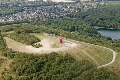
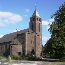
Halde Rheinpreußen, Mining heritage observation point in Moers, Germany
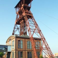
Halde Rheinpreußen is a coal mining spoil heap in Moers, in the German state of North Rhine-Westphalia, built up from the waste material extracted from the nearby Zeche Rheinpreußen colliery. At its summit stands the "Geleucht" installation, a structure of red poles and lamps that lights up after dark.
The heap began forming in 1963 from waste material removed at shaft 5/9 of the Zeche Rheinpreußen colliery and grew steadily as the mine operated. After coal extraction in the region came to an end, the site was opened to the public as a place to walk and visit.
The name "Geleucht" comes from an old mining word for the lamp that miners carried underground, and seeing it at the top of the heap gives the installation a direct connection to the work it recalls. Visitors who know this small detail tend to look at the red structure differently, as something rooted in a real working tradition rather than just public art.
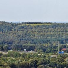
The heap can be reached on foot from several access points around its base, and sturdy shoes make the walk up more comfortable. From the top, the view extends across the Ruhr area and the flat land that surrounds it.
The "Geleucht" installation was designed by Otto Piene, one of the founders of the ZERO art movement that started in Düsseldorf in the 1950s. This means the summit holds a piece of work by an artist known far beyond the region, which many visitors who climb the heap do not expect to find there.
The community of curious travelers
AroundUs brings together thousands of curated places, local tips, and hidden gems, enriched daily by 60,000 contributors worldwide.