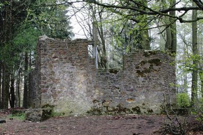
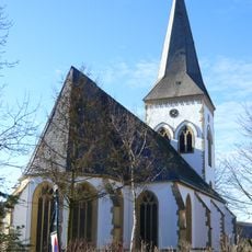
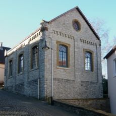
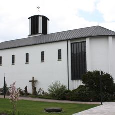
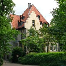
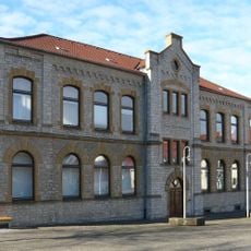
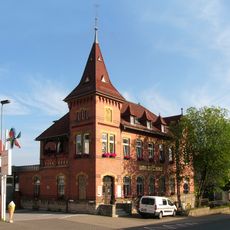
Hünenkapelle, Medieval church in Oerlinghausen, Germany.
The Hünenkapelle is a medieval church building in Oerlinghausen with stone walls and wooden structural elements typical of regional religious architecture. The building shows the basic layout of a village chapel with window arrangements designed to bring light and space into the interior.
The chapel was built in medieval times as a central gathering place for religious worship in the village and helped shape the growth of nearby settlements. Over centuries, the building was modified and repaired, adapting its structure to changing needs.
The chapel brings together the local community for worship and prayer, with religious traditions woven into its daily use. The plain but dignified design reflects how faith has shaped the lives of those who live nearby.
The chapel can be reached easily from the main road in Oerlinghausen with parking available near the building. Keep in mind that the interior is reserved for worshippers during services, though quiet visits may be possible at other times.
The chapel displays visible traces of different building phases, showing repairs and changes made across the centuries. These layers tell the story of how the community continuously adapted the structure to meet its needs over time.
Location: Oerlinghausen
GPS coordinates: 51.94690,8.69583
Latest update: December 13, 2025 17:00
Archäologisches Freilichtmuseum Oerlinghausen
2.2 km
Tönsberg
1 km
Hauptstraße 32
2.8 km
Alexanderkirche
2.9 km
Bahnhofstraße 1
2.8 km
Mausoleum Tenge
2.5 km
Bienenschmidt
2.1 km
Altdeutsche Bierstuben
2.6 km
Steinbruch am Barkhauser Berg
2.3 km
Synagoge Oerlinghausen
2.8 km
Detmolder Straße 6-10
2.4 km
St. Michael
2.3 km
Jüdischer Friedhof
2.8 km
Kirche Helpup (Oerlinghausen)
2.7 km
Steinbruchstraße 12 (Oerlinghausen)
2 km
Detmolder Straße 24
2.3 km
Robert-Koch-Straße 17
2.8 km
Grüte
2.5 km
Hauptstraße 19
2.7 km
Oerlinghausen town hall
2.6 km
Detmolder Straße 20 (Oerlinghausen)
2.2 km
Langer Gottfried
2.8 km
Robert-Koch-Straße 19
2.8 km
Rathausstraße 15
2.6 km
Tönsberg
416 m
Trockentäler, Kastentäler und Dünen des oberen Westerholter Baches
2.7 km
LSG-Teutoburger Wald mit Lippischem Wald, Osning Kamm und oestlichem Osning-Vorland
917 m
LSG-Teutoburger Wald mit Brackweder Osning und Obere Senne mit Wistinghauser-, Haustenbecker- und Augustdorfer Senne und Ausläufern der Stukenbroker Lehmplatten
1.9 kmVisited this place? Tap the stars to rate it and share your experience / photos with the community! Try now! You can cancel it anytime.
Discover hidden gems everywhere you go!
From secret cafés to breathtaking viewpoints, skip the crowded tourist spots and find places that match your style. Our app makes it easy with voice search, smart filtering, route optimization, and insider tips from travelers worldwide. Download now for the complete mobile experience.
A unique approach to discovering new places❞
— Le Figaro
All the places worth exploring❞
— France Info
A tailor-made excursion in just a few clicks❞
— 20 Minutes