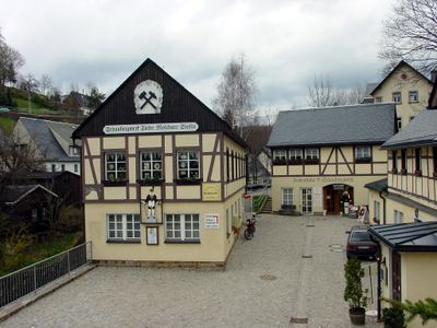
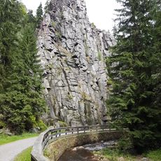
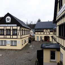
Molchner Stolln, Historical show mine in Pobershau, Germany
Molchner Stolln is a show mine near Pobershau featuring underground tunnels where visitors see traditional tools and techniques used for silver and tin extraction. The passages reveal different mining areas and the infrastructure that once supported daily operations.
The first recorded mention dates to the 16th century, though mining at this location had already started about a century earlier. The site then became an important center for metal extraction in the region.
The wooden pumping systems on display show how miners historically managed water in the shafts using handcraft and physical strength. Visitors can observe these practical engineering solutions and appreciate the skill required to operate such equipment.
Sturdy footwear is important since the underground passages are uneven and damp. The temperature inside stays cool year-round, so bringing a warm layer is practical.
An engineered water channel system was specially built to supply the mine with necessary water resources. This underground network was a technical achievement of its time and remains traceable for visitors exploring the site.
Location: Pobershau
Address: Amtsseite - Dorfstraße 67; 09496 Marienberg-Pobershau
Website: http://molchner-stolln.de
GPS coordinates: 50.63710,13.21690
Latest update: December 9, 2025 20:28
St Mary's Church, Marienberg
3.9 km
Katzenstein
1.5 km
Lauterstein Castle
3.6 km
Schwarzwassertal
2 km
Burg Nidberg
2.8 km
Liebenstein Castle
2 km
Kirche Zöblitz
2.5 km
Burg Nonnenfelsen
1.9 km
Morgensternhöhe
2.2 km
Methodistenkirche Marienberg
3.9 km
Kirche Pobershau
584 m
Roter Turm
3.8 km
Serpentinstein- und Heimatmuseum Zöblitz
2.6 km
Royal Saxon milestone B 171 Marienberg
3.8 km
Kgl.-sächs. Postmeilenstein Zöblitz
2.4 km
Kgl.-sächs. Postmeilenstein Stadtpark
3.9 km
Schaubergwerk zum Molchner Stolln Pobershau
8 m
Eiche
133 m
Wohnhaus in Ecklage und in geschlossener Bebauung Fleischerstraße 1
4.1 km
Wohnhaus in geschlossener Bebauung Freiberger Straße 6
4 km
Wohnhaus in Ecklage und in geschlossener Bebauung Markt 12
4 km
Wohnhaus in Ecklage und in geschlossener Bebauung, mit Anbau Baderstraße 1a
4 km
Kriegerdenkmal für die Gefallenen des Ersten Weltkrieges Südsteig 6
2.4 km
Wohnhaus (mit Apotheke) in Ecklage und in geschlossener Bebauung Markt 16
4.1 km
Wohnhaus in geschlossener Bebauung Markt 15
4.1 km
Wohnhaus in Ecklage und in geschlossener Bebauung und Mauer im Hof Markt 14
4.1 km
Ehemaliges Bergamt, jetzt Wohnhaus in geschlossener Bebauung, mit Gedenktafel für Oberberghauptmann von Trebra Freiberger Straße 4
4 km
Pfarrhaus in geschlossener Bebauung und in Ecklage Freiberger Straße 2
4 kmVisited this place? Tap the stars to rate it and share your experience / photos with the community! Try now! You can cancel it anytime.
Discover hidden gems everywhere you go!
From secret cafés to breathtaking viewpoints, skip the crowded tourist spots and find places that match your style. Our app makes it easy with voice search, smart filtering, route optimization, and insider tips from travelers worldwide. Download now for the complete mobile experience.
A unique approach to discovering new places❞
— Le Figaro
All the places worth exploring❞
— France Info
A tailor-made excursion in just a few clicks❞
— 20 Minutes