Enable Location

We need your location to show you interesting places around you

Discover nearby places

Find interesting locations and hidden gems around you

Precise directions

Get accurate directions and distances to places

Your location is never shared with other users. It's only used when you tap the location button.

Burg Nidberg

Log in to your account

Start exploring — it's free

Trusted by 63,449 travelers worldwide

Continue with Google
Continue with Apple
or

We will send you a code to connect

By continuing, you accept our Terms and Conditions and our Privacy Policy

Check your inbox

We've sent a pincode in your inbox. Please enter the code below.

Burg Nidberg
Discussion Reviews 1 Photos
1.3k Popularity

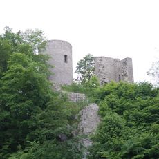
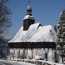
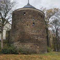
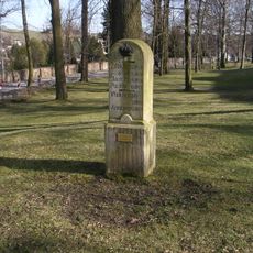
Burg Nidberg, Medieval fortress in Marienberg, Germany.

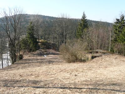
Burg Nidberg is a medieval fortress standing above the Schwarze Pockau river near Marienberg, featuring preserved tower foundations and defensive structures from the 12th century. The ruins occupy a mountain spur and reveal the strategic location that once controlled an important river crossing.

The fortress was founded around 1150 and served as the seat of a local noble family. It controlled a historic path that allowed travelers to safely cross the Schwarze Pockau river.

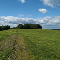
The fortress was a settlement hub in the Ore Mountains during medieval times and shaped how people colonized this mountainous region. Visitors can still sense how the site influenced the economic and social life of the area.

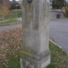
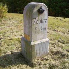
The ruins lie about one kilometer northwest of Zöblitz and are reachable via marked hiking trails. The site is easy to explore on foot and offers views over the surrounding highlands.

The Neidberg family controlled the fortress for several generations until the 14th century. This local ruling dynasty shaped the region's development and left marks still visible today in local place names.

The community of curious travelers

AroundUs brings together thousands of curated places, local tips, and hidden gems, enriched daily by 60,000 contributors worldwide.

Start exploring
Location
GPS coordinates
50.66180,13.21760
Latest update
December 9, 2025 20:24
Around this place
St Mary's Church, Marienberg
Germany

St Mary's Church, Marienberg

3.9 km
Katzenstein
Germany

Katzenstein

3.5 km
Lauterstein Castle
Germany

Lauterstein Castle

1 km
Wehrgangkirche Lauterbach
Germany

Wehrgangkirche Lauterbach

3.3 km
Molchner Stolln
Germany

Molchner Stolln

2.8 km
Kirche Zöblitz
Germany

Kirche Zöblitz

1.1 km
Morgensternhöhe
Germany

Morgensternhöhe

2.6 km
Methodistenkirche Marienberg
Germany

Methodistenkirche Marienberg

4 km
Kirche Pobershau
Germany

Kirche Pobershau

2.2 km
Roter Turm
Germany

Roter Turm

3.7 km
Heilandskirche
Germany

Heilandskirche

3.3 km
Serpentinstein- und Heimatmuseum Zöblitz
Germany

Serpentinstein- und Heimatmuseum Zöblitz

1 km
Kgl.-sächs. Postmeilenstein Zöblitz
Germany

Kgl.-sächs. Postmeilenstein Zöblitz

569 m
Wehrkirche
Germany

Wehrkirche

3.3 km
Royal Saxon milestone B 171 Marienberg
Germany

Royal Saxon milestone B 171 Marienberg

3.3 km
Schaubergwerk zum Molchner Stolln Pobershau
Germany

Schaubergwerk zum Molchner Stolln Pobershau

2.8 km
Wohnhaus in geschlossener Bebauung Freiberger Straße 6
Germany

Wohnhaus in geschlossener Bebauung Freiberger Straße 6

3.9 km
Kgl.-sächs. Postmeilenstein Stadtpark
Germany

Kgl.-sächs. Postmeilenstein Stadtpark

3.7 km
Wohnhaus in Ecklage und in geschlossener Bebauung, mit Anbau Baderstraße 1a
Germany

Wohnhaus in Ecklage und in geschlossener Bebauung, mit Anbau Baderstraße 1a

4 km
Wohnhaus in Ecklage und in geschlossener Bebauung Fleischerstraße 1
Germany

Wohnhaus in Ecklage und in geschlossener Bebauung Fleischerstraße 1

4 km
Eiche
Germany

Eiche

2.8 km
Wohnhaus (mit älterem Portal) in geschlossener Bebauung und in Ecklage Markt 5
Germany

Wohnhaus (mit älterem Portal) in geschlossener Bebauung und in Ecklage Markt 5

4 km
Wohnhaus in halboffener Bebauung Bergstraße 5
Germany

Wohnhaus in halboffener Bebauung Bergstraße 5

4 km
Wohnhaus (mit älterem Portal) in geschlossener Bebauung Markt 6
Germany

Wohnhaus (mit älterem Portal) in geschlossener Bebauung Markt 6

4 km
Ehemaliges Bergamt, jetzt Wohnhaus in geschlossener Bebauung, mit Gedenktafel für Oberberghauptmann von Trebra Freiberger Straße 4
Germany

Ehemaliges Bergamt, jetzt Wohnhaus in geschlossener Bebauung, mit Gedenktafel für Oberberghauptmann von Trebra Freiberger Straße 4

3.9 km
Pfarrhaus in geschlossener Bebauung und in Ecklage Freiberger Straße 2
Germany

Pfarrhaus in geschlossener Bebauung und in Ecklage Freiberger Straße 2

3.9 km
Kriegerdenkmal für die Gefallenen des Ersten Weltkrieges Südsteig 6
Germany

Kriegerdenkmal für die Gefallenen des Ersten Weltkrieges Südsteig 6

1.5 km
Amtsgebäude in offener Bebauung und in Ecklage Bergstraße 7
Germany

Amtsgebäude in offener Bebauung und in Ecklage Bergstraße 7

4 km
Show the full map
Reviews
Share your experience

No review yet

Discussions
Start a discussion...

No discussion yet

« Burg Nidberg - Medieval fortress in Marienberg, Germany » is provided by Around Us (aroundus.com). Images and texts are derived from Wikimedia project under a Creative Commons license. You are allowed to copy, distribute, and modify copies of this page, under the conditions set by the license, as long as this note is clearly visible.

Discover hidden gems everywhere you go!

From secret cafés to breathtaking viewpoints, skip the crowded tourist spots and find places that match your style. Our app makes it easy with voice search, smart filtering, route optimization, and insider tips from travelers worldwide. Download now for the complete mobile experience.

Around Us App Screenshot

A unique approach to discovering new places

Le Figaro

All the places worth exploring

France Info

A tailor-made excursion in just a few clicks

20 Minutes

Around Us
Travel Guide & Maps
Download

Send to your phone

QR Code
1

Open the camera app on your mobile.

2

Point at the QR code with your camera. A notification will appear.

3

Tap the notification to open the link.