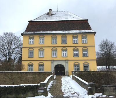
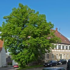
Schloss der Freiherren von Palm, 18th-century château in Wernau, Germany.
Schloss der Freiherren von Palm is an 18th-century noble residence in Wernau painted in yellow with a square floor plan. The building stands out for its distinctive mansard roof featuring three pronounced stories and is surrounded by mature trees and garden grounds.
A moated fortress of the Liebenstein family originally stood on this site before they built the current castle in the 18th century. Franz Gottlieb von Palm later acquired the property and established it as his family seat.
The castle shapes Wernau's appearance with its clean geometric form and mansard roof, features that remain characteristic of the town's identity today. Visitors can read from the exterior the design principles that expressed the wealth and social standing of its residents in the 18th century.
The property is privately occupied and viewing requires prior arrangement with the current owners. The park-like grounds surrounding the building are well-maintained and inviting, though the courtyard is generally not freely accessible.
Franz Gottlieb von Palm expanded the property in 1744 with outbuildings such as a granary and wine press, transforming it into a complete working estate. These additions reveal how noble families built not only for display but also pursued practical agricultural goals.
The community of curious travelers
AroundUs brings together thousands of curated places, local tips, and hidden gems, enriched daily by 60,000 contributors worldwide.