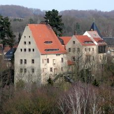
Reinsberg Castle, Medieval château in Reinsberg, Germany
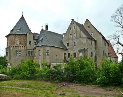
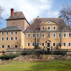
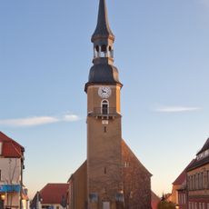
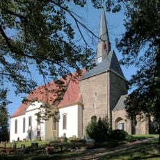
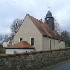
Reinsberg Castle is a fortress on elevated ground in Mittelsachsen, Saxony, built with stone walls and structures from different periods. The castle building itself remains closed to visitors, but the grounds and surroundings are open for walking and exploration.
The castle was first recorded in 1197 as a noble residence for the region. It remained under the ownership of the Schönberg family for over 500 years until modern times.
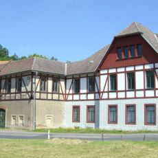
The castle shows how building styles changed over time as people modified and expanded it according to their needs. Walking around the structure, visitors can see these different periods layered into the walls and architecture.
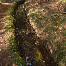
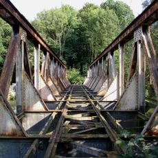
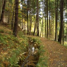
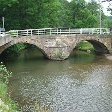
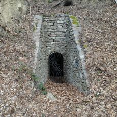
Visitors can explore the park around the castle on foot and use the nearby hiking trail called Grabentour. The area offers good walking paths, especially for those who want to discover the surrounding landscape.
During the German Democratic Republic period, the castle became a holiday retreat for workers of the Kombinat Schwarze Pumpe industrial complex. This connection reveals how historical sites were repurposed during the 20th century.
Location: Reinsberg
GPS coordinates: 51.00580,13.35560
Latest update: December 8, 2025 19:47
Bieberstein Castle
1.1 km
Graben Tour
798 m
Wünschmannmühle
2.5 km
Zollhauseiche
1.7 km
Trauer Buche Krummenhennersdorf
2.9 km
Memorial stone for the naturalist Amalie Dietrich Otto-Altenkirch-Straße 31 (before)
4.3 km
Dorfkirche Hirschfeld
3.6 km
Schmalspurbahnbrücke Freital-Potschappel–Wilsdruff–Nossen
2 km
Kirche Siebenlehn
4.2 km
Dorfkirche Neukirchen (Reinsberg)
4.2 km
Rothschönberger Stolln (Sachgesamtheit); 4. Lichtloch; Grabentour Reinsberg
774 m
Rosskastanie Dittmannsdorf
3.3 km
Esche Krummenhennersdorf
4 km
Rothschönberger Stolln (Sachgesamtheit); 4. Lichtloch; Grabentour Reinsberg
763 m
Kandlerkirche Krummenhennersdorf
2.8 km
Schloss Reinsberg
65 m
Bobritzschbrücke Krummenhennersdorf
2.7 km
Schusterbrunnen
4.3 km
Linde bei Dittmannsdorf
3.7 km
Dorfkirche Obergruna
2.8 km
Salomonis Stollen
1.3 km
Station 96 Obergruna
3.6 km
Wohnhaus und Gedenkplatte (Wandrelief) des Landschaftsmalers Otto Altenkirch Otto-Altenkirch-Straße 26
4.3 km
Memorial stone for the naturalist Amalie Dietrich with surrounding open space Amalie-Dietrich-Höhe
3.8 km
Denkmal für die Gefallenen des Ersten Weltkrieges Dorfstraße 52 (neben)
2.8 km
Rittergut Krummenhennersdorf
2.8 km
Rathaus in halboffener Bebauung Markt 29
4.3 km
Pfarrhaus mit westlichem Torbogen und östlicher Stützmauer mit Einfriedung sowie rückwärtiger Stützmauer an der Otto-Altenkirch-Straße Kirchgasse 3
4.3 kmVisited this place? Tap the stars to rate it and share your experience / photos with the community! Try now! You can cancel it anytime.
Discover hidden gems everywhere you go!
From secret cafés to breathtaking viewpoints, skip the crowded tourist spots and find places that match your style. Our app makes it easy with voice search, smart filtering, route optimization, and insider tips from travelers worldwide. Download now for the complete mobile experience.
A unique approach to discovering new places❞
— Le Figaro
All the places worth exploring❞
— France Info
A tailor-made excursion in just a few clicks❞
— 20 Minutes