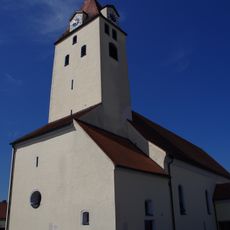
Am Keilstein, Protected area in Regensburg, Germany.
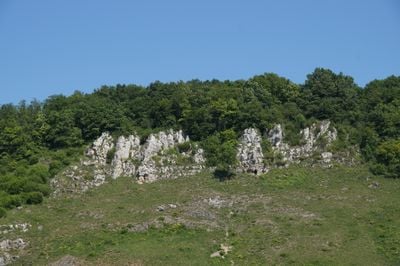
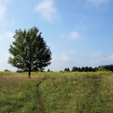
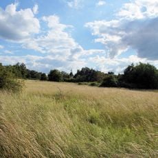
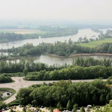
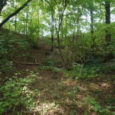
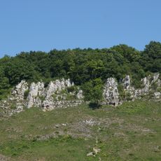
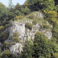
Am Keilstein is a protected nature area near Regensburg with south-facing slopes supporting mixed beech forests and dry grasslands. The terrain spreads across the land near the Danube Valley with varied soil types and plant communities.
The area received protected status in 1939 through official recognition of its ecological importance. This early designation was a milestone for nature conservation in the Regensburg region.
The reserve shows plant species more commonly found in eastern Europe, thriving here along the Danube Valley. The slopes offer space for visitors to directly experience these special habitats.
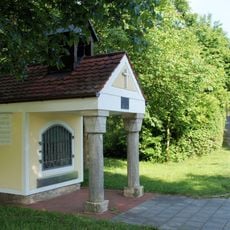
The terrain is accessible through marked trails, including an educational path with information about geological features. Visitors should wear sturdy shoes and dress for changing weather, as slopes can be steep.
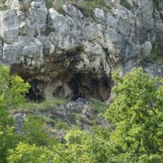
A geological fault line cuts through the area where the Bavarian Jura directly meets crystalline basement rock. This rare geological contact creates distinctive conditions that hikers can observe while exploring the slopes.
Location: Regensburg
Inception: 1939
GPS coordinates: 49.03009,12.15639
Latest update: December 14, 2025 18:14
Hohe Linie transmitter
1.5 km
Kreuzhofkapelle
3 km
Heilig-Geist-Kirche
2.5 km
St. Konrad
2.5 km
Schwabelweis road bridge
1.4 km
Schwabelweis railway bridge
1.8 km
St. Georg
1.1 km
Brandlberg
1.8 km
Mater Dolorosa Church
2.5 km
St. Michael
1.2 km
Südöstliche Juraausläufer bei Regensburg
1.5 km
St. Lukas
3 km
Katholische Pfarrkirche Maria Verkündigung (Tegernheim)
1.7 km
Kriegergedächtniskapelle
2.7 km
Verordnung über die Landschaftsschutzgebiete im Landkreis Regensburg
2.8 km
Kapellenausstattung in der erneuerten Wegkapelle
2 km
Höhle am Keilstein NE von Schwabelweis
94 m
Direktionsvilla der Kalkfabrik Funk
1.4 km
Große Doline Schauergrube W von Vorderkeilberg
1 km
Mehrfamilienwohnhaus für die städtische Kleinsiedlung Schwabelweis
884 m
Felshänge an der Südseite des Keilberges NE von Regensburg
225 m
Felsgruppe am SW-Teil des Keilbergs N von Schwabelweis
187 m
Mehrfamilienwohnhaus für die städtische Kleinsiedlung Schwabelweis
919 m
Ehemaliges Verwaltungsgebäude der Donau-Dampf-Schiffahrts-Gesellschaft
3.1 km
Wegkreuz
2.4 km
Ehemaliges Zollamt des Luitpoldhafens
3 km
Ehemaliges Bauernhaus
3 km
Ehemaliges Wirtshaus
813 mVisited this place? Tap the stars to rate it and share your experience / photos with the community! Try now! You can cancel it anytime.
Discover hidden gems everywhere you go!
From secret cafés to breathtaking viewpoints, skip the crowded tourist spots and find places that match your style. Our app makes it easy with voice search, smart filtering, route optimization, and insider tips from travelers worldwide. Download now for the complete mobile experience.
A unique approach to discovering new places❞
— Le Figaro
All the places worth exploring❞
— France Info
A tailor-made excursion in just a few clicks❞
— 20 Minutes