Enable Location

We need your location to show you interesting places around you

Discover nearby places

Find interesting locations and hidden gems around you

Precise directions

Get accurate directions and distances to places

Your location is never shared with other users. It's only used when you tap the location button.

Stausee Rötha

Log in to your account

Start exploring — it's free

Trusted by 62,321 travelers worldwide

Continue with Google
Continue with Apple
or

We will send you a code to connect

By continuing, you accept our Terms and Conditions and our Privacy Policy

Check your inbox

We've sent a pincode in your inbox. Please enter the code below.

Stausee Rötha

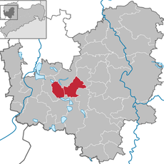
Stausee Rötha, reservoir in Germany

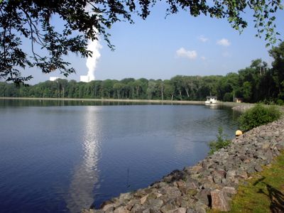
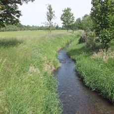
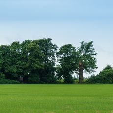
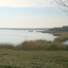
The Stausee Rötha is a reservoir located south of the town of Rötha in Germany. The water body covers a large area with gently sloping banks and is bordered by wooded areas of the Pleiße floodplain.

The reservoir was constructed between 1938 and 1940 by Sächsische Werke to supply water to nearby coal power plants and manage flooding in the region. Starting in the 1960s, a significant portion was drained for open-pit coal mining expansion, reducing the water surface by half.

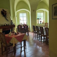
The lake takes its name from the nearby village of Rötha. Today, locals and visitors use the area for walking, fishing, and relaxing by the water in what has become a neighborhood gathering spot.

The lake has well-maintained paths for walking along its shores and is easily accessible for visitors wanting to explore the area. The flat terrain and open spaces make activities like strolling and fishing straightforward and comfortable for most people.

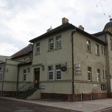
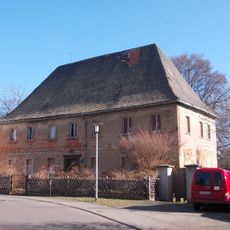
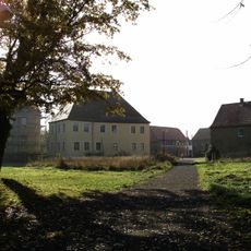
Two historic pumping stations built in 1940 still stand at the lake, protected as landmarks from when it supplied coal power plants with water. These structures remain as quiet reminders of the engineering that once kept the industrial system running.

The community of curious travelers

AroundUs brings together thousands of curated places, local tips, and hidden gems, enriched daily by 60,000 contributors worldwide.

Start exploring
Location
Location
GPS coordinates
51.18907,12.41146
Latest update
February 9, 2026 07:46
Around this place
Schloss Rötha
Germany

Schloss Rötha

820 m
Georgenkirche
Germany

Georgenkirche

860 m
Marienkirche
Germany

Marienkirche

732 m
Rötha Administrative Community
Germany

Rötha Administrative Community

739 m
Faule Pfütze
Germany

Faule Pfütze

801 m
Rötha
Germany

Rötha

801 m
Pedunculate oak Kieritzsch
Germany

Pedunculate oak Kieritzsch

3.6 km
Volkshaus Rötha
Germany

Volkshaus Rötha

1.3 km
Kirche Kieritzsch
Germany

Kirche Kieritzsch

3.6 km
Kulturhaus Böhlen
Germany

Kulturhaus Böhlen

2.6 km
Einzeldenkmal der Sachgesamtheit Rittergut Kahnsdorf: Altes Herrenhaus (siehe auch Sachgesamtheitsliste - Obj. 08970513) Theodor-Sältze-Straße 10
Germany

Einzeldenkmal der Sachgesamtheit Rittergut Kahnsdorf: Altes Herrenhaus (siehe auch Sachgesamtheitsliste - Obj. 08970513) Theodor-Sältze-Straße 10

3.5 km
Postmeilenstein Rötha
Germany

Postmeilenstein Rötha

812 m
Wohnhaus in halboffener Bebauung, mit Gaststätte Rathausstraße 3
Germany

Wohnhaus in halboffener Bebauung, mit Gaststätte Rathausstraße 3

890 m
Mietshaus Markt 9
Germany

Mietshaus Markt 9

975 m
Rathaus Böhlen
Germany

Rathaus Böhlen

2.5 km
Denkmal für die Gefallenen des 1. Weltkrieges Dorfstraße -
Germany

Denkmal für die Gefallenen des 1. Weltkrieges Dorfstraße -

1.1 km
Kahnsdorf Manor
Germany

Kahnsdorf Manor

3.5 km
Pfarrhaus Rötha
Germany

Pfarrhaus Rötha

818 m
Rittergut Zöpen
Germany

Rittergut Zöpen

3.1 km
Rückhaltebecken Stöhna
Germany

Rückhaltebecken Stöhna

3.3 km
Gasthof Markt 13
Germany

Gasthof Markt 13

1 km
St. Laurentius Zöpen
Germany

St. Laurentius Zöpen

3.2 km
Ehemaliges Amtsgericht, mit Vorgarten, Eckpavillonresten und Wachhäuschen an der Zufahrt sowie ehemaliges Amtsgefängnis mit Hofraum auf der Südseite des Gefängnisses Straße der Jugend 5
Germany

Ehemaliges Amtsgericht, mit Vorgarten, Eckpavillonresten und Wachhäuschen an der Zufahrt sowie ehemaliges Amtsgefängnis mit Hofraum auf der Südseite des Gefängnisses Straße der Jugend 5

875 m
Pfarrhaus und Toranlage des Pfarrhofes Dorfplatz 70
Germany

Pfarrhaus und Toranlage des Pfarrhofes Dorfplatz 70

3.6 km
Einzeldenkmale der Sachgesamtheit Rittergut Kahnsdorf: Wohnhaus und anschließendes Wirtschaftsgebäude eines Rittergutes (siehe auch Sachgesamtheitsliste - Obj. 08970513) Theodor-Sältze-Straße 4
Germany

Einzeldenkmale der Sachgesamtheit Rittergut Kahnsdorf: Wohnhaus und anschließendes Wirtschaftsgebäude eines Rittergutes (siehe auch Sachgesamtheitsliste - Obj. 08970513) Theodor-Sältze-Straße 4

3.5 km
Gewerkschaftshaus August-Bebel-Straße 63
Germany

Gewerkschaftshaus August-Bebel-Straße 63

1.3 km
Wohnhaus in Ecklage August-Bebel-Straße 2
Germany

Wohnhaus in Ecklage August-Bebel-Straße 2

998 m
Wasserturm in Rötha
Germany

Wasserturm in Rötha

1.3 km
Show the full map
« Stausee Rötha - reservoir in Germany » is provided by Around Us (aroundus.com). Images and texts are derived from Wikimedia project under a Creative Commons license. You are allowed to copy, distribute, and modify copies of this page, under the conditions set by the license, as long as this note is clearly visible.

Discover hidden gems everywhere you go!

From secret cafés to breathtaking viewpoints, skip the crowded tourist spots and find places that match your style. Our app makes it easy with voice search, smart filtering, route optimization, and insider tips from travelers worldwide. Download now for the complete mobile experience.

Around Us App Screenshot

A unique approach to discovering new places

Le Figaro

All the places worth exploring

France Info

A tailor-made excursion in just a few clicks

20 Minutes

Around Us
Travel Guide & Maps
Download

Send to your phone

QR Code
1

Open the camera app on your mobile.

2

Point at the QR code with your camera. A notification will appear.

3

Tap the notification to open the link.