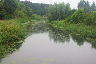
Tryggevælde Å, Small river in Stevns and Faxe municipalities, Denmark
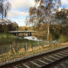
Tryggevælde Å is a small river flowing northward through the municipalities of Stevns and Faxe, moving across a flat landscape shaped by ancient glaciers before emptying into Køge Bay. The waterway drains a large watershed across eastern Zealand and forms a distinct valley that cuts through the terrain.
The river formed from meltwater following the last ice age and helped shape the landscape we see today. The meadows surrounding the valley have supported livestock farming for centuries, creating distinctive plant communities along its banks.
The river valley forms a natural boundary between the elevated terrain of eastern Zealand and the Stevns peninsula, shaping where settlements developed and how the land is used today.
The river offers several places where you can reach the water for fishing, with pike, perch, and bream present throughout the year and sea trout arriving in spring. The easiest times to visit are spring and autumn when water levels are stable and the banks are not overgrown.
During winter the river overflows its meadows and creates temporary wetlands that spread across several hundred meters along the valley. These seasonal waters become vital resting places for migrating birds and breeding grounds for frogs and other amphibians.
The community of curious travelers
AroundUs brings together thousands of curated places, local tips, and hidden gems, enriched daily by 60,000 contributors worldwide.