Tablas de Daimiel National Park

Log in to your account

AroundUs is a community-driven map of interesting places, built by curious explorers like you. It grows with every review, story, and photo you share.
Connect to save your favorite spots, contribute locations, and create personalized routes.
Continue with Google
Continue with Apple
Continue with X
Continue with Facebook
Continue with email
By continuing, you accept our Terms and Conditions and our Privacy Policy
Create an account
Add to collection
Map
Suggest a change
Share

Tablas de Daimiel National Park, National park in Ciudad Real Province, Spain

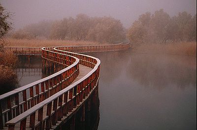
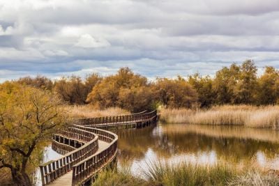
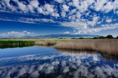
Tablas de Daimiel National Park is a wetland in Ciudad Real Province where the Guadiana and Ciguela rivers meet and form shallow pools, islands and winding channels. Wooden boardwalks cross the water and lead through reed beds, open lagoons and forested edges where birds nest and feed.

The Spanish government created the park in 1973 to protect one of the last large Mediterranean wetlands from drainage and farming. Decades of groundwater extraction had nearly dried the area completely by the late 20th century, prompting restoration efforts that continue today.

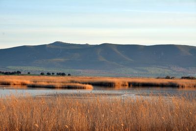
The name Tablas refers to the shallow flooded plains that appear when the rivers overflow during winter and spring months. Walking paths pass through areas where farmers once grazed livestock and harvested reeds for weaving baskets and roof thatching.

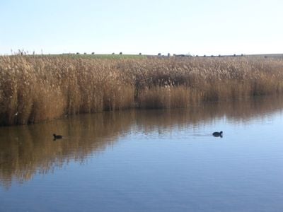
Three marked trails offer different perspectives: La Isla del Pan winds through dense reed beds, La Laguna Permanente circles open water, and La Torre de Prado Ancho climbs to an observation tower. Morning hours work best for birdwatching when waterfowl are most active and light favors photography.

When water levels drop, underground springs called Ojos del Guadiana become visible as dry craters that once fed the river year-round. Despite being the smallest national park in Spain, the reserve hosts more than 200 bird species within its wetland habitats.

Location: Castilla–La Mancha

Location: Province of Ciudad Real

Inception: 1973

Part of: Network of National Parks of Spain

Website: http://reddeparquesnacionales.mma.es/parques/daimiel

GPS coordinates: 39.14490,-3.70200

Latest update: December 14, 2025 21:23

Photos
Reviews

Visited this place? Tap the stars to rate it and share your experience / photos with the community! Try now! You can cancel it anytime.

« Tablas de Daimiel National Park - National park in Ciudad Real Province, Spain » is provided by Around Us (aroundus.com). Images and texts are derived from Wikimedia project under a Creative Commons license. You are allowed to copy, distribute, and modify copies of this page, under the conditions set by the license, as long as this note is clearly visible.

Discover hidden gems everywhere you go!

From secret cafés to breathtaking viewpoints, skip the crowded tourist spots and find places that match your style. Our app makes it easy with voice search, smart filtering, route optimization, and insider tips from travelers worldwide. Download now for the complete mobile experience.

Around Us App Screenshot

A unique approach to discovering new places

Le Figaro

All the places worth exploring

France Info

A tailor-made excursion in just a few clicks

20 Minutes