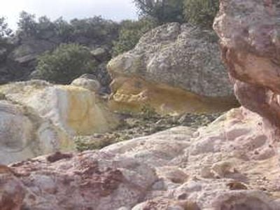
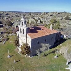
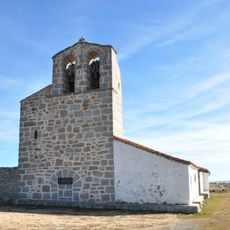
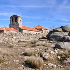
Los Infiernos, Natural site in Province of Ávila, Spain.
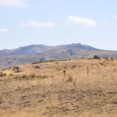
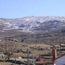
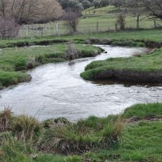
Los Infiernos is a natural area in Ávila province featuring jagged rock formations and wild vegetation spread across rolling terrain. The site combines exposed stone outcrops with native shrubs and plants that thrive in this highland environment.
The site formed over millions of years through geological processes that carved out its rocky structure in the Castilian highlands. Erosion and weathering continue to shape the landscape's appearance today.
Local communities near Los Infiernos maintain traditional agricultural practices that have influenced the surrounding landscape for generations.
The site can be reached via marked trails from the villages of Brabos or Horcajuelo, with parking available at designated entry points. Visitors should bring sturdy footwear and weather-appropriate clothing, as the terrain is rocky and exposed to the elements.
The geographical coordinates at 40.748124° latitude and -4.919398° longitude mark a location where distinct microclimates support specialized plant communities.
Location: Castile and León
Location: Province of Ávila
Location: Brabos
Location: Horcajuelo
GPS coordinates: 40.74812,-4.91940
Latest update: December 14, 2025 13:06
Hill fort of La Mesa de la Miranda
3.8 km
El Vergel roman villa
7.7 km
Castro de los Castillejos
10.4 km
Cerro de Gorría
11.5 km
Embalse de El Milagro
11.5 km
Hermitage of Nuestra Señora de Rihondo
6.1 km
Verraco de Chamartín
6.1 km
Church of Saint John the Baptist, San Juan de la Encinilla
11.2 km
Church of Nuestra Señora de la Asunción, Casasola
13.8 km
Church of the Assumption, Gallegos de Altamiros
5 km
Church of la Asunción, Muñomer del Peco
12.8 km
Church of Santo Tomás Apóstol, Aveinte
7.9 km
Church of San Pedro Apóstol, San Pedro del Arroyo
7.7 km
Cemetery of Gallegos de Altamiros
4.9 km
Church of La Santa Cruz, Solana de Rioalmar
7.7 km
San Cristóbal de Rioalmar
8.1 km
Silo of San Pedro del Arroyo
7.4 km
Church of Santo Domingo de Guzmán, Sigeres
5.8 km
Church of San Juan Evangelista, Herreros de Suso
11.7 km
Church of Nuestra Señora de la Asunción
14.3 km
Church of San Sebastián Mártir, Vita
10.2 km
Church of Santo Domingo de Guzmán, Muñico
9.9 km
Hermitage of Virgen de los Remedios, La Torre
13.2 km
Church of Santo Tomás, Santo Tomé de Zabarcos
4.5 km
Silo of Muñico
10.6 km
Potro de herrar, Casasola
11.9 km
Church of la Natividad de Nuestra Señora, Riocabado
13.5 km
Potro de herrar, Sigeres
5.8 kmVisited this place? Tap the stars to rate it and share your experience / photos with the community! Try now! You can cancel it anytime.
Discover hidden gems everywhere you go!
From secret cafés to breathtaking viewpoints, skip the crowded tourist spots and find places that match your style. Our app makes it easy with voice search, smart filtering, route optimization, and insider tips from travelers worldwide. Download now for the complete mobile experience.
A unique approach to discovering new places❞
— Le Figaro
All the places worth exploring❞
— France Info
A tailor-made excursion in just a few clicks❞
— 20 Minutes