Enable Location

We need your location to show you interesting places around you

Discover nearby places

Find interesting locations and hidden gems around you

Precise directions

Get accurate directions and distances to places

Your location is never shared with other users. It's only used when you tap the location button.

Rochefort-en-Terre

Log in to your account

Start exploring — it's free

Trusted by 62,865 travelers worldwide

Continue with Google
Continue with Apple
or

We will send you a code to connect

By continuing, you accept our Terms and Conditions and our Privacy Policy

Check your inbox

We've sent a pincode in your inbox. Please enter the code below.

Rochefort-en-Terre

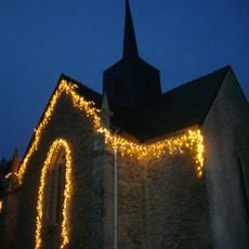
Rochefort-en-Terre, Medieval commune in Morbihan, France

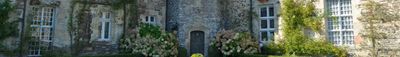
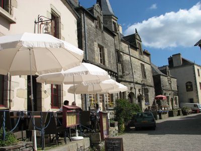
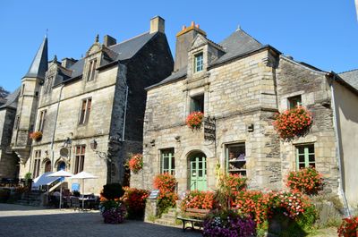
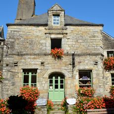
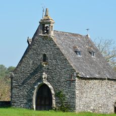
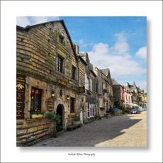
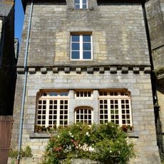
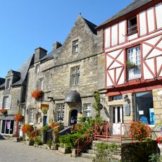
Rochefort-en-Terre is a medieval village in Brittany built on a rocky promontory, featuring stone houses with decorated facades and wooden beams lining cobblestone streets. Granite buildings dominate the landscape, creating a cohesive architectural character throughout the settlement.

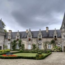
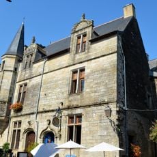
The castle dates to the 12th century and underwent multiple transformations until American painter Alfred Klots acquired and renovated it in the early 1900s as an artists' residence. This conversion into an artistic hub significantly influenced the village's character and development.

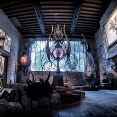
The NAIA Museum within the castle grounds displays contemporary fantasy art and kinetic sculptures against medieval stone walls. This blend of modern creativity and ancient architecture creates an unusual setting for experiencing artistic works.

The village center becomes fully pedestrian during summer months, allowing easy access to Place du Puits and Rue Saint-Michel. The cobblestone paths are narrow and hilly, so comfortable walking shoes are recommended for exploring.

Local craftspeople mark their workshops with red pennants, making it easy for visitors to find and purchase traditional Breton products directly from creators. This simple system helps tourists locate authentic artisan shops throughout the village.

The community of curious travelers

AroundUs brings together thousands of curated places, local tips, and hidden gems, enriched daily by 60,000 contributors worldwide.

Start exploring
Location
Location
Questembert Communauté
Elevation above the sea
48 m
Shares border with
Pluherlin, Malansac
Address
2 Pl. du Puits, 56220 Rochefort-en-Terre, France
Phone
GPS coordinates
47.69944,-2.33667
Latest update
February 13, 2026 20:33
Historical sites and landscapes in Brittany

Brittany combines medieval architecture with natural landscapes that shape the region's character. Granite cliffs, forests, lighthouses, and fishing villages dot the coastline. Visitors discover Celtic megaliths, castles, abbeys, and museums filled with maritime history. The shoreline displays...

« Rochefort-en-Terre - Medieval commune in Morbihan, France » is provided by Around Us (aroundus.com). Images and texts are derived from Wikimedia project under a Creative Commons license. You are allowed to copy, distribute, and modify copies of this page, under the conditions set by the license, as long as this note is clearly visible.

Discover hidden gems everywhere you go!

From secret cafés to breathtaking viewpoints, skip the crowded tourist spots and find places that match your style. Our app makes it easy with voice search, smart filtering, route optimization, and insider tips from travelers worldwide. Download now for the complete mobile experience.

Around Us App Screenshot

A unique approach to discovering new places

Le Figaro

All the places worth exploring

France Info

A tailor-made excursion in just a few clicks

20 Minutes

Around Us
Travel Guide & Maps
Download

Send to your phone

QR Code
1

Open the camera app on your mobile.

2

Point at the QR code with your camera. A notification will appear.

3

Tap the notification to open the link.