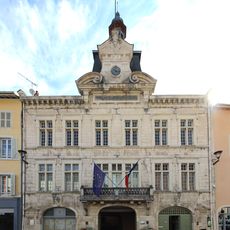
Nantua, Administrative center in Ain, France
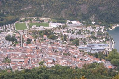
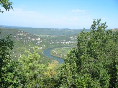
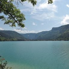
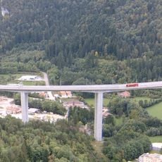
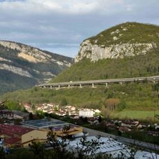
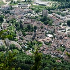
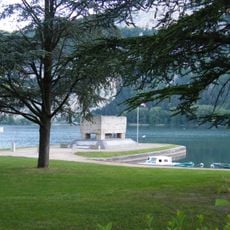
Nantua is an administrative center in Ain nestled between limestone cliffs and bordered by a lake in eastern France. The town sits at 480 meters elevation and is surrounded by mountains that shape its natural setting.
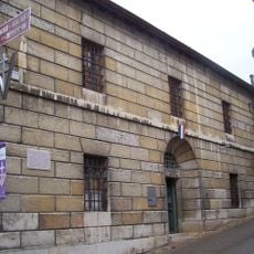
The town grew from a Benedictine monastery founded in 671 that shaped regional development throughout the medieval period. These monastic roots established the foundation for the administrative role the place would later hold.
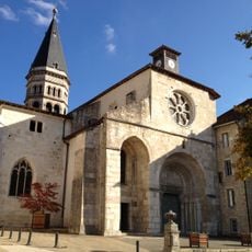
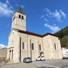
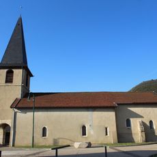
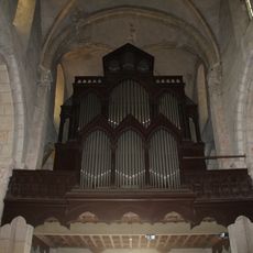
The Church of Saint-Michel stands as a spiritual center with Romanesque features and original frescoes that visitors can see today. Religious practices and celebrations continue to shape how the community gathers and marks important moments.
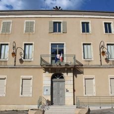
The place offers administrative services for several communes in the region and serves as a hub for local authorities. Its location between mountains and a lake makes it accessible as a central point in an alpine setting.
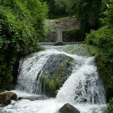
Local cooking centers on quenelles made from pike caught in the lake and prepared using methods from the 1800s. This traditional dish remains a mark of regional food culture and shows the historical link to local fishing.
Location: Ain
Location: arrondissement of Nantua
Elevation above the sea: 710 m
Shares border with: Apremont, Charix, Montréal-la-Cluse, Les Neyrolles, Port, Saint-Martin-du-Frêne
Phone: +33474752055
Email: mairie@nantua.fr
Website: https://nantua.fr
GPS coordinates: 46.15333,5.60611
Latest update: December 17, 2025 10:42
The Tour de France 2025 takes place from July 5 to 27 and marks the 112th edition of this major bike race. It is one of the three biggest road cycling events of the year. This collection shows the towns where the Tour caravan will stop, from northern cities like Lille and Dunkirk to the Norman lands...
Lac de Nantua
1.7 km
Viaduc de Nantua
1.5 km
Source de la Doye
2.7 km
Église Saint-Michel de Nantua
206 m
Musée départemental d'Histoire de la Résistance et de la Déportation de l'Ain et du Haut-Jura
232 m
Viaduc des Neyrolles
2.2 km
Abbaye Saint-Pierre de Nantua
201 m
Mémorial aux Déportés de l'Ain
646 m
Plage Albert Griot
1.2 km
Église Saint-Clair des Neyrolles
2.6 km
Église Sainte-Madeleine de Port
2.8 km
Palais de justice de Nantua
166 mMont Cornet
1.9 km
Town hall of Port
2.8 km
Building of the Savings Bank of Nantua
151 m
Orgue de tribune de l'église Saint-Michel de Nantua
191 m
War memorial of Nantua
349 mSource de la Doye
2.7 kmRochers de Nantua
1 km
War memorial of Les Neyrolles
2.8 km
Town hall of Les Neyrolles
2.5 km
Town hall of Nantua
133 m
War memorial of Port
2.8 kmScenic viewpoint
2.1 kmLa source de la Doye
222 mLe Fulet
957 mScenic viewpoint
1.8 kmScenic viewpoint
1.6 kmVisited this place? Tap the stars to rate it and share your experience / photos with the community! Try now! You can cancel it anytime.
Discover hidden gems everywhere you go!
From secret cafés to breathtaking viewpoints, skip the crowded tourist spots and find places that match your style. Our app makes it easy with voice search, smart filtering, route optimization, and insider tips from travelers worldwide. Download now for the complete mobile experience.
A unique approach to discovering new places❞
— Le Figaro
All the places worth exploring❞
— France Info
A tailor-made excursion in just a few clicks❞
— 20 Minutes